Magnetic Island facts for kids
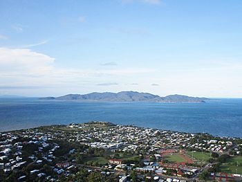
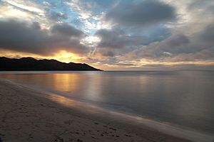
The view of Magnetic Island from the Castle Hill, Townsville
|
|
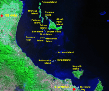
Palm Islands location
|
|
| Geography | |
|---|---|
| Location | Coral Sea |
| Area | 52 km2 (20 sq mi) |
| Highest elevation | 497 m (1,631 ft) |
| Highest point | Mount Cook |
| Administration | |
|
Australia
|
|
| Demographics | |
| Population | 2,475 (2021) |
| Pop. density | 40 /km2 (100 /sq mi) |
Magnetic Island (called Yunbenun by the Wulguru people) is an island located about 8 kilometers (5 miles) off the coast of Townsville, Queensland, Australia. This mountainous island covers 52 square kilometers (20 square miles) and is considered a suburb of Townsville.
You can reach the island by ferry from Townsville Breakwater to Nelly Bay Harbour. A large part of the island, about 39.5 square kilometers (15.2 square miles), is a National Park and a special place for birds. There are many walking tracks that connect the different bays and lead to popular spots like the World War II forts.
Magnetic Island is a popular holiday spot with many hotels and resorts. The local government, Townsville City Council, manages the island's public services. The island is part of the electoral district of Townsville for the Queensland Parliament and the Federal seat of Herbert.
The island has five main towns: Arcadia, Horseshoe Bay, Nelly Bay, Picnic Bay, and West Point. Important natural spots include Rocky Bay, Picnic Bay, Hawkings Point, Nelly Bay, Geoffrey Bay, Bremner Point, Horseshoe Bay, and Cockle Bay Reef.
In 2021, about 2,475 people lived on Magnetic Island.
Contents
What's in a Name?
The traditional name for the island is Yunbenun, given by the Wulguru people. The first European to see the island was Captain James Cook in 1770. He named it Magnetical Island because his ship's compass seemed to be affected by a magnetic pull coming from the island. Even today, people have explored the area, but no one has found what caused Cook's compass to act strangely. Locals often call the island "Maggie Isle," "Maggie Island," or "The Island."
Island History
Early Island Life
Yunbenun is the traditional home of the Wulgurukaba people. Long before Europeans arrived, Aboriginal people lived on the island, often moving between seasonal camps in different bays. They used canoes to travel between the island and the mainland. There are stories of ancient burial sites and you can still find Aboriginal middens (old shell heaps) and cave drawings in some bays. Local Wulguru stories tell of a long connection to the island and yearly trips to the mainland to avoid visitors from Papua New Guinea and the Torres Strait who traveled south using the northern trade winds. These visits became less common after missionaries arrived in the Torres Straits in 1871.
European Arrival and Growth
As the nearby town of Townsville grew in the mid-1800s, Magnetic Island became important for its hoop pine timber and granite. The granite was used to build the Port of Townsville and the Customs House.
Picnic Bay got its name because it was a popular picnic spot for European visitors from the mainland in the 1800s. The island also became a place to collect stone and coral for building on the mainland. Some gold was even mined there in 1886.
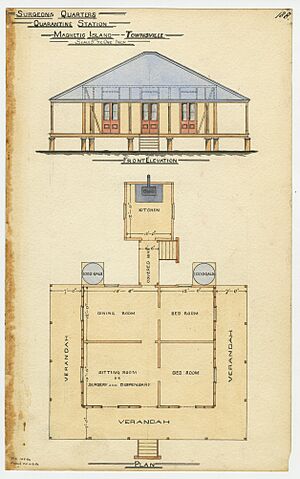
In 1875, the island was chosen as a quarantine station, a place where people arriving by ship could stay to prevent the spread of diseases. It took ten more years to build the proper facilities at West Point.
In 1896, Cyclone Sigma hit the island and Townsville, causing a lot of damage and sadly, many deaths. The ship Lalla Rookh was found on Magnetic Island after the storm.
By 1890, a resort had opened in Picnic Bay. In 1898, Robert Hayles Sr saw the island's potential for tourism. He started a regular ferry service to the island in 1901 with his ship, the Bee. Even after the Bee was wrecked, his sons built a new ship, the Phoenix. The Hayles company continued to provide ferry services to Magnetic Island until 1988.
World War II Role
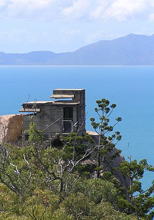
During World War II, Magnetic Island became a key defense spot. It was close to Townsville, an important military base, and offered great views over Cleveland Bay, where many ships gathered. Because of this, the Magnetic Battery, also known as "The Forts," was built. This was an artillery battery and observation post located in the hills near Florence, Horseshoe, and Arthur Bays. Picnic Bay also became a popular place for soldiers to rest and relax.
After the War
The island slowly grew after World War II. In 1953, Centaur House, a special place for nurses to recover and rest, opened in Geoffrey Bay.
In December 1971, Cyclone Althea directly hit Magnetic Island. The storm caused huge damage, with 90% of the island's houses either damaged or destroyed. However, the island quickly recovered.
In 2012, some parts of the island were given back to the Wulgurukaba Yunbenun Aboriginal Corporation.
Magnetic Island Today
In 2009, during the Q150 celebrations (Queensland's 150th anniversary), Magnetic Island was named one of the Q150 Icons of Queensland. It was recognized for being a wonderful "Natural attraction."
Island Population
In 2021, Magnetic Island had a population of 2,475 people.
Island Geography
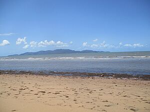
Key geographic spots include Rocky Bay, Picnic Bay, and Hawkings Point, all near the settlement of Picnic Bay. To the east-north-east is Nelly Bay. Horseshoe Bay is on the northern coast, and Cockle Bay Reef is off the western coast.
Nature and Fun Things to Do
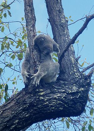
Magnetic Island is a fantastic place for wildlife. About 76% of the island is part of the Magnetic Island National Park. This park covers the steep, hilly center and the rugged north-western side. The highest point on the island is Mount Cook, which is 497 meters (1,631 feet) above sea level. A special project has recorded over 3,500 observations of 1,126 different species on Magnetic Island. The most commonly seen animal is the koala, and the most common marine animal is the Goldstripe butterflyfish.
Magnetic Island is also famous for its great fishing. You can catch fish like mackerel, giant trevally, queenfish, coral trout, blackspot tuskfish, tuna, fingermark, red emperor, and sea perch.
As of 2013, there were over 800 koalas living on the island. This is the most northern place where koalas naturally live.
The parts of the island not in the National Park can be developed, with local approval. In 2018, the island was experiencing a good economic period.
The remains of the ship SS City of Adelaide can be found off Cockle Bay. It's a popular spot for tourists to visit.
Island Towns
Here are the five main towns on Magnetic Island and their populations:
| Place | Area (km2) | Population | Density |
|---|---|---|---|
| Horseshoe Bay | 9.7 | 484 | 49.9 |
| Arcadia | 5.2 | 257 | 49.4 |
| Nelly Bay | 5.2 | 973 | 187.1 |
| Picnic Bay | 2.8 | 359 | 128.2 |
| West Point | 28.4 | 35 | 1.2 |
| Magnetic Island | 51.3 | 2107 | 41.1 |
Historic Places
Magnetic Island has several sites that are listed as important heritage locations:
- East side of island: Fort Complex
- Esplanade: Picnic Bay Jetty
Schools
There is a primary school located in Nelly Bay. For high school, students usually go to Townsville State High School on the mainland.
Community Groups
Many community groups help make Magnetic Island a great place to live:
- The Magnetic Garbutt branch of the Queensland Country Women's Association
- Magnetic Island Community Development Association (MICDA)
- Magnetic Island Nature Care Association (MINCA)
- Magnetic Island Fauna Care Organisation (MIFCO)
- Magnetic Island Network for Turtles (MINT)
- Magnetic Island Residents & Ratepayers Association (MIRRA)
- Magnetic Island Community Care (MICC)
- Magnetic Island Museum
- Magnetic Island RSL Sub-Branch
- Magnetic Island Rotary Club
- Magnetic Island Bowls Club
- Magnetic Island Country (Golf) Club
- Men's Shed Magnetic Island
- Tourism Magnetic Island
- U3A Magnetic Island
Yearly Events
Some fun events happen every year on Magnetic Island:
- Mother's Day Classic (May)
- SeaLink Magnetic Island Race Week (August/September)
- The Great Island Trek (September)
- Maggie Island Triathlon (October)
You can find out more at whatsonmagneticisland.com.au.
Famous People from the Island
- Julian Assange — The co-founder of WikiLeaks lived in Nelly Bay with his mother for a few years in the early 1970s.
- Izzy Bee and family — Known from the show Izzy's Koala World.
- Breanna Koenen — Captain of the Brisbane Lions in the AFLW (Australian Rules Football Women's league).
- Cara Koenen — An Australian netball player for the Sunshine Coast Lightning and the Australian Diamonds national team.
See also
 In Spanish: Isla Magnética para niños
 | Laphonza Butler |
 | Daisy Bates |
 | Elizabeth Piper Ensley |


