Pike River (Missisquoi Bay tributary) facts for kids
Quick facts for kids Pike River |
|
|---|---|

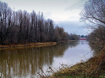
Pike River in Notre-Dame-de-Stanbridge
|
|
| Native name | Rivière aux Brochets |
| Country | Canada |
| Province | Quebec |
| Region | Montérégie |
| Regional County Municipality | Franklin County, Vermont, Brome-Missisquoi |
| Municipalities | Frelighsburg, Stanbridge East, Bedford, Notre-Dame-de-Stanbridge, Pike River (the eponymous municipality) and Saint-Armand. |
| Physical characteristics | |
| Main source | South side of Mount Pinacle Frelighsburg 45°01′26″N 072°44′00″W / 45.02389°N 72.73333°W |
| River mouth | Missisquoi Bay of Lake Champlain Saint-Armand 31 m (102 ft) 45°04′15″N 73°05′50″E / 45.07083°N 73.09722°E |
| Length | 67 km (42 mi) |
| Basin features | |
| Progression | Missisquoi Bay - Lake Champlain - Richelieu River - St. Lawrence River |
| Basin size | 630 km2 (240 sq mi) |
| Tributaries |
|
The Pike River (also known as Rivière aux Brochets in French) is a river that flows into Lake Champlain. It starts in Quebec, Canada, then goes into Vermont, United States, and finally flows back into Quebec.
This river is important for the towns it passes through. These include Frelighsburg, Stanbridge East, Bedford, Notre-Dame-de-Stanbridge, Pike River, and Saint-Armand.
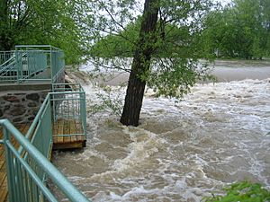
The areas around the river are mostly used for farming and forestry. During winter, the river usually freezes from mid-December to the end of March. It's generally safe to walk on the ice from late December to early March. The amount of water in the river changes with the seasons and how much rain falls.
Contents
River's Journey
The Pike River begins in Quebec, on the south side of a place called Mount Pinacle. From there, it flows into Vermont. In Vermont, it gets more water from Lake Carmi. After that, the river flows back into Quebec and continues its journey.
The river's path is about 67 kilometers (42 miles) long. Most of it is in Quebec. Over 85% of the area that drains into the river, which is about 630 square kilometers (243 square miles), is in the Brome-Missisquoi Regional County Municipality in southern Quebec.
From Lake Carmi to Frelighsburg
From Lake Carmi, the river flows north for about 3.2 kilometers (2 miles) until it reaches the border between Canada and the United States.
Once it crosses the border, the river continues north for about 5.1 kilometers (3.2 miles). It then meets Selby Creek, which flows in from the northeast. After that, it flows northwest for 1.4 kilometers (0.9 miles) to the village bridge in Frelighsburg.
Flowing Through Towns
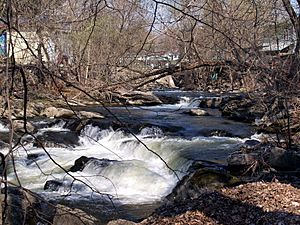
North of the border, the river goes through several waterfalls and rapids. These are mixed with long sections where the water flows slowly. It passes through Frelighsburg, Stanbridge East, and Bedford. After Bedford, it leaves the Appalachian Mountains and reaches the flat lands of the St. Lawrence Lowlands.
There are five dams that control a series of close waterfalls. Further downstream, the river becomes winding. It takes a long detour through Notre-Dame-de-Stanbridge. Then, it crosses its last rapids near the town of Pike River. Finally, it flows through swampy forests before reaching the northeast shore of Missisquoi Bay in Quebec.
The main town in the river's watershed (the area that drains into the river) is Bedford. Other towns in the watershed include Saint-Armand, Notre-Dame-de-Stanbridge, Saint-Ignace-de-Stanbridge, Pike River, and Frelighsburg.
River's Name
This river used to be known by its English name, "Pike River."
The French name, "Rivière aux Brochets," was officially recognized on December 5, 1968. This was done by the Commission de toponymie du Québec, which is the official body for naming places in Quebec.
River's Health
The area where the Pike River flows into Missisquoi Bay is a special biological reserve. For many years, the water in the bay was not moving well, which caused problems for the lake.
In 2014, a news report mentioned that blue-green algae was affecting the water treatment plant in Bedford. This type of algae can be a problem, especially with warmer temperatures. Efforts are being made to improve the water flow and health of the river and bay.
 | Aaron Henry |
 | T. R. M. Howard |
 | Jesse Jackson |


