Pinehurst, Georgia facts for kids
Quick facts for kids
Pinehurst, Georgia
|
|
|---|---|

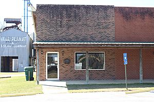
Pinehurst City Hall
|
|

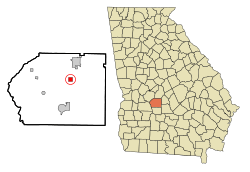
Location in Dooly County and the state of Georgia
|
|
| Country | United States |
| State | Georgia |
| County | Dooly |
| Area | |
| • Total | 1.02 sq mi (2.64 km2) |
| • Land | 1.02 sq mi (2.63 km2) |
| • Water | 0.00 sq mi (0.01 km2) |
| Elevation | 413 ft (126 m) |
| Population
(2020)
|
|
| • Total | 309 |
| • Density | 303.83/sq mi (117.29/km2) |
| Time zone | UTC-5 (Eastern (EST)) |
| • Summer (DST) | UTC-4 (EDT) |
| ZIP code |
31070
|
| Area code(s) | 229 |
| FIPS code | 13-60984 |
| GNIS feature ID | 0320662 |
Pinehurst is a small city located in Dooly County, Georgia, in the United States. In 2020, about 309 people lived there. It's a quiet place known for its connection to nature.
Contents
A Look Back: Pinehurst's History
Pinehurst became an official city in 1895. This happened when the Georgia General Assembly, which is like the state's main law-making group, approved it. The city got its name because of the many pine trees that grow all around Georgia.
Where is Pinehurst? Geography Facts
Pinehurst is found in the northeastern part of Dooly County. You can find its exact spot using coordinates: 32 degrees, 11 minutes, 40 seconds North and 83 degrees, 45 minutes, 40 seconds West.
U.S. Route 41 runs right through the middle of town. It's called Pine Avenue there. This road can take you north about 5 miles (8 km) to Unadilla. If you go south about 8 miles (13 km), you'll reach Vienna, which is the main town for Dooly County.
Interstate 75 is a big highway just east of Pinehurst. You can get on it from Exit 117. I-75 goes north about 48 miles (77 km) to Macon. If you head south, it's about 56 miles (90 km) to Tifton.
The United States Census Bureau says that Pinehurst covers a total area of about 1.02 square miles (2.6 square kilometers). All of this area is land.
Who Lives in Pinehurst? Demographics
| Historical population | |||
|---|---|---|---|
| Census | Pop. | %± | |
| 1900 | 330 | — | |
| 1910 | 451 | 36.7% | |
| 1920 | 596 | 32.2% | |
| 1930 | 519 | −12.9% | |
| 1940 | 474 | −8.7% | |
| 1950 | 430 | −9.3% | |
| 1960 | 457 | 6.3% | |
| 1970 | 405 | −11.4% | |
| 1980 | 431 | 6.4% | |
| 1990 | 388 | −10.0% | |
| 2000 | 307 | −20.9% | |
| 2010 | 455 | 48.2% | |
| 2020 | 309 | −32.1% | |
| U.S. Decennial Census | |||
Every ten years, the United States counts its population. This is called a census. In the year 2000, the census showed that 307 people lived in Pinehurst. There were 145 households, which are like homes or families living together. Out of those, 87 were families. By the time of the 2020 census, the population had grown slightly to 309 people.
Images for kids
See also
 In Spanish: Pinehurst (Georgia) para niños
 | Delilah Pierce |
 | Gordon Parks |
 | Augusta Savage |
 | Charles Ethan Porter |


