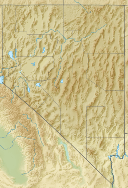
Pintwater Range facts for kids
Quick facts for kids Pintwater Range |
|
|---|---|
| Highest point | |
| Peak | Quartz Peak (Nevada) (Pintwater Range (center-north)) |
| Elevation | 6,395 ft (1,949 m) |
| Geography | |
| Country | United States |
| State | Nevada |
| District | Churchill/Lincoln counties |
| Settlement | Indian Springs, NV |
| Range coordinates | 36°56′25.855″N 115°33′44.079″W / 36.94051528°N 115.56224417°W |
| Borders on | Indian Springs Valley-W Three Lakes Valley-E East Desert Range-NE Desert Range-SE Spring Mountains-SSE |
| Topo map | USGS Quartz Peak |
The Pintwater Range is a group of mountains found in the U.S. state of Nevada. It is located across two different areas: Churchill County and Lincoln County.
About the Pintwater Range
The Pintwater Range is a notable mountain range in southern Nevada. It is known for its dry conditions. This area is part of the larger desert landscape of the state.
Where is the Pintwater Range?
This mountain range is in the southern part of Nevada. It forms a natural border between several valleys. To the west, you'll find the Indian Springs Valley. The Three Lakes Valley is to its east. Other nearby ranges include the East Desert Range and the Desert Range.
What's in a Name?
The name Pintwater Range is quite interesting. It was given this name because there is very little water there. Imagine trying to find just a "pint" of water in this dry area! This name helps us understand how tough the environment can be.
Highest Point
The tallest point in the Pintwater Range is called Quartz Peak. It stands at about 6,395 feet (1,949 meters) high. Quartz Peak is located in the center-north part of the range.
 | James Van Der Zee |
 | Alma Thomas |
 | Ellis Wilson |
 | Margaret Taylor-Burroughs |


