Plandome Heights, New York facts for kids
Quick facts for kids
Plandome Heights, New York
|
|
|---|---|
| Incorporated Village of Plandome Heights | |
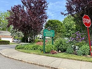
A welcome sign to Plandome Heights on Webster Avenue, as seen on May 26, 2021.
|
|
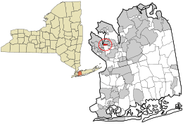
Location in Nassau County and the state of New York
|
|
| Country | |
| State | |
| County | Nassau |
| Town | North Hempstead |
| Incorporated | June 11, 1929 |
| Named for | Latin phrase "Planus Domus," meaning plain, or level home |
| Area | |
| • Total | 0.19 sq mi (0.49 km2) |
| • Land | 0.18 sq mi (0.47 km2) |
| • Water | 0.01 sq mi (0.02 km2) |
| Elevation | 89 ft (27 m) |
| Population
(2020)
|
|
| • Total | 1,009 |
| • Density | 5,574.59/sq mi (2,155.37/km2) |
| Time zone | UTC-5 (Eastern (EST)) |
| • Summer (DST) | UTC-4 (EDT) |
| ZIP Code |
11030
|
| Area code(s) | 516, 363 |
| FIPS code | 36-58486 |
| GNIS feature ID | 0960669 |
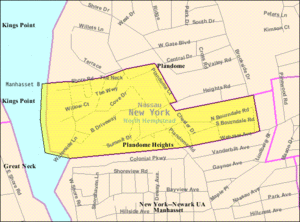
Plandome Heights is a small village located in Nassau County, on the North Shore of Long Island, in New York, United States. It is part of the larger Manhasset area. In 2020, about 1,009 people lived here.
The Incorporated Village of Plandome Heights is completely within the Town of North Hempstead. It is the southernmost of the three villages named Plandome.
Contents
History of Plandome Heights
Early Development and Architecture
In the early 1900s, Benjamin N. Duke helped develop much of what is now Plandome Heights. He was part of the Duke tobacco family and owned a real estate company called the Plandome Heights Company. Many of the homes built during this time were in the Spanish style, which was very popular back then.
Becoming an Official Village
Before Plandome Heights became its own village, people living in the western and central parts tried to join the nearby village of Plandome. However, Plandome said no. So, the residents decided to form their own village. Plandome Heights officially became a village on June 11, 1929.
Village Growth and Name Origin
In 1949, Plandome Heights grew by adding an area called Chester Hill. This area is on the southeastern side of the village and includes streets like Chester Drive.
Like its neighbors, Plandome and Plandome Manor, Plandome Heights gets its name from a Latin phrase. "Planus Domus" means "plain" or "level home."
Geography of Plandome Heights
Plandome Heights covers a total area of about 0.2 square miles (0.49 square kilometers). Most of this area is land, with a small part being water.
Population and People
| Historical population | |||
|---|---|---|---|
| Census | Pop. | %± | |
| 1930 | 265 | — | |
| 1940 | 317 | 19.6% | |
| 1950 | 882 | 178.2% | |
| 1960 | 1,025 | 16.2% | |
| 1970 | 1,032 | 0.7% | |
| 1980 | 963 | −6.7% | |
| 1990 | 852 | −11.5% | |
| 2000 | 971 | 14.0% | |
| 2010 | 1,005 | 3.5% | |
| 2020 | 1,009 | 0.4% | |
| U.S. Decennial Census | |||
In 2000, there were 971 people living in Plandome Heights. By 2020, the population had grown slightly to 1,009 people.
Many households in the village have children. The average household had about 3 people. The median age of residents was 40 years old.
Education in Plandome Heights
School District
All children living in Plandome Heights attend public schools in the Manhasset Union Free School District.
Library District
The village is also part of the Manhasset Library District. This means residents can use the services of the Manhasset Library.
Village Infrastructure
Transportation Options
Roads and Street Design
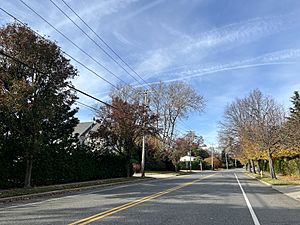
Major roads in Plandome Heights include Plandome Road and Webster Avenue. The border between Manhasset and Plandome Heights runs along Webster Avenue.
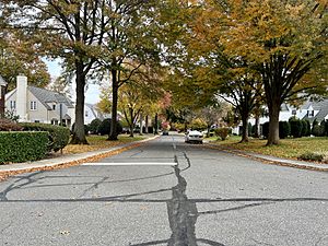
The village has different types of street layouts. West of Plandome Road, you'll find winding roads and cul-de-sacs (streets with only one entrance/exit). East of Plandome Road, the streets are laid out in a traditional grid pattern.
Train and Bus Services
There are no train stations directly in Plandome Heights. The closest train station is Manhasset, which is part of the Long Island Rail Road system. No public bus routes run through the village.
Essential Utilities
Natural Gas and Power
National Grid USA provides natural gas to homes and businesses in Plandome Heights. PSEG Long Island supplies electricity to everyone in the village.
Sewage and Waste Management
Plandome Heights does not have a central sanitary sewer system. Instead, homes in the village use cesspools and septic systems to manage wastewater.
Trash collection services are handled by Dejana Industries, which works under a contract with the Village of Plandome Heights.
Water Supply
The Manhasset–Lakeville Water District provides water to all homes and businesses in Plandome Heights.
Notable People from Plandome Heights
- Bloodgood Cutter – A landowner, farmer, and poet.
- Albert F. D'Oench – A famous architect and New York City Superintendent of Buildings. He was married to Alice Grace D'Oench, the daughter of W. R. Grace.
- Genesta M. Strong – A politician who lived at 27 Chester Drive. She was the first woman from Nassau County to be elected to the New York State Assembly.
See also
 In Spanish: Plandome Heights para niños
 | Misty Copeland |
 | Raven Wilkinson |
 | Debra Austin |
 | Aesha Ash |


