
Playa, Ponce, Puerto Rico facts for kids
Quick facts for kids
Playa
|
|
|---|---|

La Guancha Boardwalk, one of the landmarks in Barrio Playa
|
|

Location of barrio Playa within the municipality of Ponce shown in red
|
|
| Commonwealth | |
| Municipality | |
| Area | |
| • Total | 14.99 sq mi (38.8 km2) |
| • Land | 4.39 sq mi (11.4 km2) |
| • Water | 10.60 sq mi (27.5 km2) |
| Elevation | 0 ft (0 m) |
| Population
(2010)
|
|
| • Total | 14,077 |
| • Density | 3,206.6/sq mi (1,238.1/km2) |
| Source: 2010 Census | |
| Time zone | UTC−4 (AST) |
Playa, also called Playa de Ponce or La Playa, is a special neighborhood in Ponce, Puerto Rico. It's one of 31 neighborhoods that make up the city of Ponce. Playa is one of five neighborhoods in Ponce right on the coast. This means it's next to the Caribbean Sea! It even includes some islands, like the big one called Caja de Muertos. Playa was started way back in 1831.
Contents
Where is Playa Located?
Playa is an urban neighborhood in the southern part of Ponce. It sits right on the shores of the Caribbean Sea. You can find it south of the main city center, Plaza Las Delicias. The name "Playa" means "beach" in Spanish. This name perfectly describes its location facing the Caribbean Sea.
What are Playa's Borders?
Playa has clear boundaries that help define it.
- To the North, it's bordered by PR-2.
- To the South, you'll find the wide Caribbean Sea.
- The Río Matilde river forms its western border.
- The Río Bucaná river marks its eastern edge.
When looking at other neighborhoods, Playa is next to:
- Canas Urbano and San Anton to the North.
- The Caribbean Sea to the South.
- Canas to the West.
- Bucaná to the East.
Playa's Features and People
Playa is mostly flat, which is different from many other neighborhoods in Ponce. It has the second-longest coastline among Ponce's five coastal areas, right after Canas. Playa covers about 4.6 square miles of land.
In 2010, about 14,077 people lived in Playa. This means there were about 3,206 people living in each square mile. Several communities are part of Playa, including Villa del Carmen, Valle Real, Villa Tabaiba, and Salistral. Other areas are El Caribe, Puerto Viejo, Los Meros, Amalia Marin, Lirios del Sur, and Playa itself.
This neighborhood feels like a small town within the city. It has its own town square, called a plaza. Playa has homes, a fun tourist spot called La Guancha, and a big harbor. This harbor is known as Puerto de Ponce.
Roads and Transportation
Many important roads serve the Playa neighborhood. These include PR-52, PR-2, PR-12, PR-123, and PR-585. These roads help people travel easily in and out of Playa.
Playa's History

Playa has a very old history, going back to the 1500s. It was important because it was the main way Ponce connected with the outside world by sea. In the 16th century, Playa was called Montones.
Later, in the 1600s and 1700s, there was a lot of secret trading happening here. People also tried to attack the Playa settlement. A special lookout post was built at El Vigia. This post would warn the city if help was needed at the Playa harbor.
By the 1830s, Playa had one of the best roads in Puerto Rico. This road connected the port to the main city of Ponce. Playa became the center of business for Ponce. It was also the first place in Ponce to get phone lines and railroad service from downtown.
Sadly, a big fire happened in La Playa in 1845. The fire destroyed most of Playa and the nearby areas of Ponce. The Spanish Customs House in Ponce was one of the few buildings left standing. This fire led the governor of Puerto Rico to create a new volunteer firefighting group across the island.
In 1887, the Spanish government built a lighthouse at Caja de Muertos Light. This lighthouse is on an island near Playa. Then, in 1889, the Cayo Cardona lighthouse was built. It's on a small island at the entrance to Ponce's harbor. Both of these islands are part of the Playa neighborhood.
By 1913, Playa was a busy place with over 5,000 people. It had homes, sugar cane farms, churches, schools, and hospitals. It also had local businesses that helped create a strong group of workers. Playa is even thought to be Puerto Rico's first planned suburb.
Today, Playa is mostly a low-income neighborhood. This is where Isolina Ferré started her "Centro de Orientacion de la Playa." This hospital and school helped many people. For her work, she received the U.S. Presidential Medal of Freedom in 1999. The Ponce Playa Diagnostic and Treatment Center is also located here.
Important Places in Playa
.jpg)
Playa is home to many famous places in Ponce and Puerto Rico.
- The Puerto Rico Iron Works foundry.
- The Plaza del Caribe mall.
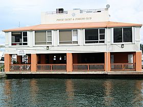
- The Club Náutico de Ponce yacht club.
- The popular La Guancha boardwalk.
- The Caja de Muertos natural reserve.
Historic landmarks listed on the National Register of Historic Places are also in Playa. These include the Cardona Island Light, Caja de Muertos Lighthouse, United States Custom House, and McCabe Memorial Church. Playa also has Puerto Rico's most important Caribbean seaport, called Port of the Americas.
Famous People from Playa
People who come from La Playa are called "playeros."
- Rafael Cordero Santiago: He was the mayor of Ponce from 1988 to 2004.
- Javier Culson: An Olympic medal winner in track-and-field.
- Carmen Nydia Velázquez: A talented comedian and singer.
- Jaime L. Drew: An educator, writer, and engineer.
- José "Chegüi" Torres: A professional boxer.
Gallery
-
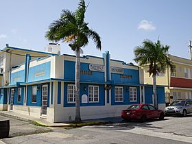
Sea food restaurant facing the Caribbean Sea on Calle Alfonso XII
-
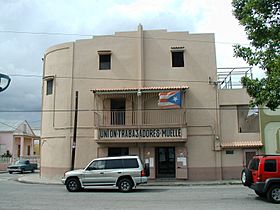
Dockworkers' union building in Playa
-
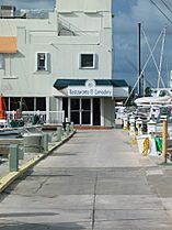
Seafood restaurant at Club Nautico de Ponce
-
International food restaurant at Club Nautico de Ponce
-
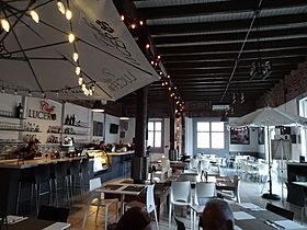
Interior of International food Cafe Lucero restaurant
-
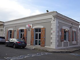
International food restaurant Cafe Lucero on Calle Salmon and Calle Ramon R. Velez
-
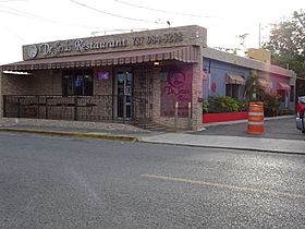
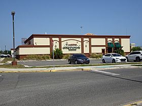
Puerto Rican and sea food restaurant on Avenida Hostos
-
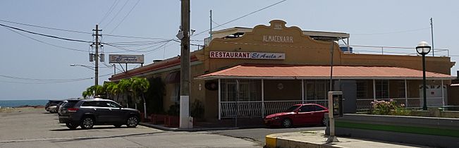
Sea-front Puerto Rican and sea food restaurant at historic train depot on Avenida Hostos Final
-
Italian restaurant on the campus of Plaza del Caribe mall
-
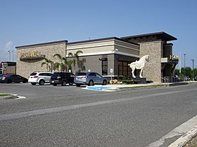
Chinese restaurant on the campus of Plaza del Caribe mall
.jpg)

.jpg)
.jpg)
.jpg)
.jpg)
.jpg)
.jpg)
.jpg)
.jpg)
See also
 In Spanish: Playa (Ponce) para niños
- List of communities in Puerto Rico
- Carnaval de Vejigantes
