
Pleasant Grove, Alabama facts for kids
Quick facts for kids
Pleasant Grove, Alabama
|
|
|---|---|
| Nickname(s):
The Good Neighbor City
|
|

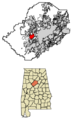
Location of Pleasant Grove in Jefferson County, Alabama
|
|
| Country | United States |
| State | Alabama |
| County | Jefferson |
| Established | 1889 |
| Incorporated | January 16, 1934 |
| Area | |
| • Total | 9.82 sq mi (25.44 km2) |
| • Land | 9.82 sq mi (25.44 km2) |
| • Water | 0.00 sq mi (0.00 km2) |
| Elevation | 673 ft (205 m) |
| Population
(2020)
|
|
| • Total | 9,544 |
| • Estimate
(2022)
|
9,446 |
| • Density | 962/sq mi (371.3/km2) |
| Time zone | UTC−6 (Central (CST)) |
| • Summer (DST) | UTC−5 (CDT) |
| ZIP Code |
35127
|
| Area code(s) | 205 and 659 |
| FIPS code | 01-61008 |
| GNIS feature ID | 2404538 |
Pleasant Grove is a city in western Jefferson County, Alabama, United States. It is part of the larger Birmingham area. In 2020, about 9,544 people lived there.
Contents
History of Pleasant Grove
Pleasant Grove was first settled in September 1836. It became a city on January 16, 1934. The city's name, "Pleasant Grove," was used as early as 1884. It was formed from four smaller communities: Frog Pond, Lizard Ridge, Cottage Hill, and Pleasant Grove.
Why the City Was Formed
The city's official start was due to a special problem. The land under Pleasant Grove has many old coal mines. For many years, people got their water from wells. But as more mining happened, the water in the wells sometimes disappeared into the mines.
In the 1930s, the government offered money to help communities build water systems. To get this money, a community had to be officially a city. This is why Pleasant Grove became an incorporated city.
City Leaders
The first mayor of Pleasant Grove was W.P. Stone. Today, the city is run by a mayor and five council members. They serve for four years. Elections for these leaders happen every leap year.
Tornadoes in Pleasant Grove
Pleasant Grove has been hit by strong tornadoes several times. These storms caused damage in 1956, 1977, 1998, and during the 2011.
Geography
Pleasant Grove is located at 33°29′33″N 86°58′23″W / 33.492400°N 86.972927°W. The city covers an area of about 9.82 square miles (25.44 square kilometers). All of this area is land.
A stream called Milk Creek runs through Pleasant Grove. It is named for its creamy-white color and thick, chalky feel.
Education
Schools in Pleasant Grove are managed by the Jefferson County Board of Education. Land was given for a new school building. In 1970, Pleasant Grove High School was built. It also included a Junior High School.
The schools officially received their accreditation from the State of Alabama in 1973. Later, money was given to expand the Elementary School. This allowed all students from kindergarten to sixth grade to be in one building. In 1997, students from Woodward School also moved to the city's schools.
A new Pleasant Grove High School was finished in 2010. This high school has the best graduation rate in the Jefferson County School system. Many teachers there are nationally certified. The old high school building is now the JCIB Middle School.
Population Information
| Historical population | |||
|---|---|---|---|
| Census | Pop. | %± | |
| 1940 | 1,066 | — | |
| 1950 | 1,802 | 69.0% | |
| 1960 | 3,097 | 71.9% | |
| 1970 | 5,090 | 64.4% | |
| 1980 | 7,102 | 39.5% | |
| 1990 | 8,458 | 19.1% | |
| 2000 | 9,983 | 18.0% | |
| 2010 | 10,110 | 1.3% | |
| 2020 | 9,544 | −5.6% | |
| 2022 (est.) | 9,446 | −6.6% | |
| U.S. Decennial Census 2020 Census |
|||
In 2020, Pleasant Grove had 9,544 people living there. There were 3,605 households and 2,598 families. The city had about 971 people per square mile.
In 2010, the city had 10,110 people. About 53.7% of the people were White, and 44.8% were Black or African American. Most households were married couples living together. The average age of people in Pleasant Grove was 41.2 years.
Notable People
- R. G. Armstrong, an actor and playwright.
- James Bradberry, a football player for the Philadelphia Eagles.
- Jake Elmore, a former Major League Baseball player.
Images for kids
-
Location of Pleasant Grove in Jefferson County, Alabama
See also
 In Spanish: Pleasant Grove (Alabama) para niños
