Pleasant View, Tennessee facts for kids
Quick facts for kids
Pleasant View, Tennessee
|
|||
|---|---|---|---|

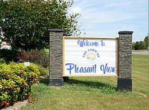
Pleasant View welcome sign
|
|||
|
|||
| Motto(s):
Away from it all, close to everything
|
|||

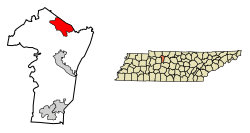
Location of Pleasant View in Cheatham County, Tennessee.
|
|||
| Country | United States | ||
| State | Tennessee | ||
| County | Cheatham | ||
| Incorporated | 1996 | ||
| Government | |||
| • Type | City council | ||
| Area | |||
| • Total | 12.52 sq mi (32.43 km2) | ||
| • Land | 12.52 sq mi (32.43 km2) | ||
| • Water | 0.00 sq mi (0.00 km2) | ||
| Elevation | 692 ft (211 m) | ||
| Population
(2020)
|
|||
| • Total | 4,807 |
||
| • Density | 383.88/sq mi (148.22/km2) | ||
| Time zone | UTC-6 (CST) | ||
| • Summer (DST) | UTC-5 (CDT) | ||
| ZIP code |
37146
|
||
| Area code(s) | 615, 629 | ||
| FIPS code | 47-59560 | ||
| GNIS feature ID | 1297944 | ||
| Website | https://townofpleasantview.com/ | ||
Pleasant View is a city located on the northern edge of Cheatham County, Tennessee. It is part of the larger Nashville area in Middle Tennessee. In 2020, the city had a population of 4,807 people.
Contents
Exploring Pleasant View Village
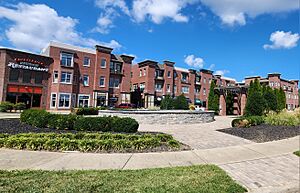
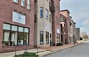
The Pleasant View Village is a lively area where many businesses and homes are mixed together. You can find restaurants, doctors' offices, and even a preschool here. It is one of the most popular places to visit in Pleasant View.
A Look at Pleasant View's History
In the past, Pleasant View had different names like "Bradley's Stand" and "Turnbull Horse Stamp." It was an important stop for stagecoaches traveling between Clarksville and Nashville. People would stop here to rest and get mail.
Citizens officially named the town Pleasant View in 1870. The first post office opened in 1880.
Pleasant View first became an official town in 1921, covering about 105 acres. It was led by a mayor and six aldermen. However, ten years later, it stopped being an official town. In 1996, the people of Pleasant View voted to become an official town again.
When it re-incorporated, Pleasant View had about 2,150 residents. At first, the town was governed by a mayor and two aldermen. Later, in 1998, the town decided to have four aldermen. Today, the Pleasant View City Hall is located at 1008 Civic Court.
Geography of Pleasant View
Pleasant View covers about 12.6 square miles (32.6 square kilometers) of land. There is no water area within the city limits.
The town's northern border is the line between Robertson and Cheatham counties. The eastern border runs from Goodsprings Road to Triangle Road. The southern border follows Old Clarksville Pike, and the western border goes along Oaklawn Road.
Pleasant View manages about 55 city streets, which are about 24 miles long in total.
Population Changes in Pleasant View
| Historical population | |||
|---|---|---|---|
| Census | Pop. | %± | |
| 1930 | 177 | — | |
| 2000 | 2,934 | — | |
| 2010 | 4,149 | 41.4% | |
| 2020 | 4,807 | 15.9% | |
| Sources: | |||
Population in 2020
The 2020 United States census showed that 4,807 people lived in Pleasant View. There were 1,587 households and 1,269 families in the city.
Population in 2010
According to the census from 2010, Pleasant View had 4,149 people. There were 1,005 households, and 843 of these were families. The average household had about 2.91 people.
About 31.6% of the population was under 18 years old. Around 6.8% of residents were 65 years or older. The average age in the city was 33 years.
Schools in Pleasant View
Students in Pleasant View attend several schools. These include Pleasant View Christian School, Pleasant View Elementary School, Sycamore Middle School, and Sycamore High School.
Images for kids
See also
 In Spanish: Pleasant View (Tennessee) para niños


