Plover Hill facts for kids
Quick facts for kids Plover Hill |
|
|---|---|
 |
|
| Highest point | |
| Elevation | 680 m (2,230 ft) |
| Prominence | 59 m (194 ft) |
| Parent peak | Pen-y-ghent |
| Listing | Hewitt, Nuttall |
| Geography | |
| Parent range | Yorkshire Dales |
| OS grid | SD849752 |
| Topo map | OS Explorer OL2 |
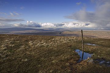
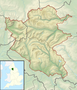
Plover Hill is a special area of moorland in the beautiful Yorkshire Dales in England. It's located north of another famous hill called Pen-y-ghent. These two hills are connected by high ground, making them part of the same elevated area.
This whole region is known as "open access land". This means people can explore it freely. The main paths to Plover Hill come from the north, off Foxup Road, and from the south, starting at the top of Pen-y-ghent.
Plover Hill sits between two smaller valleys of Littondale. To the south is the valley of Hesleden Beck, and to the north is Foxup Beck. The hill is part of the small village area called Halton Gill.
Contents
Exploring Plover Hill and Its Surroundings
Plover Hill is a great place for outdoor adventures. It's part of the Yorkshire Dales National Park, which is famous for its stunning landscapes. This area is perfect for hiking and enjoying nature.
What is Moorland?
Moorland is a type of habitat found in upland areas. It's usually covered with low-growing plants like heather and grasses. These plants can handle tough weather conditions. Moorland is often wet and boggy in places. It's home to many unique plants and animals.
How High is Plover Hill?
Plover Hill reaches an elevation of 680 meters (about 2,231 feet) above sea level. While it's not the tallest mountain, it offers fantastic views. Its height makes it a "Hewitt" and a "Nuttall". These are special lists for hills in England and Wales that meet certain height requirements.
What are Hewitts and Nuttalls?
- A Hewitt is a hill in England, Wales, or Ireland that is at least 2,000 feet (610 meters) high. It must also have a "prominence" of at least 30 meters (98 feet). Prominence means how much a peak rises above the land around it.
- A Nuttall is a hill in England or Wales that is at least 2,000 feet (610 meters) high. It must have a prominence of at least 15 meters (49 feet). Plover Hill fits both of these descriptions!
Getting to Plover Hill
Hikers often reach Plover Hill from Pen-y-ghent. This is a popular route for experienced walkers. The paths are well-known and offer a good challenge. You can also start your walk from the north, near Foxup Road. Always remember to wear appropriate gear and check the weather before you go.
The Yorkshire Dales National Park
Plover Hill is located within the Yorkshire Dales. This is one of the most beautiful national parks in the United Kingdom. It's known for its rolling hills, green valleys, and traditional stone walls. The Dales are a popular spot for tourists and nature lovers.
Wildlife in the Dales
The Yorkshire Dales are home to many different animals. You might spot red grouse on the moorland. Curlew birds with their long, curved beaks are also common. If you're lucky, you might even see a red squirrel or a roe deer. The area is also important for many types of insects and plants.
Protecting the Landscape
The Yorkshire Dales National Park Authority works hard to protect this special place. They look after the wildlife, plants, and historical sites. They also help people enjoy the park responsibly. This ensures that places like Plover Hill remain beautiful for future generations.
 | Victor J. Glover |
 | Yvonne Cagle |
 | Jeanette Epps |
 | Bernard A. Harris Jr. |


