Point Pinole Regional Shoreline facts for kids
Quick facts for kids Point Pinole Regional Shoreline |
|
|---|---|
| Location | Contra Costa County, California, United States |
| Nearest city | Richmond, California |
| Area | 2,315 acres (9.37 km2) |
| Created | 1973 |
| Operated by | East Bay Regional Park District |
| Status | Open |
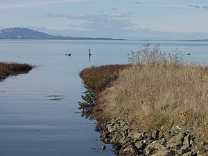
Point Pinole Regional Shoreline is a large park located on the edge of San Pablo Bay in California. This bay is the northern part of the famous San Francisco Bay. The park covers about 2,315 acres (9.37 square kilometers). It is managed by the East Bay Regional Park District. Inside the park, you'll find the Dotson Family Marsh and the Point Pinole Lagoon. It's also home to the North Richmond Shoreline Festival.
Contents
Park History: From Factories to Fun
Point Pinole is in the city of Richmond, California. This area used to be home to several factories that made explosives. The biggest one was run by the Giant Powder Company. They moved here after some accidental explosions at their earlier locations in San Francisco and Albany Hill.
Giant Powder Company built the first dynamite factory in the United States in 1868. But an explosion in 1869 destroyed everything. This made them move their factory even farther away from people. After another explosion in 1892, Giant built its last factory in the quiet area of Pinole Point. They even created a small community nearby called Giant, California.
The factory at Point Pinole operated until 1960. Today, you can barely see any signs of it. After many years, the East Bay Regional Park District managed to open the land to the public as a park in 1973. A special marker shows that this spot is a California Historical Landmark.
Trails and Eucalyptus Trees
The park's old tramway paths now offer nearly 20 kilometers (12 miles) of gentle trails. These paths are perfect for hiking, cycling, and horse-riding. Another interesting leftover from the factory days is the many groves of eucalyptus trees. These trees were planted around the factory to help protect against potential explosions.
Amazing Bay Views
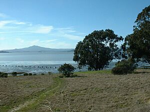
Point Pinole sticks out into the bay. This is where the East Bay shoreline changes direction. It offers amazing views in every direction. You can see San Francisco to the southwest, Mount Tamalpais and the Marin Headlands to the northwest. You can also look across San Pablo Bay to the north and east, and see Mount Diablo inland to the southeast.
Freshwater and ocean water mix here, which means there's a lot of different marine life. A long pier has been built at the end of Point Pinole. It replaced an old pier used by the factories. Now, it's a popular spot for angling (fishing).
Easy Access and Fees
The park's trails are mostly flat, making them easy to walk. There is a small fee for parking cars and a fee for bringing dogs.

In 2008, the park grew bigger by adding the nearby Breuner Marsh. This area was later renamed the Dotson Family Marsh.
Nature and Wildlife at Point Pinole
The park has a mix of open grasslands, woodlands, beaches, and small cliffs. It's a fantastic place for bird watching. You can see many different kinds of ducks and shorebirds. The endangered black rail also lives here.
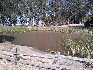
Point Pinole is on the Pacific Flyway. This is a major route for many birds that migrate (travel long distances). So, you might see many different types of birds passing through. The marsh areas provide homes for creatures like the ridgeway rail and the salt marsh harvest mouse.
Ancient History and Earthquakes
Whittell Marsh in the park is home to one of the few remaining Native American shellmounds in the San Francisco Bay Area. These are ancient piles of shells and other materials left by early people.
The park is also located on the Hayward Fault. This is a major earthquake fault line. The United States Geological Survey (USGS) has placed special markers here to show its exact location. The USGS also has a seismometer (a device that measures earthquakes) near the Union Pacific Railroad tracks. These tracks separate the park from the mainland. You can reach the park by crossing a bridge over the railroad.
Getting to the Park
The San Francisco Bay Trail runs right through the park. You can get to Point Pinole by AC Transit bus, by car, or by bike. Walking or cycling into the park is free, but there is a fee if you park a car.
Recent Park Improvements
New Playground Area
The playground at Point Pinole park was updated in 2017. The ground was resurfaced with wood fiber. New equipment like a net climber and a stand-up spinner were added. A path and picnic tables that are easy for wheelchairs to use were also installed. All other park paths stayed open during this work.
Atlas Road Bridge Project
On April 22, 2017, the East Bay Regional Park District opened the Atlas Road Bridge. This bridge is for both vehicles and people using wheelchairs. It connects to the San Francisco Bay Trail. This project also included building a new main entrance and parking area. The new bridge goes over active railroad tracks, making it much safer for people to enter the park. The project cost about $11.7 million. Most of the money came from local funds and grants.
This new bridge is part of a bigger plan. Future projects might include more picnic areas, another new playground, and a path to a new learning center for the park.
Dotson Family Marsh Dedication
At the same ceremony in April 2017, Breuner Marsh was officially renamed the Dotson Family Marsh. This was done to honor the Dotson family, led by Reverend Richard Dotson. For many years, Rev. Dotson worked hard to keep Breuner Marsh wild and open to the public. He fought against several plans to build businesses on the land.
Rev. Dotson gathered people from his neighborhood to remind them that they were promised access to the bay. He also got help from the Sierra Club, a powerful environmental group. Dotson's group won their long legal fight. The park district officially bought the marsh in 2008 and added it to Point Pinole Regional Shoreline.
Marsh Restoration Efforts
The Dotson Marsh restoration project aims to make the marsh a healthy, self-sustaining wetland. This means it will naturally filter polluted water runoff. It also helps the marsh adapt to the expected sea level rise caused by climate change. This restoration project is estimated to cost $14 million, with many different groups providing the money.
 | Janet Taylor Pickett |
 | Synthia Saint James |
 | Howardena Pindell |
 | Faith Ringgold |


