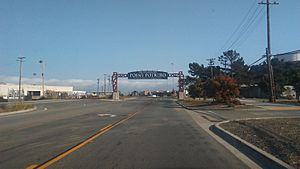
Point Potrero facts for kids
Quick facts for kids Point Potrero |
|
|---|---|
| Location | Contra Costa County, California |
| Coordinates | 37°54′15″N 122°21′59″W / 37.904092°N 122.3663599°W |
| Topo map | USGS Richmond |
Point Potrero is a piece of land that sticks out into San Pablo Bay. It forms a cape, which is like a small peninsula. This area is located next to the Potrero Hills in Richmond, California.
Contents
What is Point Potrero?
Point Potrero is a natural landmark. It is a landform that extends into the water. The area is covered with a type of plant community called chaparral. Chaparral is made up of shrubs and small trees. These plants are well-suited to dry, warm climates.
Where is Point Potrero Located?
Point Potrero has water on two sides. San Pablo Bay is to its west and north. To its east, you will find Castro Cove. Just east of the point are the Chevron Richmond Refinery and Potrero Ridge.
History of Winehaven
On the western slopes of Point Potrero is a place called Winehaven. This spot was once home to the biggest winery in the entire United States. It was a very important place for making wine.
Nature and Community
Today, Point Potrero is a bit separated from the main city areas. This isolation helps it serve as a home for wildlife. Animals like deer and other creatures live there. It is an important natural habitat.
Nearby Neighborhoods and Parks
The southern part of the ridge has developed into a neighborhood. This area is known as the historic Point Richmond neighborhood. Many houses are built there. A section of the western coast is also part of Point Molate Regional Park. This park offers natural beauty and outdoor activities.
 | Calvin Brent |
 | Walter T. Bailey |
 | Martha Cassell Thompson |
 | Alberta Jeannette Cassell |


