Port Graham, Alaska facts for kids
Quick facts for kids
Port Graham, Alaska
Paluwik
|
|
|---|---|

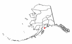
Location of Port Graham, Alaska
|
|
| Country | United States |
| State | Alaska |
| Borough | Kenai Peninsula |
| Area | |
| • Total | 6.39 sq mi (16.56 km2) |
| • Land | 6.39 sq mi (16.56 km2) |
| • Water | 0.00 sq mi (0.00 km2) |
| Elevation | 20 ft (6 m) |
| Population
(2020)
|
|
| • Total | 162 |
| • Density | 25.34/sq mi (9.78/km2) |
| Time zone | UTC-9 (Alaska (AKST)) |
| • Summer (DST) | UTC-8 (AKDT) |
| ZIP code |
99603
|
| Area code(s) | 907 |
| FIPS code | 02-63280 |
Port Graham, also called Paluwik (pah-LU-wig) in the Alutiiq language, is a small community in Alaska, United States. It is a census-designated place (CDP) in the Kenai Peninsula Borough. In 2020, about 162 people lived there.
Contents
Where is Port Graham Located?
Port Graham is found near the southern tip of the Kenai Peninsula in Alaska. It is very close to another village called Nanwalek, less than 5 miles away.
How to Get to Port Graham
Even though Port Graham has local roads, you cannot drive there from other cities. All vehicles must arrive by a large boat called a barge or a ferry. You can also reach the village by airplane or by boat.
Port Graham is about 22 miles southwest of Homer. It is also about 7 miles by air from Seldovia. The Alaska Marine Highway System offers ferry service across Kachemak Bay. This bay separates Port Graham, Nanwalek, and Seldovia from Homer.
Land Area of Port Graham
Port Graham is located at 59°20′52″N 151°50′0″W. The United States Census Bureau states that the community covers a total area of about 16.5 square kilometers. All of this area is land.
Who Lives in Port Graham?
The population of Port Graham has changed over many years. The first time it was counted in a U.S. Census was in 1920.
| Historical population | |||
|---|---|---|---|
| Census | Pop. | %± | |
| 1920 | 47 | — | |
| 1940 | 93 | — | |
| 1950 | 92 | −1.1% | |
| 1960 | 139 | 51.1% | |
| 1970 | 107 | −23.0% | |
| 1980 | 161 | 50.5% | |
| 1990 | 166 | 3.1% | |
| 2000 | 171 | 3.0% | |
| 2010 | 177 | 3.5% | |
| 2020 | 162 | −8.5% | |
| U.S. Decennial Census | |||
Population Changes Over Time
Port Graham first appeared in the 1920 U.S. Census as a small village. It was not counted in 1930, but it has been included in every census since 1940. In 1980, it became a census-designated place (CDP).
Community Life in Port Graham
In 2000, there were 171 people living in Port Graham. These people lived in 70 different homes, and 46 of these were families. Most people in the community were Native American. A smaller number were White or from other backgrounds.
Many homes (35.7%) had children under 18 living there. The average home had about 2.44 people. The average family had about 2.98 people.
The people in Port Graham are of different ages. About 30.4% were under 18 years old. About 10.5% were 65 years or older. The average age was 38 years.
Income and Economy
In 2000, the average income for a household in Port Graham was $40,250 per year. For families, the average income was $43,438. The average income per person was $13,666. About 18.8% of the people in Port Graham lived below the poverty line. This included 25.9% of those under 18.
See also
 In Spanish: Port Graham (Alaska) para niños
 | Aurelia Browder |
 | Nannie Helen Burroughs |
 | Michelle Alexander |

