Port Noarlunga Reef Aquatic Reserve facts for kids
Quick facts for kids Port Noarlunga Reef Aquatic ReserveSouth Australia |
|
|---|---|
|
IUCN Category VI (Managed Resource Protected Area)
|
|

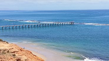
Port Noarlunga Jetty and the submerged Port Noarlunga Reef
|
|
| Nearest town or city | Christies Beach Port Noarlunga Port Noarlunga South Noarlunga Downs Seaford Meadows Seaford |
| Established | 1 December 1971 |
| Area | 5.79 km2 (2.2 sq mi) |
| Visitation | 170,000 (in 1987) |
| Managing authorities | Primary Industries and Regions SA (PIRSA) |
| Footnotes | Coordinates Nearest towns/cities Managing authority |
| See also | Protected areas of South Australia |
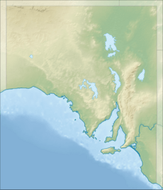
The Port Noarlunga Reef Aquatic Reserve is a special ocean area in South Australia. It's a protected place in Gulf St Vincent, near Adelaide. It also includes part of the Onkaparinga River.
This reserve stretches about 1.75 kilometres (1.09 mi) out into the ocean. It goes from Christies Beach in the north to Seaford in the south. The reserve also covers the entire Onkaparinga River from its mouth up to the bridge on South Road.
Inside the reserve, there are two cool reef systems that you can see at low tide. One is called Horseshoe Reef, near Christies Beach. The other is the Port Noarlunga Reef, which is connected to the shore by a long jetty.
The reserve was created on November 30, 1971. Its main goal is to protect the amazing sea creatures and plants on the reefs. It also helps look after the Onkaparinga River and its wetlands. This area is important for fun activities and learning about nature.
The Port Noarlunga Reef Aquatic Reserve is a Category VI protected area. This means it's a place where people can use natural resources in a way that helps them last for a long time.
Fishing Rules for the Reserve
Fishing in the reserve is mostly limited to using a rod and handline. However, you cannot fish within 25 metres (82 ft) of Horseshoe Reef. At Port Noarlunga, you can only fish from the beach and the jetty, but not within 50 metres (160 ft) of the Port Noarlunga Reef itself.
In the river and estuary, you are allowed to use small hand nets. These nets are only for catching shrimps to use as bait. It's really important that everyone follows these rules to help protect the marine life.
Explore the Underwater Trail
In 1994, an "underwater interpretation trail" was set up here. This trail helps people learn about the reef and its sea creatures. It's a great way to explore the underwater world!
The trail is about 800 metres (2,600 ft) long. It has 12 concrete blocks on the seabed. Each block has a plaque with information about the plants and animals living there. The trail starts at the jetty and goes south along one side of the reef. It then passes through a gap in the reef called "The Gap." After that, it heads north on the other side of the reef, ending opposite the jetty.
Part of Encounter Marine Park
Since 2012, the Port Noarlunga Reef Aquatic Reserve has been part of a larger protected area. This bigger area is called the Encounter Marine Park. The reserve is fully covered by special zones within this park. These zones include 'habitat protection zones' and 'sanctuary zones'. These zones offer even more protection for the marine environment.
 | William M. Jackson |
 | Juan E. Gilbert |
 | Neil deGrasse Tyson |


