Port Reading, New Jersey facts for kids
Quick facts for kids
Port Reading, New Jersey
|
|
|---|---|

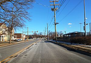
Northbound West Avenue (CR 611) in Port Reading
|
|

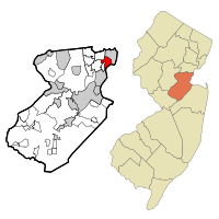
Location of Port Reading in Middlesex County highlighted in red (left). Inset map: Location of Middlesex County in New Jersey highlighted in orange (right).
|
|
| Country | |
| State | |
| County | Middlesex |
| Township | Woodbridge |
| Area | |
| • Total | 2.20 sq mi (5.70 km2) |
| • Land | 1.98 sq mi (5.12 km2) |
| • Water | 0.23 sq mi (0.59 km2) 22.61% |
| Elevation | 13 ft (4 m) |
| Population
(2020)
|
|
| • Total | 3,921 |
| • Density | 1,984.31/sq mi (766.05/km2) |
| Time zone | UTC−05:00 (Eastern (EST)) |
| • Summer (DST) | UTC−04:00 (Eastern (EDT)) |
| ZIP Code |
07064
|
| Area code(s) | 732/848 |
| FIPS code | 34-60540 |
| GNIS feature ID | 02389698 |
Port Reading is a small community located in Woodbridge Township, New Jersey. It is part of Middlesex County, New Jersey, in the United States. Even though it's not an official town, it's recognized as a census-designated place (CDP). This means the U.S. Census Bureau counts it as a specific area for statistics. In 2020, about 3,921 people lived here.
Contents
History of Port Reading
Port Reading was built in the late 1800s. It was created by the Reading Company, a big railroad company from Pennsylvania. They needed a place to ship their goods, especially coal from Pennsylvania's anthracite coal fields.
In 1892, a new train line called the Port Reading Secondary was built. This line connected Port Reading to the main Reading Railroad system. There was also a large oil processing plant, the Port Reading Refinery, in the area.
Geography and Location
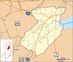
Port Reading is in the northeastern part of Middlesex County, New Jersey. It's located within the larger Woodbridge Township, New Jersey.
Neighboring Areas
- To the north and east, you'll find the borough of Carteret.
- To the northwest is Avenel.
- To the west is Woodbridge proper.
- To the south is Sewaren.
- To the southeast, it borders the Arthur Kill, a tidal strait. Across the Arthur Kill is Staten Island, New York.
Transportation and Size
The New Jersey Turnpike highway goes through Port Reading. The closest exit for the Turnpike is Exit 12 in Carteret.
Port Reading covers an area of about 2.20 square miles (5.70 square kilometers). Most of this is land, but about 0.23 square miles (0.59 square kilometers) is water. This water area is part of the Arthur Kill.
Population and People
| Historical population | |||
|---|---|---|---|
| Census | Pop. | %± | |
| 1990 | 3,977 | — | |
| 2000 | 3,829 | −3.7% | |
| 2010 | 3,728 | −2.6% | |
| 2020 | 3,921 | 5.2% | |
| Population sources: 1990-2010 2000 2010 2020 |
|||
The population of Port Reading has changed a bit over the years. In 1990, there were 3,977 people. By 2010, the number was 3,728. The most recent count in 2020 showed the population had grown slightly to 3,921 people.
Who Lives in Port Reading?
Based on the 2010 census, here's a quick look at the people living in Port Reading:
- Most residents (about 80%) were White.
- About 7% were Black or African American.
- Around 5% were Asian.
- About 18% of the population identified as Hispanic or Latino.
The average household in Port Reading had about 2.91 people. Many families were married couples living together. About 22.5% of the population was under 18 years old. The median age was 41.2 years, meaning half the people were younger than 41.2 and half were older.
Education
Port Reading has its own public elementary school.
- Port Reading School #9 serves students from kindergarten through 6th grade.
See also
 In Spanish: Port Reading para niños
 | Laphonza Butler |
 | Daisy Bates |
 | Elizabeth Piper Ensley |


