Sewaren, New Jersey facts for kids
Quick facts for kids
Sewaren, New Jersey
|
|
|---|---|

|
|

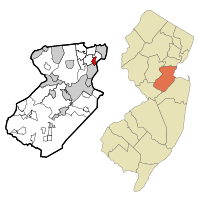
Map of Sewaren highlighted within Middlesex County. Right: Location of Middlesex County in New Jersey.
|
|
| Country | |
| State | |
| County | Middlesex |
| Township | Woodbridge |
| Area | |
| • Total | 1.66 sq mi (4.30 km2) |
| • Land | 1.22 sq mi (3.16 km2) |
| • Water | 0.44 sq mi (1.13 km2) 5.02% |
| Elevation | 16 ft (5 m) |
| Population
(2020)
|
|
| • Total | 2,885 |
| • Density | 2,360.88/sq mi (911.70/km2) |
| Time zone | UTC−05:00 (Eastern (EST)) |
| • Summer (DST) | UTC−04:00 (Eastern (EDT)) |
| ZIP Code |
07077
|
| Area code(s) | 732/848 |
| FIPS code | 34-66720 |
| GNIS feature ID | 02390280 |
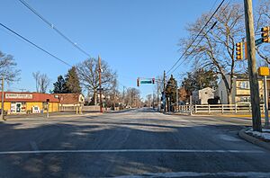
Sewaren (pronounced SEE-waren) is a small community in Woodbridge Township, New Jersey. It's a special kind of area called a census-designated place (CDP). This means it's a place the government counts for population, but it's not a separate town with its own local government. Sewaren is located in Middlesex County, New Jersey. In 2020, about 2,885 people lived there.
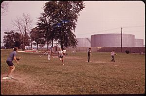
One important part of Sewaren is the PSE&G Sewaren Generating Station. This is a large power plant that helps create electricity. It's located along the Arthur Kill waterway. The plant has been updated over the years, with some older parts from the 1940s being replaced by newer, more efficient technology in 2018.
Contents
Exploring Sewaren's Location
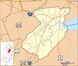
Sewaren is in the northeastern part of Middlesex County, New Jersey. It's surrounded by other communities. To the south, you'll find the city of Perth Amboy. To the west is Woodbridge itself. North of Sewaren is Port Reading.
On its eastern side, Sewaren borders the Arthur Kill. This is a waterway that separates New Jersey from Staten Island, which is part of New York. The borough of Carteret is about 2 miles north. The Outerbridge Crossing, a bridge that also leads to New York, is about 2 miles to the south.
Sewaren covers a total area of about 1.66 square miles. Most of this is land, but about 0.44 square miles is water. Woodbridge Creek forms some of the community's borders. Smith Creek also flows through the eastern part of Sewaren.
Who Lives in Sewaren?
| Historical population | |||
|---|---|---|---|
| Census | Pop. | %± | |
| 1990 | 2,569 | — | |
| 2000 | 2,780 | 8.2% | |
| 2010 | 2,756 | −0.9% | |
| 2020 | 2,885 | 4.7% | |
| Population sources: 1990-2010 2000 2010 |
|||
Sewaren is home to a diverse group of people. The population has grown slightly over the years. In 2010, there were 2,756 people living here. By 2020, the population increased to 2,885.
Many different backgrounds make up the community. In 2010, most residents were White, but there were also significant numbers of Black or African American, Asian, and Hispanic or Latino people. This mix of cultures helps make Sewaren a vibrant place to live.
About one-fifth of the population is under 18 years old. This means there are many kids and teenagers in Sewaren. The average age in 2010 was around 40.5 years old. Families are common here, with many married couples living together.
Education in Sewaren
Sewaren has its own elementary school. It is called Matthew Jago School #28. This school serves the younger students in the community.
Famous People from Sewaren
Some notable people have connections to Sewaren:
- John A. Hall (1877–1919): He was a college football player. He even coached the Carlisle Indians football team in 1898.
- Arthur A. Quinn (1866–1957): He was a leader in labor unions. He also worked as a politician.
See also
 In Spanish: Sewaren para niños
 | Kyle Baker |
 | Joseph Yoakum |
 | Laura Wheeler Waring |
 | Henry Ossawa Tanner |


