
Portage River (Kalamazoo–St. Joseph counties) facts for kids
Quick facts for kids Portage River |
|
|---|---|

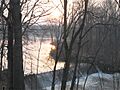
Boys Dam and Hoffman Pond
|
|
| Physical characteristics | |
| Main source | Portage Lake, Kalamazoo County, Michigan 42°15′19″N 85°21′21″W / 42.25532°N 85.35582°W |
| River mouth | St. Joseph River, Michigan 41°56′38″N 85°37′52″W / 41.94393°N 85.6311°W |
| Length | 38.6 mi (62.1 km) |
The Portage River is a river in Michigan that stretches about 38.6 miles (62.1 km) long. It flows south through Kalamazoo County and St. Joseph County, Michigan. The river starts at Portage Lake, about 8 miles (13 km) east of the city of Kalamazoo. It then flows southwest until it reaches the St. Joseph River in the city of Three Rivers.
Contents
What Does "Portage" Mean?
The word Portage comes from a French word meaning "to carry." It describes the act of carrying a canoe or boat over land. This was done to move between different waterways or to get around obstacles like waterfalls.
Native American Travel Routes
Even before the French arrived, Native American tribes like the Potawatomi used the Portage River. They used it for trade and travel. The river and its main branch, Portage Creek, were important links. They connected the Kalamazoo River and the St. Joseph River systems.
A Key Carrying Place
In what is now the city of Portage, two creeks (both called Portage Creek) flow very close to each other. One flows north, and the other flows south. This area was a key "portage" spot. People would carry their birch bark and dugout canoes across this land. This made it a vital part of the travel network for Native Americans in Michigan.
How Glaciers Shaped the River Area
Long ago, during the Wisconsin glaciation period, huge sheets of ice covered the land. As these glaciers melted, they left behind many kettles, ponds, and wet areas called bogs. The upper parts of the Portage River once had countless wetlands formed this way.
Changes to the Landscape
Over time, farmers built drainage ditches to dry out many of these wet areas. This allowed them to create farmland. As more people moved south of Kalamazoo, the landscape changed even more. However, some of the larger lakes from the glacial period still remain:
- Austin Lake: Located in Portage, this is the biggest lake in the Portage River area.
- Gourdneck Lake: Near Portage, this lake is named for its unique shape, which looks like a mature gourd.
- Indian Lake: This lake was a long-time camping spot for the Potawatomi tribe of Native Americans.
- Portage Lake (St. Joseph County): This lake covers about 510 acres (2.1 km²). It's important to note that this is a different lake from the one with the same name in Kalamazoo County where the river starts.
A Look Back at the River's History
The Portage River was an important trade route for Native American tribes. These included the Pottawatomi, Ojibwa, and Ottawa tribes. French traders also used the river.
Celebrating History and Battles
Today, a pow-wow is held every year in Three Rivers. It celebrates this rich history. There's also a reenactor camp where people dress up as French traders. A famous battle happened on the banks of the Portage River in 1802. It was between the Potawatomi and the Shawnee, led by Chief Elkhart. A plaque in Three Rivers remembers this event.
Early Industry and Farming
In 1831, a man named John Vickers saw the power of Portage Creek. He built a gristmill (a mill for grinding grain) there. This created Sunset Lake and led to the founding of the town of Vicksburg, named after him.
After the American Civil War, Dutch and Low German farmers came to the area. They were skilled in growing crops in wetlands. The southern Kalamazoo region became one of the first places in the United States to grow celery for salads. For many years, the Portage River area was a leader in celery production. Other special crops grown in the wet "muckland" included peppermint and spearmint. On the higher, sandy banks further south, farmers grew strawberries. The R. M. Kellogg farm in Three Rivers, started in 1896, was very well known for its strawberries. This farm also had the Kellogg Gardens, a popular tourist spot with unique structures next to the river.
River as a Transportation Route
Today, people mostly use the Portage River for fun activities. But until the early 1900s, it was a busy path for transportation and trade. Frank Dentler of Parkville even ran a paddle wheel steamboat. It carried goods downriver to Three Rivers and upriver to the Portage Station.
The Portage River Today
Much of the Portage River area is still wet and covered with trees. Trees have been allowed to grow back along the riverbanks, as these areas are not good for farming.
Recreation and Wildlife
The river is a great place for canoeists and kayakers. Fishing is also excellent, with fish like largemouth bass, smallmouth bass, and walleye. However, it's always a good idea to check the State of Michigan Department of Health's fish advisory [1] before eating any fish from the river or lakes.
The banks of the Portage River form a special wetland ecosystem. This area is home to many interesting animals and plants. You might see painted turtles, wood ducks, and bullfrogs. There are also many rare and unusual native plants. The Southwest Michigan Land Conservancy helps protect this area. They manage the Hidden Marsh Sanctuary, a wilderness preserve with walking trails near Three Rivers. One of the river's original bogs, Bishop's Bog in Portage, Michigan, is also protected.
Dams Along the River
Several dams are located along the Portage River. These include the historic Cook's Mill Dam in Kalamazoo County. There's also the Parkville Dam and mill site near Parkville. In Three Rivers, you'll find the Hoffman Street Dam and the Boy's Dam from Hoffman Pond.
Images for kids
-
Boys Dam and Hoffman Pond
