
Portugués (Ponce) facts for kids
Quick facts for kids
Portugués
|
|
|---|---|

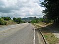
Scene in Barrio Portugués on Highway PR-503 heading northbound
|
|

Location of barrio Portugues within the municipality of Ponce shown in red
|
|

Portugués
Location in Caribbean
|
|
| Commonwealth | |
| Municipality | |
| Area | |
| • Total | 3.57 sq mi (9.2 km2) |
| • Land | 3.55 sq mi (9.2 km2) |
| • Water | 0.02 sq mi (0.05 km2) |
| Elevation | 554 ft (169 m) |
| Population
(2010)
|
|
| • Total | 4,134 |
| • Density | 1,167.8/sq mi (450.9/km2) |
| Source: 2010 Census | |
| Time zone | UTC−4 (AST) |
Portugués, also known as Barrio Portugués, is a neighborhood in Ponce, Puerto Rico. It is one of 31 neighborhoods in the city. Portugués is a rural area, meaning it's more like the countryside. It was started in 1831. It's one of eight rural neighborhoods in Ponce.
Contents
Where is Portugués Located?
Portugués is a hilly, rural neighborhood. It is in the middle part of the Ponce area, just north of the city itself.
The Río Chiquito (Little River) flows through the middle of Portugués. This river helps shape the neighborhood. It makes Portugués long from north to south, but narrow from east to west. The Río Portugués (Portuguese River) also runs nearby, to the east. It enters Portugués in the southern part.
Neighborhood Borders
Portugués has clear boundaries. To the north, it's bordered by hills near Pandura Road. To the south, it meets Camino de Ponce, Majagua Street, Arboleda Street, and Highway PR-504.
On the west side, it's bordered by Turell Road, La Zarza Road, and PR-10. To the east, you'll find PR-505, hills west of Río Bayagán, and the eastern slopes of El Gato Hill.
Portugués shares borders with other neighborhoods:
- North: Monte Llano
- South: Portugues Urbano and Machuelo Arriba
- West: Tibes and Magueyes
- East: Monte Llano and Machuelo Arriba
History of Portugués

The Río Portugués and the famous Ceiba tree in Ponce are linked to the first people who settled here. In the 1600s, the river was the eastern edge of a growing settlement. This area later became known as Ponce.
In 1824, Portugués first appeared on a list of Ponce neighborhoods. This list was made by Pedro Tomás de Córdova. However, the name "Barrio Portugués" was used in official records of Ponce as early as September 1821.
By 1878, a report showed that Portugués had 155 families living in 33 houses and 100 bohios (simple huts). At that time, it was one of the least populated neighborhoods in Ponce. There were also some hot springs called the Quintana Baths in the area. The building for these baths still stands today on Highway PR-503.
How Portugués Got Its Name
The name Hato de Portugués comes from old land records from 1800. Hatos were large areas of land used for raising cattle. They were the main land units in Puerto Rico until the late 1800s.
The name might be even older. In the late 1500s, before Ponce was even a town, a man named Don Pedro Rodríguez de Guzmán started a small community. He also had a store near the Río Baramaya. Rodríguez was one of the first settlers of what is now Ponce. He was known as “El Portugués” (The Portuguese).
Some say he was from Portugal. Others say he was from San German but had Portuguese family. His store was likely at a place where people could easily cross the river. River crossings were important landmarks back then. Over time, people might have started calling the river "Río Portugués" instead of "Río Baramaya." This unofficial name then stuck to the land area, becoming today's Barrio Portugués.
Facts and Figures
Portugués covers about 3.52 square miles of land. This is about three percent of all the land in Ponce. It is the 15th largest neighborhood in Ponce.
In 2010, about 4,134 people lived in Portugués. This means there were about 1,167 people per square mile.
The highest point in Portugués is 1,735 feet high. Another important hill is Cerro El Gato, which is 827 feet high.
Important Places to Visit
Portugués is home to the Tibes Indigenous Ceremonial Center. This important site was found in 1975 after a hurricane. It is the oldest cemetery found in the Antilles (Caribbean islands) so far. Over 200 skeletons from the year 300 AD were found here. It is considered a very important archaeological discovery in the West Indies.
Communities and Roads
Several communities are located within Portugués:
- Villa Elena
- Nuevo Mameyes
- El Señorial
- Río Chiquito
Major roads that go through Portugués include:
- PR-9
- PR-10
- PR-503
- PR-504
- PR-588
See also
 In Spanish: Portugués (Ponce) para niños
- List of communities in Puerto Rico
Images for kids
-
Scene in Barrio Portugués on Highway PR-503 heading northbound
