Promontory Mountains facts for kids
Quick facts for kids Promontory Mountains |
|
|---|---|

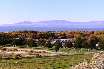
Promontory Mountains from the east shore of Willard Bay north of Ogden
|
|
| Highest point | |
| Peak | Messix Peak |
| Elevation | 7,349 ft (2,240 m) |
| Dimensions | |
| Length | 35 mi (56 km) north to south |
| Geography | |
| Country | United States |
| State | Utah |
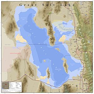
The Promontory Mountains are a group of mountains in Box Elder County, Utah. These mountains stretch about 35 miles (56 km) from north to south. The southern part of the range forms a point of land that reaches 20 miles (32 km) into the Great Salt Lake.
A very important event in American history happened just north of these mountains. The First Transcontinental Railroad was finished here. This is where the famous Golden Spike was driven in, connecting the East and West by train. Today, trains still cross the southern tip of the Promontory Mountains. They use a special causeway called the Lucin Cutoff to go over the lake.

How the Promontory Mountains Formed
The Promontory Mountains are a type of mountain range called a block fault range. This means they formed because large blocks of the Earth's crust moved up or down along cracks. These cracks are called faults. This kind of mountain building is common in the Basin and Range Province, a large area in the western United States.
On the west side of the Promontory Mountains, there's a major fault called the East Great Salt Lake Fault. This fault runs under the lake. It connects to other faults, like the one near Antelope Island. On the east side of the mountains, there's another fault system called the East Promontory Mountains fault zone. These faults are similar to the much larger Wasatch Fault, which is located further east of the Great Salt Lake. All these faults are "normal faults," meaning one side of the land drops down compared to the other.
Railroad History and the Mountains
The Promontory Mountains played a big role in the history of railroads in the United States. When the First Transcontinental Railroad was being built, engineers decided to go around the northern part of these mountains. This was because building tracks directly over the mountains would have been too difficult.
Later, in 1904, a new route was built. This route, called the Lucin Cutoff, crossed the Great Salt Lake near Promontory Point, the southern tip of the mountains. It first used a long wooden bridge called a trestle. This trestle was later replaced in 1959 by a solid causeway built across the lake. This allowed trains to cross the lake more easily, rather than going all the way around the mountains.
 | John T. Biggers |
 | Thomas Blackshear |
 | Mark Bradford |
 | Beverly Buchanan |


