Providence, New York facts for kids
Quick facts for kids
Providence
|
|
|---|---|
| Town of Providence | |

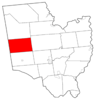
Map highlighting Providence's location within Saratoga County.
|
|
| Country | United States |
| State | New York |
| County | Saratoga |
| Area | |
| • Total | 45.09 sq mi (116.79 km2) |
| • Land | 44.00 sq mi (113.95 km2) |
| • Water | 1.1 sq mi (2.84 km2) |
| Elevation | 1,457 ft (444 m) |
| Population
(2020)
|
|
| • Total | 2,075 |
| • Density | 46.019/sq mi (17.767/km2) |
| Time zone | UTC-5 (Eastern (EST)) |
| • Summer (DST) | UTC-4 (EDT) |
| ZIP code |
12850
|
| Area code(s) | 518 |
| FIPS code | 36-59949 |
| GNIS feature ID | 0979400 |
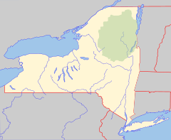
Providence is a small town in Saratoga County, New York, United States. It is located on the western edge of the county, northwest of Saratoga Springs. More than half of the town is inside the Adirondack Park, a large protected natural area. The town also borders the Great Sacandaga Lake.
Contents
History of Providence
The area that is now Providence was first settled before 1786. The town was officially formed in 1796. It was created from a part of the Town of Galway.
Early Economy and Development
In its early days, the town's economy mainly focused on forestry. People harvested lumber and produced pulpwood, which was very important for the area.
In more recent times, there have been plans to build a wireless internet network for the town. This would help connect residents to the internet.
Historic Places
A special place called the Packer Farm and Barkersville Store was added to the National Register of Historic Places in 2013. This means it is recognized as an important historical site.
Geography of Providence
Providence covers about 45.1 square miles (116.79 square kilometers). Most of this area is land, with about 1.1 square miles (2.84 square kilometers) being water.
Location and Natural Features
The western border of the town is also the border of Fulton County. The northern part of Providence is within the Adirondack Park, a large state park. Part of the western town line is along the shore of Great Sacandaga Lake.
The town's landscape includes many rolling hills. You can also find many small streams and lakes throughout the area. Several reservoirs, which are artificial lakes used for water storage, are located in the northeastern part of the town.
Population and People
| Historical population | |||
|---|---|---|---|
| Census | Pop. | %± | |
| 1820 | 1,515 | — | |
| 1830 | 1,579 | 4.2% | |
| 1840 | 1,507 | −4.6% | |
| 1850 | 1,458 | −3.3% | |
| 1860 | 1,443 | −1.0% | |
| 1870 | 1,155 | −20.0% | |
| 1880 | 994 | −13.9% | |
| 1890 | 874 | −12.1% | |
| 1900 | 607 | −30.5% | |
| 1910 | 520 | −14.3% | |
| 1920 | 462 | −11.2% | |
| 1930 | 470 | 1.7% | |
| 1940 | 409 | −13.0% | |
| 1950 | 369 | −9.8% | |
| 1960 | 556 | 50.7% | |
| 1970 | 803 | 44.4% | |
| 1980 | 1,210 | 50.7% | |
| 1990 | 1,360 | 12.4% | |
| 2000 | 1,841 | 35.4% | |
| 2010 | 1,995 | 8.4% | |
| 2020 | 2,075 | 4.0% | |
| U.S. Decennial Census | |||
According to the 2020 census, the total population of Providence was 2,075 people.
Population Trends
The population of Providence has changed over the years. In 1820, there were 1,515 people. The population decreased for many years, reaching a low of 369 people in 1950. Since then, the population has grown steadily, reaching 2,075 in 2020.
Communities and Locations in Providence
Providence is home to several smaller communities and interesting locations:
- Barkersville – A small village, also known as a hamlet, located in the southern part of the town on County Road 16.
- Fayville – Another hamlet found on the shore of Great Sacandaga Lake. It is in the northwestern section of town on County Road 13.
- Glenwild – A hamlet in the northern part of the town, north of Barkersville. It is located inside the Adirondack Park.
- Green Corners – A hamlet in the southeastern part of the town, just east of Hagedorns Mills.
- Hagedorns Mills – A hamlet north of Whiteside Corners on County Road 14.
- Lake Desolation – A small lake that is partly in Providence, near the eastern town line and County Road 12. Most of this lake is actually in Greenfield.
- Lake Nancy – A small lake located north of Wiley Corners.
- Long Corners – A specific spot east of Skinner Corners on County Road 13.
- Shaw Corners – A hamlet in the southern section of the town on County Road 16.
- Skinner Corners – A location in the southeastern part of the town on County Road 13.
- Whiteside Mills – A hamlet in the southwestern part of the town.
- Wiley Corners – A location in the northeastern part of the town on County Road 16.
See also
 In Spanish: Providence (Nueva York) para niños
 | Bessie Coleman |
 | Spann Watson |
 | Jill E. Brown |
 | Sherman W. White |


