Puerto Maldonado facts for kids
Quick facts for kids
Puerto Maldonado
|
||
|---|---|---|

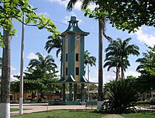
Central Plaza in Puerto Maldonado
|
||
|
||
| Country | Peru | |
| Department | Madre de Dios | |
| Province | Tambopata | |
| Founded | July 10, 1902 | |
| Area | ||
| • Total | 85,183 km2 (32,889 sq mi) | |
| Elevation | 183 m (600 ft) | |
| Population
(2017)
|
||
| • Total | 85,024 | |
| • Estimate
(2015)
|
74,494 | |
| • Density | 0.998133/km2 (2.585154/sq mi) | |
| Time zone | UTC-5 | |
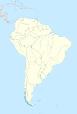
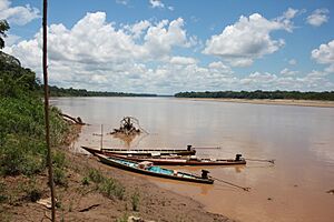
Puerto Maldonado is a city in southeastern Peru. It sits in the amazing Amazon rainforest, about 55 kilometers (34 miles) west of the Bolivian border. The city is located where two rivers, the Tambopata and the Madre de Dios, meet. The Madre de Dios River later joins the Madeira River, which is a branch of the mighty Amazon. This city is the capital of the Department of Madre de Dios.
Close to Puerto Maldonado are several important nature areas. These include the Manu National Park, Tambopata National Reserve, and Bahuaja-Sonene National Park. These places were created to protect the natural environment. They are some of the most untouched primary rain forests in the world. You can find special lakes shaped like U's, called oxbow lakes, and clay licks here. At clay licks, hundreds of birds, like colorful macaws, eat clay. Some of the native people living in this area are the Machiguenga.
Contents
History of Puerto Maldonado
The Madre de Dios area was harder to reach by big rivers. Because of this, it was explored later during the late 1800s. This was when the "rubber boom" happened in the Amazon. People like Carlos Fermín Fitzcarrald from Iquitos, Peru, and others from Brazil and Bolivia, were involved in the rubber business.
Workers brought in diseases from Europe that the local indigenous peoples had never been exposed to. This caused many people along the Manu River to get sick and die between 1889 and 1892. Another similar event happened in 1896.
Fitzcarrald explored the area and found a short path over land. This path connected the Mishagua River (a branch of the Urubamba River) and the Manu River (a branch of the Madre de Dios River). This land was named the Isthmus of Fitzcarrald after him. Moving rubber across this path allowed it to be put on ships. These ships could then travel down the Madre de Dios River, connect to the Madeira River, and finally reach the Amazon River. From there, the rubber could be sent to ports on the Atlantic Ocean for sale. Fitzcarrald also realized that the spot where Puerto Maldonado is today was a very important location. He died in 1897 when his ship sank near where the city was later founded.
In 1901, the Peruvian Government created a group to explore how to use the country's rainforest resources. Don Juan Villalta led a trip along the Tambopata River, starting from Sandia. Villalta officially founded Puerto Maldonado on July 10, 1902. It was set up as a station where the Tambopata and Madre de Dios rivers meet. He named the port after Faustino Maldonado, who had explored the Madre de Dios River in 1861. Faustino Maldonado had sadly drowned in the fast-moving water of the Mamoré River.
The Department of Madre de Dios was officially created on December 26, 1912, with Puerto Maldonado as its capital city. The city was formally recognized in 1985.
Geography and Climate
Puerto Maldonado's Location
Puerto Maldonado is located in the tropical Amazon Basin. This means it's in a hot, wet area. The average low temperature each year and the amount of rain it gets give it a tropical rainforest climate. The weather is usually warm and always humid.
Weather Patterns
The average temperature throughout the year is about 26 degrees Celsius (79 degrees Fahrenheit). August and September are usually the hottest months. The city gets more than 2,000 millimeters (79 inches) of rain every year. The wet season, when it rains a lot, is from October to April. This is known as a tropical monsoon climate.
The main part of the town is on slightly higher ground. This helps prevent it from flooding during the wet season. However, traveling by road can become very difficult during this time. There is a low water season between June and August.
A special weather event called a surazo or friaje sometimes happens. This is when cold winds from the mountains in the south blow in. The temperature can drop to as low as 8 degrees Celsius (46 degrees Fahrenheit) for a few days.
| Climate data for Puerto Maldonado (1961-1990, extremes 1958-1995) | |||||||||||||
|---|---|---|---|---|---|---|---|---|---|---|---|---|---|
| Month | Jan | Feb | Mar | Apr | May | Jun | Jul | Aug | Sep | Oct | Nov | Dec | Year |
| Record high °C (°F) | 36.7 (98.1) |
36.0 (96.8) |
36.5 (97.7) |
36.6 (97.9) |
37.0 (98.6) |
38.7 (101.7) |
39.2 (102.6) |
38.1 (100.6) |
40.0 (104.0) |
39.4 (102.9) |
39.0 (102.2) |
39.5 (103.1) |
40.0 (104.0) |
| Mean daily maximum °C (°F) | 30.9 (87.6) |
30.7 (87.3) |
31.0 (87.8) |
30.7 (87.3) |
29.8 (85.6) |
29.0 (84.2) |
29.6 (85.3) |
31.2 (88.2) |
32.0 (89.6) |
32.0 (89.6) |
31.6 (88.9) |
31.1 (88.0) |
30.8 (87.4) |
| Mean daily minimum °C (°F) | 21.4 (70.5) |
21.2 (70.2) |
20.9 (69.6) |
20.3 (68.5) |
18.8 (65.8) |
17.4 (63.3) |
16.8 (62.2) |
17.8 (64.0) |
18.8 (65.8) |
20.4 (68.7) |
21.1 (70.0) |
21.3 (70.3) |
19.7 (67.5) |
| Record low °C (°F) | 15.0 (59.0) |
14.0 (57.2) |
13.0 (55.4) |
11.5 (52.7) |
7.0 (44.6) |
7.0 (44.6) |
4.5 (40.1) |
7.4 (45.3) |
4.7 (40.5) |
13.0 (55.4) |
13.0 (55.4) |
15.5 (59.9) |
4.5 (40.1) |
| Average rainfall mm (inches) | 342.6 (13.49) |
333.4 (13.13) |
274.9 (10.82) |
154.2 (6.07) |
105.5 (4.15) |
57.6 (2.27) |
56.8 (2.24) |
63.3 (2.49) |
98.1 (3.86) |
164.4 (6.47) |
236.9 (9.33) |
279.3 (11.00) |
2,167 (85.31) |
| Source 1: NOAA | |||||||||||||
| Source 2: CIIFEN (record highs and lows) | |||||||||||||
Industries and Economy
The main ways people make a living in Puerto Maldonado include cutting down trees (logging), small-scale gold mining, collecting Brazil nuts, building boats, and eco-tourism. Most of the valuable trees have already been cut down, and only one timber mill remains. This area was once famous for its mahogany wood.
In the late 1800s and early 1900s, during the "rubber boom," people collected latex (rubber) by tapping rubber trees here. However, rubber production in South America decreased after rubber tree seeds were secretly taken out of the country. New rubber farms were then started in Southeast Asia. Rubber collection in this area has stopped a long time ago.
Today, at least 30,000 gold miners work in the region around Puerto Maldonado.
Tourism and building boats for tourists are the biggest sources of money in the early 21st century. Many eco-lodges (places for tourists who want to experience nature) are located around Puerto Maldonado and in the nature reserves.
Transportation and Roads
Local Travel
A ferry used to carry people and vehicles across the river. It connected the main road from Cusco to the towns of San Lorenzo, Iberia, and Iñapari. Now, a new bridge, the 750-meter long Continental Bridge (also called Billinghurst), has replaced the ferry for many. However, the ferry still helps many local people cross the river. Since gasoline is very expensive here, most locals travel by motorcycle. Puerto Maldonado also has an airport called Padre Aldamiz International Airport.
The Interoceanic Highway
The Interoceanic Highway, also known as Rodovia do Pacifico, is a major road project. It was built to connect river ports in Brazil with ports on the Pacific coast of Peru. This highway was planned to go through Puerto Maldonado. It crosses the Madre de Dios River on a 722-meter (2,369 feet) long bridge called the Puente Continental (or Continental Bridge). This bridge faced some delays during construction, which affected its cost. There were also reports of problems with its structure. But it was finished and opened in March 2012.
Around Puerto Maldonado, the highway cuts through primary rain forest. Some groups, like the Peruvian organization Asociación Civil Labour, are worried about this. They fear the road might encourage illegal logging, hunting, and new settlements in areas that were hard to reach before. This could also lead to problems with indigenous people who have lived very isolated from the modern world.
See also
 In Spanish: Puerto Maldonado para niños
 | Frances Mary Albrier |
 | Whitney Young |
 | Muhammad Ali |


