Pyramid Mountain (Clallam County, Washington) facts for kids
Quick facts for kids Pyramid Mountain |
|
|---|---|

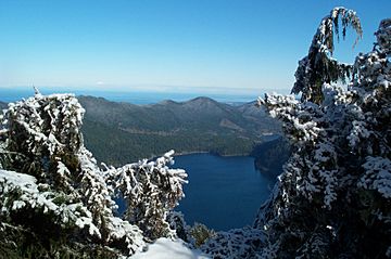
Pyramid Peak summit view in February with Mount Baker in the distance.
|
|
| Highest point | |
| Elevation | 3,100+ ft (940+ m) NGVD 29 |
| Prominence | 700 ft (210 m) |
| Geography | |
| Location | Clallam County, Washington, U.S. |
| Parent range | Olympic Mountains |
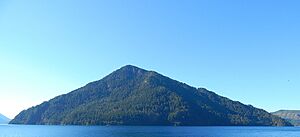
Pyramid Mountain is a cool mountain that stands tall above the north shore of Lake Crescent. It used to be called Sugarloaf Mountain, but it got its current name in 1928. At the very top, you can find the remains of an old fire lookout station.
This mountain offers amazing views from places like Barnes Point and Lake Crescent Lodge. You can reach it by following a trail from the Spruce Railroad Trail. On a clear day, you might even see Mount Baker far away in the Cascade Range, across the Puget Sound.
From the top of Pyramid Mountain, you can easily spot the huge landslide that once blocked Indian Creek. This landslide actually created a natural dam, forming Lake Crescent. Below the landslide, you can see Lake Sutherland and the Indian Creek valley leading down to the Elwha River.
Mountain Weather
Pyramid Mountain is located in the northwest part of the Olympic Mountains. This area has a "marine west coast" climate. This means the weather is greatly influenced by the nearby Pacific Ocean.
Most weather fronts, which are like big air masses, start over the Pacific Ocean. They then travel northeast towards the Olympic Mountains. As these weather fronts hit the tall peaks of the Olympic Range, they are forced to rise. When the air rises, it cools down and drops its moisture as rain or snow. This process is called Orographic lift.
Because of this, the Olympic Mountains get a lot of rain and snow, especially in winter. During winter, it's often cloudy. But in summer, high-pressure systems over the Pacific Ocean usually bring clear skies and sunshine.
How the Mountain Formed
The Olympic Mountains, including Pyramid Mountain, are made of special types of rock. These rocks were formed from pieces of old ocean floor and sediments that were pushed up over time. They are mostly sandstone, turbidite (rock formed from underwater landslides), and basalt (a type of volcanic rock).
The mountains got their shape during the Pleistocene era, which was a long time ago. During this period, huge sheets of ice called glaciers moved across the land many times. These glaciers carved out valleys and peaks, shaping the mountains we see today.
 | Selma Burke |
 | Pauline Powell Burns |
 | Frederick J. Brown |
 | Robert Blackburn |


