Quảng Ninh province facts for kids
Quick facts for kids
Quảng Ninh province
Tỉnh Quảng Ninh
|
|
|---|---|
|
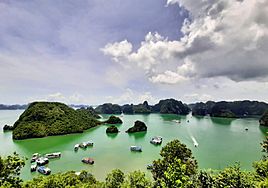
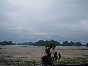
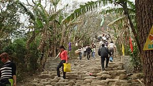
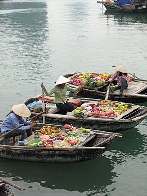
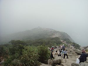
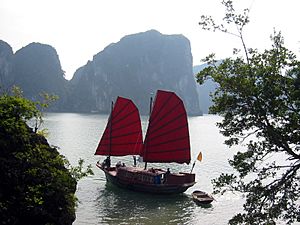
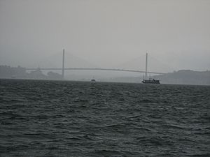
From top, left to right: Hạ Long Bay, Bái Tử Long Bay, Hồng Vàn Beach, primeval forest in Cô Tô Island, and Thiên Cung Cave.
|
|
| Nickname(s):
The Miner's Province (Đất Mỏ)
|
|
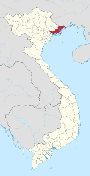
Location of Quảng Ninh in Vietnam
|
|
| Country | |
| Region | Northeast |
| Capital | Hạ Long |
| Subdivision | 4 cities, 2 district-level towns and 7 rural districts |
| Government | |
| • Body | Quảng Ninh Provincial People's Council |
| Area | |
| • Province | 6,178.21 km2 (2,385.42 sq mi) |
| Population
(2021)
|
|
| • Province | 1,323,149 |
| • Density | 214.16381/km2 (554.6817/sq mi) |
| • Urban | 850,761 |
| Ethnic groups | |
| • Vietnamese | 87.69% |
| • Dao | 5.57% |
| • Tày | 3.08% |
| • Sán Dìu | 1.56% |
| • Others | 2.1% |
| Time zone | UTC+7 (ICT) |
| Area codes | 203 |
| ISO 3166 code | VN-13 |
| License plate | 14 |
| HDI (2020) | 0.769 (6th) |
| Climate | Cwa |
Quảng Ninh is a province located on the northeastern coast of Vietnam. It's about 153 kilometers (95 miles) east of Hanoi. The province is made up of four cities, two district-level towns, and seven rural districts. Its capital city is Hạ Long.
Quảng Ninh covers an area of 6,178 square kilometers (2,385 square miles). In 2019, it had a population of 1,320,324 people. A large part of the province, nearly 80%, is mountainous. It has lots of land, forests, water, and mineral resources. In fact, 90% of Vietnam's coal comes from this province!
Quảng Ninh is also home to Hạ Long Bay, a famous World Heritage Site. This bay has 1,969 islands, and 989 of them have been given names. The province has a high Human Development Index, ranking sixth among all areas in Vietnam.
Contents
What's in a Name?
The name "Quảng Ninh" comes from two older provinces: Quảng Yên and Hải Ninh. President Ho Chi Minh combined their names to create the new province's name.
Exploring Quảng Ninh's Geography
Quảng Ninh province has a unique shape, like a slanted rectangle. To the west, it has a large area of forests and mountains. To the east, it touches the Gulf of Bắc Bộ. The province has a winding coastline with many rivers meeting the sea, and over 2,000 islands. About 1,030 of these islands have names.
The province is 195 kilometers (121 miles) wide at its widest point. From north to south, it is 102 kilometers (63 miles) long. Its northernmost point is in the mountains at Mo Toòng village. The southernmost point is on Hạ Mai Island. The westernmost point is by the Vàng Chua River, and the easternmost point is at Got Cape near Móng Cái Town.
Quảng Ninh shares a border with China to the north. This border is about 170 kilometers (106 miles) long. To the east, it borders the Gulf of Bắc Bộ. To the west, it borders Lạng Sơn, Bắc Giang, and Hải Dương provinces. To the south, it borders the city of Hải Phòng. The coastline is 250 kilometers (155 miles) long.
The total area of Quảng Ninh is 8,239 square kilometers (3,181 square miles). Of this, 5,938 square kilometers (2,293 square miles) is mainland. The rest, a huge 2,449 square kilometers (946 square miles), is made up of islands, bays, and sea. The islands alone cover 620 square kilometers (239 square miles).
Mountains and Plains
Quảng Ninh is mostly mountains and coast. More than 80% of its land is mountains and hills. Even the 2,000 islands are considered mountains!
The mountainous areas are split into two parts:
- The eastern mountains stretch from Tiên Yên through Bình Liêu, Hải Hà, Đầm Hà, and Móng Cái. These are part of the Thâp Van Đai Son range from China. Key peaks include Quảng Nam Châu (1,507 meters) and Cao Xiêm (1,330 meters).
- The western mountains go from Tiên Yên through Ba Chẽ and Hoành Bồ, north of Uông Bí Town. These are smoother, curved mountains called Đông Triều. They include Yên Tu Mount (1,068 meters) and Am Váp Mount (1,094 meters).
The central and coastal plains have low hills worn down by weather. These areas form fields and river basins. They are found in places like Đông Triêu, Uông Bí, and parts of Móng Cái. Near river mouths, rich soil builds up, creating low, flat areas. These plains are great for farming and transportation, and many people live there.
The sea and island areas of Quảng Ninh are very special. With over 2,000 islands, it has two-thirds of Vietnam's islands. They stretch along the coast for over 250 kilometers. The biggest islands are Cái Bầu and Bản Sen. Some islands are tiny, like rocks. Vân Đồn and Cô Tô are island districts. Many islands in Hạ Long Bay and Bái Tử Long Bay have amazing caves. Besides rich soil, there are also white sand beaches, which are used for glassmaking or as tourist spots like Trà Cổ and Quan Lạn.
The sea floor in Quảng Ninh is not flat, with an average depth of 20 meters. It has old riverbeds and rocky areas underwater, forming natural waterways and harbors.
Rivers and Water Sources
Quảng Ninh has many rivers and springs, but most are short and small. Their water levels change a lot between seasons. In winter, many rivers dry up. In summer, they become fast-flowing waterfalls.
The largest rivers include the Ka Long (which forms a natural border with China), Hà Côi, Đầm Hà, Tiên Yên, and Ba Chẽ rivers. The total amount of water stored in the province is estimated at 175 million cubic meters. There are 72 lakes and dams, with 28 large lakes holding 195.53 million cubic meters of water. The biggest is Yên Lập Lake.
Underground water is also plentiful, even on some larger islands. There are natural bottled water sources in Quảng Hanh (Cẩm Phả), Khe Lạc (Tiên Yên), and Đồng Long (Bình Liêu). The mineral water in Quảng Hanh is clear and colorless, rich in minerals.
Mineral Riches
Quảng Ninh is very rich in natural minerals. It has large amounts of coal, limestone, clay, kaolin, white sand, and granite. The province holds 90% of Vietnam's total coal supply, mostly anthracite coal. Limestone reserves are estimated at 3.1 billion tonnes, which is used to make cement. Other minerals like phosphorus, titanium, and quartz have also been found. Clay and glassy sand are also abundant, used for making tiles, bricks, and ceramics.
Quảng Ninh's Climate
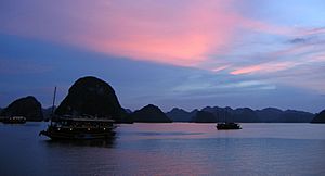
Quảng Ninh's weather is typical for North Vietnam, with four distinct seasons.
- Summer: It's hot, humid, and rainy, with strong monsoons. The average yearly temperature is 22.9°C (73.2°F).
- Winter: It's cold (sometimes as low as 1-3°C or 34-37°F), dry, and doesn't get much rain.
The average humidity is 82%. The yearly rainfall, influenced by northeastern monsoons, ranges from 1,700 mm to 2,400 mm (67 to 94 inches). Most rain falls in the summer months, especially July and August.
Quảng Ninh is more affected by the cold northeastern monsoon than other northern provinces. This brings strong winds and low temperatures. In high mountain areas like Bình Liêu and Hải Hà, temperatures can even drop below 0°C (32°F). Storms also affect the province, mainly in June, July, and August, and can be very strong, especially near the coast and islands.
Because of its varied landscape, different parts of Quảng Ninh have slightly different climates:
- The border area of Móng Cái District is colder and rainier.
- The southernmost area, Yên Hưng District, is warmer and gets less rain.
- High mountainous regions like Hoành Bồ and Ba Chẽ districts have frost for about 20 days a year and less rainfall.
- Bình Liêu District gets heavy rain and a long winter.
- The offshore islands are not the wettest, but they often have thick fogs in winter.
| Climate data for Hạ Long | |||||||||||||
|---|---|---|---|---|---|---|---|---|---|---|---|---|---|
| Month | Jan | Feb | Mar | Apr | May | Jun | Jul | Aug | Sep | Oct | Nov | Dec | Year |
| Record high °C (°F) | 28.8 (83.8) |
29.5 (85.1) |
32.0 (89.6) |
34.6 (94.3) |
36.1 (97.0) |
37.0 (98.6) |
37.9 (100.2) |
36.5 (97.7) |
36.3 (97.3) |
33.6 (92.5) |
33.8 (92.8) |
29.7 (85.5) |
37.9 (100.2) |
| Mean daily maximum °C (°F) | 19.4 (66.9) |
19.3 (66.7) |
21.8 (71.2) |
25.9 (78.6) |
30.0 (86.0) |
31.3 (88.3) |
31.6 (88.9) |
31.2 (88.2) |
30.6 (87.1) |
28.5 (83.3) |
25.3 (77.5) |
21.9 (71.4) |
26.4 (79.5) |
| Daily mean °C (°F) | 16.1 (61.0) |
16.6 (61.9) |
19.3 (66.7) |
23.1 (73.6) |
26.8 (80.2) |
28.2 (82.8) |
28.6 (83.5) |
27.9 (82.2) |
27.0 (80.6) |
24.7 (76.5) |
21.2 (70.2) |
17.8 (64.0) |
23.1 (73.6) |
| Mean daily minimum °C (°F) | 13.9 (57.0) |
14.8 (58.6) |
17.5 (63.5) |
21.2 (70.2) |
24.4 (75.9) |
25.8 (78.4) |
26.1 (79.0) |
25.2 (77.4) |
24.2 (75.6) |
21.9 (71.4) |
18.4 (65.1) |
15.1 (59.2) |
20.7 (69.3) |
| Record low °C (°F) | 5.0 (41.0) |
5.3 (41.5) |
7.1 (44.8) |
11.4 (52.5) |
15.9 (60.6) |
18.4 (65.1) |
21.4 (70.5) |
21.1 (70.0) |
16.6 (61.9) |
14.0 (57.2) |
9.0 (48.2) |
1.7 (35.1) |
1.7 (35.1) |
| Average precipitation mm (inches) | 23 (0.9) |
25 (1.0) |
41 (1.6) |
91 (3.6) |
170 (6.7) |
299 (11.8) |
327 (12.9) |
445 (17.5) |
282 (11.1) |
159 (6.3) |
37 (1.5) |
19 (0.7) |
1,918 (75.5) |
| Average precipitation days | 7.7 | 11.0 | 13.8 | 11.6 | 11.4 | 15.6 | 15.6 | 18.6 | 14.1 | 10.1 | 5.7 | 5.2 | 140.3 |
| Average relative humidity (%) | 80.2 | 84.6 | 87.6 | 86.7 | 83.0 | 83.6 | 83.4 | 85.6 | 82.3 | 78.5 | 75.9 | 76.5 | 82.3 |
| Mean monthly sunshine hours | 87 | 48 | 47 | 89 | 190 | 173 | 200 | 173 | 188 | 189 | 164 | 143 | 1,690 |
| Source: Vietnam Institute for Building Science and Technology | |||||||||||||
A Look at Quảng Ninh's History
Quảng Ninh has a very long and interesting history.
Ancient Times
In the Hạ Long Bay area, archaeologists have found signs of people living there from 3000 to 1500 BC. This time is known as the Hạ Long culture. They found ancient shells used as jewelry and money, old animal bones, and human bones. This land was one of the 15 tribes of the ancient Văn Lang State.
Feudal Period
Over time, the Quảng Ninh area was called by different names:
- Ngô dynasty: Lục Châu
- Lý dynasty: Đông Hải
- Trần dynasty: Hải Đông
- Later Lê dynasty: An Bang
- Nguyễn dynasty: Quảng Yên
Important historical places in Quảng Ninh include:
- Bạch Đằng River: This is where famous naval battles took place, especially against invaders.
- Commercial Vân Đồn port: This was an important trading port and a site of naval battles against the Mongol Empire.
- Tomb of Trần dynasty: This area in Đông Triều District was home to the ancestors of the Trần dynasty.
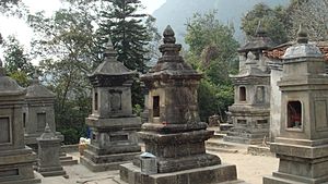
- Yên Tu Mount: This mountain in Uông Bí city is famous as the home of the Trúc Lâm Zen Buddhist tradition.
French Colonial Period to Today
After the French took over Tonkin (northern Vietnam) in 1899, they created Hải Ninh province from part of Quảng Yên. They saw the rich coal resources and started mining a lot in areas like Hong Gai and Cẩm Phả. The French company SFCT controlled all the coal mining and selling. Because of this, Quảng Ninh became one of the first places in Vietnam where a working class of miners was formed.
On November 12, 1936, over 30,000 miners went on strike. They demanded better wages and shorter work hours. This strike was a big victory and became a symbol of the Vietnamese fight for rights and independence. It's now celebrated as the traditional "Date of the Indomitable Mines."
After Vietnam gained independence in the August Revolution of 1945, the government changed. In 1963, the Hong Quang and Hải Ninh provinces were combined to create Quảng Ninh province. This was done following the idea of Ho Chi Minh, using parts of the old names. During the Sino-Vietnamese War, battles like the Battle of Móng Cái happened here.
How Quảng Ninh is Divided
Quảng Ninh is divided into 13 main areas called district-level sub-divisions. These areas then have 177 smaller parts called commune-level sub-divisions.
| District-level sub-divisions | City Hạ Long |
City Cẩm Phả |
City Móng Cái |
City Uông Bí |
Town Đông Triều |
Town Quảng Yên |
District Vân Đồn |
District Tiên Yên |
District Hải Hà |
District Cô Tô |
District Đầm Hà |
District Bình Liêu |
District Ba Chẽ |
|---|---|---|---|---|---|---|---|---|---|---|---|---|---|
| Area (km2) | 1,119.12 | 386.5 | 519.6 | 252.3 | 395.1 | 327.2 | 581.8 | 652.1 | 511.6 | 50 | 335 | 470.1 | 606.5 |
| Population | 300,267 | 190,232 | 100,100 | 120,982 | 169,300 | 134,600 | 52,940 | 49,300 | 57,400 | 5,900 | 38,100 | 30,900 | 21,100 |
| Density | 268 | 492 | 193 | 480 | 428 | 411 | 91 | 76 | 112 | 118 | 117 | 66 | 35 |
| Commune-level sub-divisions | 21 wards, 12 communes | 13 wards, 3 communes | 8 wards, 9 communes | 9 wards, 1 communes | 10 wards, 11 communes | 11 wards, 8 communes | 1 town, 11 communes | 1 town, 10 communes | 1 town, 10 communes | 1 town, 2 communes | 1 town, 8 communes | 1 town, 6 communes | 1 town, 7 communes |
| Year of establishment | 1993 | 2012 | 2008 | 2011 | 2015 | 2011 | 1948 | 1963 | 2001 | 1994 | 2001 | 1919 | 1946 |
People of Quảng Ninh
In 2019, Quảng Ninh Province had a population of 1,320,324 people. This means there were about 216 people per square kilometer. More people live in cities (63.9%) than in rural areas (36.1%).
There are about 40 different ethnic groups living in Quảng Ninh. Each group has its own language, traditions, and culture. The largest groups are:
- Vietnamese: 87.69%
- Dao: 5.57%
- Tày: 3.08%
- Sán Dìu: 1.56%
- Other groups make up the remaining 2.1%.
The main religious beliefs in this area are Buddhism, Christianity, and ancestor worship. People also follow other traditional folk beliefs.
Cities and Towns in Quảng Ninh
| No | Name | Class | Area (km2) |
Population (people) |
Density | Number of wards | Number of communes | |
|---|---|---|---|---|---|---|---|---|
| 1 | Hạ Long | Class I | 1,119.12 | 300,267 | 268 | 21 | 12 |  |
| 2 | Uông Bí | Class II | 252.3 | 120,982 | 480 | 9 | 1 | 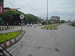 |
| 3 | Móng Cái | Class II | 519.6 | 125,000 | 241 | 8 | 9 | 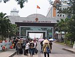 |
| 4 | Cẩm Phả | Class II | 386.5 | 190,232 | 492 | 13 | 3 |  |
| 5 | Quảng Yên | Class III | 337.57 | 139,596 | 444 | 11 | 8 | 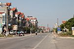 |
| 6 | Đông Triều | Class III | 397.2 | 179,902 | 401 | 10 | 11 | 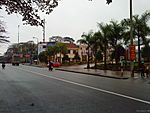 |
| 7 | Cái Rồng, Vân Đồn District | Class IV | 8.8 | 6,583 | 748 |  |
||
| 8 | Tiên Yên, Tiên Yên District | Class IV | 7.07 | 7,206 | 1,019 | |||
| 9 | Đầm Hà, Đầm Hà District | Class V | 3.37 | 5,958 | 1,768 | |||
| 10 | Cô Tô, Cô Tô District | Class V | 6.5 | 2,010 | 309 |  |
||
| 11 | Bình Liêu, Bình Liêu District | Class V | ||||||
| 12 | Ba Chẽ, Ba Chẽ District | Class V | 6.99 | 3,874 | 554 | |||
| 13 | Quảng Hà, Hải Hà District | Class V |  |
Amazing Animals and Plants
Quảng Ninh has a rich and diverse natural environment. This is thanks to its varied land, climate, and soil. The province is home to many different kinds of plants and animals. Scientists have found 1,027 plant species and 120 animal species here.
Animals of Quảng Ninh
- Farm Animals: You'll find common farm animals like cattle, pigs, chickens, cats, dogs, and rabbits. Cattle farming is popular in the mountains. The Móng Cái pig is famous for its lean meat. In eastern districts, a mix of swans and ducks called cà sáy are also raised. Some foreign animals like Indian buffaloes and Dutch milk cows have also been brought in.
- Wild Animals: Long ago, Quảng Ninh had many wild animals like elephants, rhinoceroses, tigers, leopards, and bears. Today, you can still find monkeys, deer, pheasants, eagles, wild boars, and various birds. Tortoises are also found, but their numbers are decreasing.
- Water Animals: The waters of Quảng Ninh are full of life, both in fresh water and the sea. The Gulf of Bắc Bộ has many types of fish. Special creatures like pearl mussels, stockfish, sea turtles, and lobsters live here. Along the coast, you can find oysters and edible seaweed. These sea resources are a very important source of income for the people of Quảng Ninh.
Plants of Quảng Ninh
Forestry is a strong point for Quảng Ninh's plant life. While the land for growing rice and corn is not very fertile, the province is great for fruit trees, timber trees, and industrial plants.
The Đông Triều District has about 30 square kilometers (11.6 square miles) of fruit trees. In the past, Quảng Ninh had many different kinds of high-quality wood, like ironwood and teak. Today, pine trees are common. In the mountainous areas, you can find a variety of trees and plants that provide spices and traditional medicines.
Quảng Ninh's Economy
Even though farming is important, other industries and tourism are also growing in Quảng Ninh. The province is part of the "northern economic triangle" (Hà Nội – Hải Phòng – Quảng Ninh). This means it has many resources and a lot of potential for economic growth.
The government of Quảng Ninh has plans to develop the province into a modern industrial area by 2015 and a high-quality tourism center. Industrial growth is happening quickly, especially in mineral extraction. Special economic zones are being created, like the Mong Cai Border Gate Economic Zone and the Van Don Economic Zone. Tourism is also a top priority, aiming to make Quảng Ninh a major tourist destination in the North.
Historical Places to Visit
Quảng Ninh has many interesting places to visit, from mountains and bays to temples and historical sites.
Famous Mountains
- Bài Thơ Mountain: This limestone mountain is 106 meters (348 feet) tall and sits right in the middle of Hạ Long City. It looks like a giant castle with three rocky towers. It was once called "Transmission Mount."
- That Bai Tho Mountain: This mountain has a historical connection to Emperor Lê Thánh Tông, who visited in 1468. He was so impressed by its beauty that he wrote a poem about it, which was carved into the rock. Later, in 1729, another leader, Lord Trịnh Cương, also added a painting and poem. This is why it's called "Poem Mountain." It's an important historical site and a popular tourist spot.
Temples and Historical Sites
- Cua Ong Temple: This temple is located on a mountain with views of the beautiful Bai Tu Long Bay.
- Tien Temple: This temple is found next to the local government office in Cam La commune.
- Bạch Đằng Beach: This is a very important historical site. It marks the place where Vietnamese forces, led by Trần Quốc Tuấn, famously defeated the Mongol invaders in the 13th century.
Getting Around Quảng Ninh
Quảng Ninh has a good transportation system:
- Roads: Major highways like National Highways No. 10, 18, and 48 connect Quảng Ninh to Hanoi, Haiphong, and other northern provinces. Highway 4B links the province to Lạng Sơn and Cao Bằng.
- Air Travel: The Van Don International Airport serves the province. You can also reach the Mong Cai International Border Gate from Hanoi's Noi Bai International Airport.
- Railways: The railway line connecting Hanoi to Hạ Long (Cai Lan port) has been improved. There are also 64 kilometers (40 miles) of rail links connecting to industries within the province.
- Water Transport: Quảng Ninh has many rivers and important seaports. The Cai Lan port is the largest deep-water port in North Vietnam and is being expanded to handle even more cargo. The Cu Ong port can handle very large ships. Other smaller ports along the coast include Bo, Cau Trang, and Tien Yen.
- Bridges: The Bính Bridge crosses the Cấm River, connecting Quảng Ninh with the city of Hai Phong.
See also
 In Spanish: Provincia de Quảng Ninh para niños
- Economy of Vietnam
- Energy in Vietnam
- South China Sea
- World Heritage Site
 | William Lucy |
 | Charles Hayes |
 | Cleveland Robinson |


