Quinault River facts for kids
Quick facts for kids Quinault River |
|
|---|---|

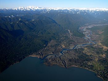
Quinault River emptying into Lake Quinault
|
|
|
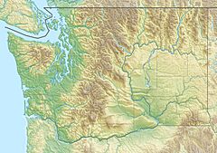
Mouth of the Quinault River in Washington
|
|
| Country | United States |
| State | Washington |
| Physical characteristics | |
| Main source | Olympic Mountains 47°42′6″N 123°20′3″W / 47.70167°N 123.33417°W |
| River mouth | Pacific Ocean Taholah 47°20′58″N 124°17′59″W / 47.34944°N 124.29972°W |
| Length | 69 mi (111 km) |
| Basin features | |
| Basin size | 188 sq mi (490 km2) |
The Quinault River is a river in the United States. It is about 69-mile (111 km) long. You can find it on the Olympic Peninsula in the state of Washington.
This river starts high up in the Olympic Mountains. It flows through Olympic National Park. The river then travels southwest through a beautiful area called the "Enchanted Valley." It passes by Quinault Canyon.
Before reaching Lake Quinault, the river meets its main branch, the North Fork Quinault River. Sometimes, the part of the river above this meeting point is called the East Fork Quinault River. After this, the river forms part of the Olympic National Park boundary. It then flows into Lake Quinault.
From Lake Quinault, the Quinault River continues southwest. It finally reaches the Pacific Ocean near a town called Taholah. The part of the river from Lake Quinault to the ocean is inside the Quinault Indian Reservation. This is land set aside for the Quinault people.
About the River's Path
The Quinault River collects water from an area of about 188 square miles (487 km2). This area is called its drainage basin. Think of it like a giant funnel that gathers all the rainwater and snowmelt into the river.
Many smaller streams flow into the Quinault River. These are called tributaries. The main ones include:
- North Fork Quinault River
- Graves Creek
- Fox Creek
- Cook Creek
Exploring the Enchanted Valley
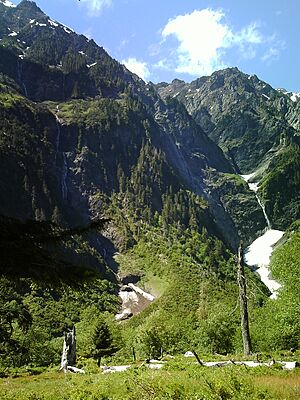
There is a well-kept trail that follows the East Fork of the Quinault River. This trail goes from Graves Creek to the Enchanted Valley Ranger Station. As you walk, you pass through an old-growth rainforest. This means the forest has very old, tall trees.
In early summer, the snow in the mountains melts. This melting snow creates many waterfalls in the valley. Because of all these waterfalls, the area is sometimes called the "Valley of a Thousand Waterfalls." It's a truly magical place to visit!
River Changes Over Time
In recent years, the Quinault River has been flowing at lower levels than before. This is because it used to get a lot of its water from the Anderson Glacier. However, the Anderson Glacier completely melted away by 2011. This shows how changes in our environment can affect rivers.
 | Isaac Myers |
 | D. Hamilton Jackson |
 | A. Philip Randolph |


