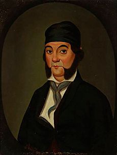
Rancho La Sierra (Yorba) facts for kids

Rancho La Sierra, also known as La Sierra de Santa Ana, was a huge piece of land in what is now Riverside County, California, United States. It covered about 17,769 acres (about 72 square kilometers). In 1846, a Mexican governor named Pio Pico gave this land as a grant to Bernardo Yorba. The grant was located between Rancho Jurupa and Rancho El Rincon, and it included the area where the city of Corona is today.
Contents
The Story of Rancho La Sierra
Early Days and Land Requests
Bernardo Yorba's father, José Antonio Yorba, owned another large ranch called Rancho Santiago de Santa Ana in what is now Orange County. For many years, Bernardo (who lived from 1800 to 1858) and his brothers used lands east of their father's ranch to graze their animals.
In 1834, Bernardo asked for and received another land grant called Rancho Cañón de Santa Ana. Bernardo and his brother Tomas (1787–1845) continued to graze their animals even further east. They called this area La Sierra, which means "The Mountains" in Spanish.
How the Land Was Divided
In 1845, after his brother Tomas passed away, Bernardo asked for about four square leagues (a large area) of the La Sierra lands. Just nine days later, Maria Vicenta Sepulveda, who was Tomas's widow, also asked for some of the same La Sierra lands.
On June 15, 1846, Governor Pio Pico decided to divide the land. He gave the western half, called Rancho La Sierra (Yorba), to Bernardo Yorba. The eastern half, called Rancho La Sierra (Sepulveda), went to Vicente Sepulveda.
California Becomes Part of the U.S.
After the Mexican–American War, California became part of the United States. This change was agreed upon in 1848 with the Treaty of Guadalupe Hidalgo. This treaty promised that the land grants given by Mexico would still be honored.
Because of a new law called the Land Act of 1851, Bernardo Yorba had to file a claim for Rancho La Sierra (Yorba) in 1852. The government officially recognized his ownership of the land in 1875. This official recognition is called a "patent."
Changes in County Borders
When California became a state in 1850, Rancho La Sierra was part of Los Angeles County. However, by the time Bernardo Yorba's land was officially recognized in 1875, Rancho La Sierra had become part of San Bernardino County.
Later, in 1893, Rancho La Sierra became part of Riverside County. This happened when the California government created Riverside County by taking land from both San Bernardino County and San Diego County.
The Founding of Corona
In 1886, a group of citrus growers bought Rancho La Sierra from Bernardo Yorba. This group included R.B. Taylor, George L. Joy, Samuel Merrill, A. S. Garretson, and Adolph Rimpau. They also bought another nearby land grant called Rancho Temescal (Serrano).
This group then created a new settlement called South Riverside. In 1896, the town was renamed Corona. The name "Corona" means "Crown" in Spanish. It was chosen because of a 3-mile (5-kilometer) circular road that goes around the center of the city. This road was even used for international car races between 1913 and 1916!
Bernardo Yorba also expanded his land by buying Rancho El Rincon from Juan Bandini.
What "La Sierra" Means
The name "La Sierra de Santa Ana" comes from Spanish and means "The mountains of Santa Ana". Bernardo Yorba and his brothers had been using this name for the area as early as 1825. The name helped people tell the difference between the higher lands of La Sierra de Santa Ana and Bernardo's Cañón de Santa Ana lands, both of which were located near the Santa Ana River.
Important Historic Sites
- Corona Founders Monument – This monument honors the people who bought Rancho La Sierra and Rancho Temescal on May 4, 1886. These individuals – Taylor, Joy, Merrill, Garretson, and Rimpau – were the founders of the citrus colony and the town that became Corona.
 | Tommie Smith |
 | Simone Manuel |
 | Shani Davis |
 | Simone Biles |
 | Alice Coachman |

