Range Ponds State Park facts for kids
Quick facts for kids Range Ponds State Park |
|
|---|---|
| Location | Poland, Androscoggin, Maine, United States |
| Area | 740 acres (300 ha) |
| Elevation | 308 ft (94 m) |
| Established | 1965 |
| Operator | Maine Department of Agriculture, Conservation and Forestry |
| Website | Range Ponds State Park |
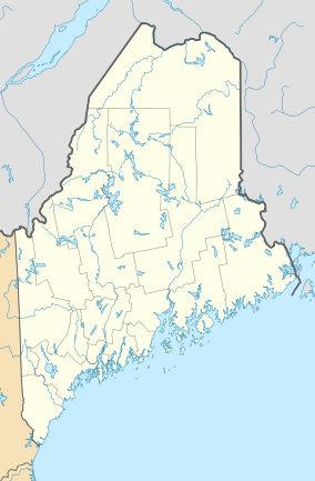
Range Ponds State Park is a fun place in Poland, Maine, where you can enjoy the outdoors. It's located in Androscoggin County, Maine and wraps around the eastern side of Lower Range Pond.
This state park is perfect for many activities. You can swim at the sandy beach, which has lifeguards to keep everyone safe. You can also go kayaking or use small motorboats on the pond. If you like hiking, there are trails to explore. Fishing is another popular activity here. For those who love biking, there are mountain biking trails built by local volunteers. These trails are great for intermediate riders and wind through beautiful pine and hardwood forests.
Contents
History of Range Ponds State Park
The park you see today was created a long time ago. In 1965, the State Park and Recreation Commission bought over 500 acres of land. This land was next to Lower Range Pond. It was purchased from a company called Hiram Ricker and Sons. This company was famous for bottling Poland Spring Water.
Exploring the Range Ponds
| Upper Range Pond | |
|---|---|
| Location | Poland, Maine |
| Coordinates | 44°00′N 70°24′W / 44.000°N 70.400°W |
| Max. length | 1.6 mi (2.6 km) |
| Surface area | 391 acres (158 ha) |
| Max. depth | 38 feet (12 m) |
| Surface elevation | 305 ft (93 m) |
| Middle Range Pond | |
|---|---|
| Location | Poland, Maine |
| Coordinates | 44°02′N 70°23′W / 44.033°N 70.383°W |
| Max. length | 1.8 mi (2.9 km) |
| Surface area | 366 acres (148 ha) |
| Max. depth | 66 feet (20 m) |
| Surface elevation | 305 ft (93 m) |
| Lower Range Pond | |
|---|---|
| Location | Poland, Maine |
| Coordinates | 44°03′N 70°22′W / 44.050°N 70.367°W |
| Max. length | 2.6 mi (4.2 km) |
| Surface area | 290 acres (120 ha) |
| Max. depth | 46 feet (14 m) |
| Surface elevation | 305 ft (93 m) |
The Range Ponds are a group of three ponds: Upper, Middle, and Lower. They are all at the same height and are connected by narrow parts of the water. Bridges cross these narrow sections, allowing roads to pass over the ponds.
Water flows from the Upper Pond, then into the Middle Pond, and finally to the Lower Pond. From the Lower Pond, the water flows out through Range Brook. This brook then goes to the Little Androscoggin River in Mechanic Falls, Maine, about 3 miles (5 km) north.
Fish in the Range Ponds
The ponds are home to several types of fish. You can find native fish like chain pickerel, white perch, and smallmouth bass. Other fish, such as brown trout and largemouth bass, have been added to the ponds. These fish often eat smaller fish like rainbow smelt and alewife. In the past, rainbow trout and land-locked Atlantic salmon were also added, but this is no longer done.
Upper Range Pond Details
Upper Range Pond is the shallowest of the three ponds. It is the southernmost pond in the group. Its northern end connects directly to the Middle Range Pond.
Middle Range Pond Details
Middle Range Pond stretches from the Upper Pond in the south to the Lower Pond in the north. Maine State Route 26 has a bridge that crosses the narrow area connecting the Middle and Lower ponds. This pond is the largest and deepest of the three. It is one of the few places where you might find lake trout. While there aren't natural places for brook trout to lay eggs, this type of fish is regularly added for people who enjoy fishing. In the early 2000s, a new type of fish, the Black crappie, was introduced to the Middle Pond.
Lower Range Pond Details
Lower Range Pond covers about 290 acres (117 hectares). It is the smallest of the three ponds by area, but it is the longest. It forms the top part of a "T" shape with the Middle and Upper ponds. The northern end of the Middle Pond connects to a short bay on the southwest side of the Lower Pond. Range Ponds State Park is located on the northeast shore and the southeast end of Lower Range Pond. The water from the northwest end of Lower Range Pond flows out to become Range Brook.
 | Ernest Everett Just |
 | Mary Jackson |
 | Emmett Chappelle |
 | Marie Maynard Daly |


