Red Hill, Pennsylvania facts for kids
Quick facts for kids
Borough of Red Hill
|
|
|---|---|

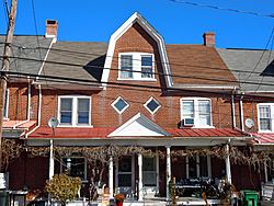
House in the historic district
|
|

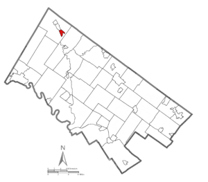
Location of Red Hill in Montgomery County, Pennsylvania
|
|
| Country | United States |
| State | Pennsylvania |
| County | Montgomery |
| Government | |
| • Type | Council-manager |
| Area | |
| • Total | 0.67 sq mi (1.73 km2) |
| • Land | 0.67 sq mi (1.73 km2) |
| • Water | 0.00 sq mi (0.00 km2) |
| Elevation | 358 ft (109 m) |
| Population
(2020)
|
|
| • Total | 2,496 |
| • Density | 3,742.13/sq mi (1,443.77/km2) |
| Time zone | UTC-5 (EST) |
| • Summer (DST) | UTC-4 (EDT) |
| ZIP Codes |
18073, 18076
|
| Area codes | 215, 267, and 445 |
| FIPS code | 42-63808 |
| School district | Upper Perkiomen School District |
| Website | https://www.redhillborough.org/ |
Red Hill is a small town, called a borough, located in Montgomery County, Pennsylvania, United States. It is a community with a suburban feel, found northwest of Philadelphia. The town is part of the Delaware River Valley watershed. In 2010, about 2,383 people lived here.
Red Hill is one of three small towns that are very close together along Route 29. These towns are Red Hill, Pennsburg, and East Greenville. People sometimes call this group of towns "East Penn Hill." The town got its name because of the large amount of red shale rock found in the soil and ground.
Contents
History of Red Hill
The Red Hill Historic District is a special area in the town. It was added to the National Register of Historic Places in 1985. This means it has important buildings and history that are protected. Red Hill is also home to the Red Hill Band, which is even older than the town itself!
Geography and Location
Red Hill is located at coordinates 40.376288 degrees North and -75.484308 degrees West. This helps us find it on a map. The U.S. Census Bureau says that the borough covers about 0.7 square miles (1.73 square kilometers) of land. There is no water area within the borough limits.
Getting Around Red Hill
In 2010, Red Hill had about 9.42 miles (15.16 kilometers) of public roads. The Pennsylvania Department of Transportation (PennDOT) takes care of 1.65 miles (2.66 kilometers) of these roads. The rest, about 7.77 miles (12.50 kilometers), are looked after by the borough itself.
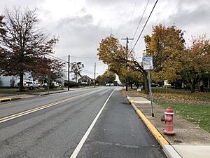
Pennsylvania Route 29 is the main highway that goes through Red Hill. It runs north and south, following what is known as Main Street in the town.
Population and People
| Historical population | |||
|---|---|---|---|
| Census | Pop. | %± | |
| 1910 | 664 | — | |
| 1920 | 787 | 18.5% | |
| 1930 | 851 | 8.1% | |
| 1940 | 881 | 3.5% | |
| 1950 | 914 | 3.7% | |
| 1960 | 1,086 | 18.8% | |
| 1970 | 1,201 | 10.6% | |
| 1980 | 1,727 | 43.8% | |
| 1990 | 1,794 | 3.9% | |
| 2000 | 2,196 | 22.4% | |
| 2010 | 2,383 | 8.5% | |
| 2020 | 2,496 | 4.7% | |
| U.S. Decennial Census | |||
The population of Red Hill has grown over the years. In 2020, the town had 2,496 residents.
In 2010, most of the people living in Red Hill were White. There were also smaller groups of Black or African American people and Asian people. Some residents identified as being of two or more races. A small percentage of the population had Hispanic or Latino family backgrounds.
Education for Students
Students in Red Hill attend schools that are part of the Upper Perkiomen School District. This district provides education for children and teens living in the area.
See also
 In Spanish: Red Hill para niños


