Regional District of Mount Waddington facts for kids
Quick facts for kids
Mount Waddington
|
|
|---|---|
|
Regional district
|
|
| Regional District of Mount Waddington | |

Mount Waddington
|
|

Location in British Columbia
|
|
| Country | Canada |
| Province | British Columbia |
| Administrative office location | Port McNeill |
| Government | |
| • Type | Regional district |
| • Body | Board of Directors |
| Area | |
| • Land | 20,244.27 km2 (7,816.36 sq mi) |
| Population
(2016)
|
|
| • Total | 11,035 |
| • Density | 0.545/km2 (1.41/sq mi) |
| Website | rdmw.bc.ca |
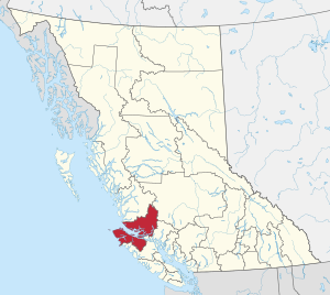
The Regional District of Mount Waddington (often called RDMW) is a special area in British Columbia, Canada. It's like a big county that helps manage services for several towns and smaller communities. This region covers parts of northern Vancouver Island and the nearby mainland coast.
The RDMW is named after Mount Waddington, a very tall mountain in the area. Its main office is in the town of Port McNeill. In 2016, about 11,035 people lived here. The total land area is about 20,288 square kilometers (7,833 square miles).
Contents
What is the RDMW?
The RDMW is a type of local government in British Columbia. It provides services that individual towns might not offer on their own. These services can include things like fire protection, parks, and waste management for the whole region.
Communities in the RDMW
The Regional District of Mount Waddington includes several important towns and villages. These are:
- Alert Bay
- Port Alice
- Port Hardy
- Port McNeill
What is the Chilton Regional Arena?
The RDMW is home to the Chilton Regional Arena, built in 1974. This arena is special because it's carbon neutral. This means it doesn't add carbon to the atmosphere. It uses only electricity for everything, from making ice for skating to mowing the grass around the building.
Amazing Geography
The RDMW is known for its incredible natural beauty and rugged landscapes.
Mountains and Volcanoes
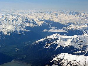
The region is named after Mount Waddington, which is the highest mountain completely within British Columbia. Another impressive peak here is Mount Silverthrone. It's the tallest volcano in Canada and is found in the remote Ha-Iltzuk Icefield.
The eastern side of the RDMW is bordered by the Coast Mountains. These mountains separate the region from the Chilcotin District. To the north, a natural boundary separates the RDMW from the Central Coast Regional District.
Population and Landscape
Compared to other regional districts, the RDMW has fewer people. This is because much of its land is made up of tough mountains or distant islands. These areas are not easy to live in.
Indigenous Peoples and History
The traditional lands of the Kwakwaka'wakw people are within the RDMW. They make up a large part of the population in many smaller communities. Their own governments and reserve lands work separately from the regional district's system. However, First Nations people living in the towns can vote in local elections.
Sointula, on Malcolm Island, is a historic settlement. It was started by Finnish Canadian people as a cooperative community. Another similar attempt by Danish settlers at Cape Scott didn't succeed, but the Danish name Holberg is still used in that area.
Economy and Jobs
The main jobs and businesses in the RDMW are:
- Logging: Cutting down trees for wood.
- Fishing: Catching fish and seafood.
- Transport: Moving goods and people around.
- Tourism: Visitors coming to see the beautiful nature and enjoy activities.
These activities help the communities in the region thrive.
 | Audre Lorde |
 | John Berry Meachum |
 | Ferdinand Lee Barnett |

