Rhymney River facts for kids
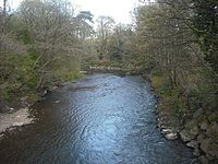
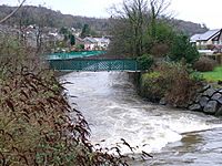
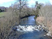
The Rhymney River (called Afon Rhymni in Welsh) is an important river in South Wales. It flows through the beautiful Rhymney Valley and eventually reaches the Severn Estuary near Cardiff. For a long time, this river formed a natural border between the old areas of Glamorgan and Monmouthshire.
Where Does the Rhymney River Flow?
The Rhymney River starts its journey near the town of Rhymney. From there, it flows south through several towns and villages. These include New Tredegar, Bargoed, Ystrad Mynach, and Llanbradach.
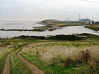
It then reaches Caerphilly at the southern end of the Rhymney Valley. The river continues past Bedwas, Trethomas, Machen, and Draethen. Closer to the sea, it flows through Llanrumney and Rumney. Finally, its estuary (where it meets the sea) joins the much larger River Severn.
How the Rhymney Valley Was Formed
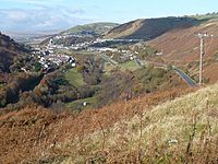
The Rhymney Valley (Cwm Rhymni in Welsh) is a special type of valley. It was carved out by huge sheets of ice, known as glaciers, a very long time ago. This is why it's called a glacial valley.
The Rhymney River begins high up in the valley. Its source is on the southern edge of the Brecon Beacons mountains. The river flows steeply downhill through New Tredegar. It then continues towards Ystrad Mynach. After that, it crosses a flatter area before reaching the Severn Estuary. This estuary is located just east of Cardiff.
The river's path is about 30 miles (48 kilometers) long. It can be divided into two main parts:
- Upper reaches: This is the top part of the river. It flows through a mountainous valley with steep sides. This area often gets a lot of rain.
- Lower reaches: This part is below Machen. Here, the valley becomes wider and flatter. The river starts to curve and bend in a gentle way, like a lowland river.
From Pollution to Clean Water
For many years, the Rhymney River had a lot of pollution. This was because it was located in the South Wales coalfield. This area was famous for its coal mines and iron production. The river often looked black and its water quality was very poor. This lasted through most of the 1800s and 1900s.
In some of its upper parts, the river even flows underground. It goes through tunnels, including one under old factories in Rhymney. It then comes out again at Pontlottyn.
However, things have changed a lot! The last coal mines closed in the late 1980s. Since then, the river's water has become much cleaner. Now, it's full of fish and different kinds of insects. This means it can support many other types of wildlife.
Today, the river is home to healthy numbers of grayling and natural brown trout. A lot of effort has been made to remove old industrial barriers in the river. This helps fish swim freely to the upper parts of the river. The river is now looked after by Natural Resources Wales and the South East Wales Rivers Trust. These groups work to keep the river healthy and clean for everyone.
 | William L. Dawson |
 | W. E. B. Du Bois |
 | Harry Belafonte |


