Richlands, Queensland facts for kids
Quick facts for kids RichlandsBrisbane, Queensland |
|||||||||||||||
|---|---|---|---|---|---|---|---|---|---|---|---|---|---|---|---|

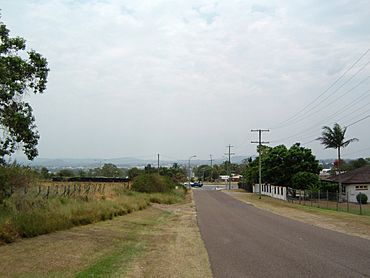
Orchard Road, Richlands
|
|||||||||||||||
| Population | 5,621 (2021 census) | ||||||||||||||
| • Density | 1,124/km2 (2,910/sq mi) | ||||||||||||||
| Established | 1928 | ||||||||||||||
| Postcode(s) | 4077 | ||||||||||||||
| Area | 5.0 km2 (1.9 sq mi) | ||||||||||||||
| Time zone | AEST (UTC+10:00) | ||||||||||||||
| Location | 19.6 km (12 mi) SW of Brisbane CBD | ||||||||||||||
| LGA(s) | City of Brisbane (Forest Lake Ward) |
||||||||||||||
| State electorate(s) | Inala | ||||||||||||||
| Federal Division(s) | Oxley | ||||||||||||||
|
|||||||||||||||
Richlands is a suburb located in the south-west part of Brisbane, Queensland, Australia. In 2021, about 5,621 people lived there. It is known for its mix of industrial areas and places where people live.
Contents
Exploring Richlands' Location
Richlands is about 19.6 kilometers (12.2 miles) south-west of Brisbane's city center.
Roads and Railways in Richlands
A major road called the Centenary Motorway goes through Richlands. It runs from the north-west to the south-west. The Springfield railway line also runs next to this motorway. Richlands railway station helps people travel to and from the suburb.
Land Use and Natural Features
The northern and western parts of Richlands are mostly for businesses and factories. The eastern and southern areas are where people live. You can still find a few small farms here too.
A creek called Ric Nattrass Creek starts in Richlands. It flows north and eventually joins the Brisbane River. This creek was named in 2013 after Ric Nattrass, who was a wildlife expert.
A Look Back at Richlands' History
The name Richlands comes from the Richland Estate. This was a group of small farms sold in 1928 and 1929. These farms were about 4 acres (1.6 hectares) each. Richlands used to be part of a larger suburb called Darra. It officially became its own suburb in 1975.
Early Industries and Farming
In the early days, people in Richlands were involved in dairy farming, raising chickens for eggs, making honey, and growing grapes.
Richlands' Schools Over Time
- Richlands State School opened on 12 June 1934. It was located on Orchard Road. This school closed on 31 December 2010. Today, the site is used by the Richlands Community Centre and the local emergency service.
- Richlands East State School opened on 23 January 1967. It is now located within the suburb of Inala.
- Richlands State High School opened on 27 January 1970. In the 1990s, this high school joined with Inala State High School. They formed a new school called Glenala State High School. Richlands State High School closed completely on 13 December 1996.
Fun and Entertainment in the Past
The Richlands drive-in theatre opened in the late 1970s. It was a place where people could watch movies from their cars. It closed in December 2000 and was the last drive-in theatre operating in Brisbane.
Sports and Recreation
Richlands has been home to several sports clubs. The Brisbane West Tennis Centre opened in the early 1980s. Richlands Tenpin Bowl opened in 1991. The Darra Oxley Pony Club is also located here.
Shopping and Community Hubs
Richlands Plaza, a shopping and business center, first opened in 2010.
Who Lives in Richlands?
In 2011, Richlands had a population of 2,076 people. The average age was 29 years old. Many people living in Richlands were born in Australia (52.8%). Other common birthplaces included Vietnam, New Zealand, and England. Most people spoke English at home, but Vietnamese was also a common language.
By 2016, the population grew to 3,598 people. In 2021, it reached 5,621 people.
Important Places in Richlands
Richlands has some sites that are important for their history:
- 48 Bandara Street: The Serbian Orthodox Church of St Nicholas.
- 75 Old Progress Road: The former Richlands State School building.
Education Opportunities Near Richlands
There are no schools directly inside Richlands today. However, there are several schools nearby:
- Primary Schools: Richlands East State School and Inala State School (in Inala), Darra State School (in Darra), and Carole Park State School (in Wacol).
- Secondary Schools: Glenala State High School (in Durack) and Forest Lake State High School (in Forest Lake).
What Can You Do in Richlands?
Shopping and Services
Richlands Plaza is a shopping and business center. It has a large supermarket, other shops, cafes, and a gym. You can find it at 511 Archerfield Road. Other shopping areas include Progress Corner.
Sports and Parks
- Queensland Lions Football Club: This soccer club plays in the Brisbane Premier League.
- CJ Greenfield Park: This park has fields for football and soccer, cricket grounds, and basketball courts. It also has walking trails and a playground for kids.
- Other sports facilities include the Pony Club, West Brisbane Tennis Centre, and Ten Pin Bowling.
Community Services
Richlands is home to several important services. These include the Magistrates Court, the Queensland State Emergency Service, and the Richlands Community Centre.
 | Bayard Rustin |
 | Jeannette Carter |
 | Jeremiah A. Brown |


