Riga, New York facts for kids
Quick facts for kids
Riga
|
|
|---|---|
| Motto(s):
the first pioneers of Monroe County
|
|

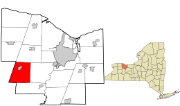
Location in Monroe County and the state of New York.
|
|

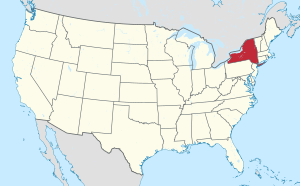
Location of New York in the United States
|
|
| Country | United States |
| State | New York |
| County | Monroe |
| Established | April 8, 1808 |
| Area | |
| • Total | 35.23 sq mi (91.24 km2) |
| • Land | 34.96 sq mi (90.55 km2) |
| • Water | 0.27 sq mi (0.69 km2) |
| Elevation | 577 ft (176 m) |
| Population
(2020)
|
|
| • Total | 5,586 |
| • Density | 160.95/sq mi (62.14/km2) |
| Time zone | UTC-5 (EST) |
| • Summer (DST) | UTC-4 (EDT) |
| ZIP code |
14428
|
| Area code(s) | 585 |
| FIPS code | 36-055-61808 |
| Website | https://www.townofriga.com/ |
Riga is a small town located in Monroe County, New York, in the United States. In 2020, about 5,586 people lived there. The town is about 18.5 miles (29.8 km) southwest of the big city of Rochester. It is also close to the I-490 highway.
It's interesting to know that the name of the town, Riga, is pronounced RYE-ga by the people who live there. This is different from how you might say "Riga," the capital city of Latvia.
Contents
Exploring Riga's Location
Riga is a town that covers about 35.3 square miles (91.4 square kilometers). Most of this area is land, with only a small part being water.
Where is Riga Located?
Riga is surrounded by other towns and counties:
- To the north, you'll find the town of Ogden.
- To the east, it borders the town of Chili.
- To the west and south, it shares a border with Genesee County.
- It also borders the town of Wheatland to the south.
The major highway, Interstate 490, runs right through the town, making it easy to travel to and from Riga.
People Living in Riga
| Historical population | |||
|---|---|---|---|
| Census | Pop. | %± | |
| 1820 | 3,139 | — | |
| 1830 | 1,917 | −38.9% | |
| 1840 | 1,984 | 3.5% | |
| 1850 | 2,159 | 8.8% | |
| 1860 | 2,177 | 0.8% | |
| 1870 | 2,171 | −0.3% | |
| 1880 | 2,221 | 2.3% | |
| 1890 | 2,031 | −8.6% | |
| 1900 | 1,864 | −8.2% | |
| 1910 | 1,853 | −0.6% | |
| 1920 | 1,649 | −11.0% | |
| 1930 | 1,718 | 4.2% | |
| 1940 | 1,669 | −2.9% | |
| 1950 | 1,906 | 14.2% | |
| 1960 | 2,800 | 46.9% | |
| 1970 | 3,746 | 33.8% | |
| 1980 | 4,309 | 15.0% | |
| 1990 | 5,114 | 18.7% | |
| 2000 | 5,437 | 6.3% | |
| 2010 | 5,590 | 2.8% | |
| 2020 | 5,586 | −0.1% | |
| 2016 (est.) | 5,627 | 0.7% | |
| U.S. Decennial Census | |||
In the year 2000, there were 5,437 people living in Riga. These people lived in 1,969 different homes. About 1,518 of these homes were families.
Who Lives in Riga?
Most people living in Riga are White (97.26%). There are also smaller groups of African American, Native American, and Asian people. About 1% of the population is from two or more races. A small number of people (0.92%) are of Hispanic or Latino background.
Many homes (39.1%) had children under 18 living there. Most families (64.9%) were married couples. About 9.1% of homes had a female head of household without a husband.
The average age of people in Riga in 2000 was 38 years old. About 28.3% of the population was under 18. About 9.6% of the people were 65 years old or older.
Riga's Past: A Look at History
The land where Riga is now was once part of a large area called the "Mill Seat Tract." This land was originally given by Native Americans to a group of people called Phelps and Gorham in the 1700s. Later, a man named Robert Morris bought the land. He then sold it to the family of Sir William Pulteney in England.
How Riga Became a Town
In the beginning, the Riga area was part of a larger county called Ontario County. This was set up by the government in 1789. Later, it became part of Genesee County.
The first organized town in this region was Northampton. In 1802, Northampton was split into several smaller towns. These included Leicester, Batavia, Southampton, and East and West Pulteney. The Pulteney towns were named after Sir William Pulteney.
Finally, in 1808, East and West Pulteney became East and West Riga. Then, in 1809, these two parts joined together to form the single Town of Riga we know today.
Important Historical Places
The Riga Academy is a special building in Riga. It was added to the National Register of Historic Places in 1980. This means it's an important historical site that should be protected.
Communities and Places in Riga
The town of Riga includes a few smaller communities and important spots:
- Churchville – This is a village located in the northwest part of the town. You can find it along Route 33.
- Churchville Park – A park also found in the northwest area of the town. It's a great place for outdoor activities.
- Five Point – This is a specific location found east of the main Riga area, along Route 33A.
- Riga (or Riga Center) – This is the main hamlet (a small settlement) of Riga. It is located on Route 33A.
See also
 In Spanish: Riga (Nueva York) para niños
 | John T. Biggers |
 | Thomas Blackshear |
 | Mark Bradford |
 | Beverly Buchanan |

