Ringling, Oklahoma facts for kids
Quick facts for kids
Ringling, Oklahoma
|
|
|---|---|
 |
|

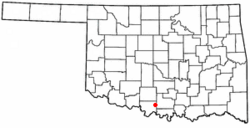
Location of Ringling, Oklahoma
|
|
| Country | United States |
| State | Oklahoma |
| County | Jefferson |
| Area | |
| • Total | 0.78 sq mi (2.03 km2) |
| • Land | 0.78 sq mi (2.03 km2) |
| • Water | 0.00 sq mi (0.00 km2) |
| Elevation | 906 ft (276 m) |
| Population
(2020)
|
|
| • Total | 869 |
| • Density | 1,111.25/sq mi (429.07/km2) |
| Time zone | UTC-6 (Central (CST)) |
| • Summer (DST) | UTC-5 (CDT) |
| ZIP code |
73456
|
| Area code(s) | 580 |
| FIPS code | 40-63350 |
| GNIS feature ID | 2412552 |
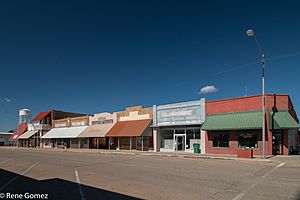
Ringling is a town in Jefferson County, Oklahoma, United States. Its population was 869 people in 2020. The town got its name from John Ringling, who was famous for starting the Ringling Brothers Circus.
History of Ringling
In 1913, John Ringling and his partner, Jake Hamon, helped pay for a new railroad. It was called the Oklahoma, New Mexico and Pacific Railway. The goal was to help farmers and ranchers move their goods between the towns of Ardmore and Lawton.
Building the railroad started on May 1, 1913, in Ardmore. As they built westward, something big happened. In August 1913, oil was found in the Healdton field. Ringling and Hamon saw a chance to make a lot of money in the oil business. So, they decided to change the railroad's path. They moved it toward Healdton, which was about 10 miles (16 km) northeast of the planned town site. A post office was set up in Ringling in June 1914.
| Historical population | |||
|---|---|---|---|
| Census | Pop. | %± | |
| 1920 | 1,039 | — | |
| 1930 | 1,002 | −3.6% | |
| 1940 | 902 | −10.0% | |
| 1950 | 1,092 | 21.1% | |
| 1960 | 1,170 | 7.1% | |
| 1970 | 1,206 | 3.1% | |
| 1980 | 1,561 | 29.4% | |
| 1990 | 1,250 | −19.9% | |
| 2000 | 1,135 | −9.2% | |
| 2010 | 1,037 | −8.6% | |
| 2020 | 869 | −16.2% | |
Geography of Ringling
Ringling is located in the eastern part of Jefferson County. The town of Cornish is right next to Ringling, to its south.
A major road, U.S. Route 70, goes through the southern part of Ringling. If you go west on this road for about 23 miles (37 km), you will reach Waurika. Waurika is the main town, or county seat, of Jefferson County. If you go east on U.S. Route 70 for about 25 miles (40 km), you will get to Ardmore.
Another important road, Oklahoma State Highway 89 (also known as Fifth Street), runs north to south through the middle of Ringling.
According to the United States Census Bureau, the town covers a total area of about 0.78 square miles (2.03 km²). All of this area is land, with no water.
People in Ringling
In the year 2000, a census counted 1,135 people living in Ringling. There were 469 households and 297 families. The town had about 1,481 people per square mile (572 per km²). There were 567 homes, with about 740 homes per square mile (286 per km²).
Most of the people in Ringling were White (87.40%). About 8.28% were Native American, and a small number were Asian (0.35%) or from other backgrounds. About 1.67% of the population identified as Hispanic or Latino.
In 2000, about 29.4% of households had children under 18 living with them. About 49.3% were married couples living together. Some households (10.0%) had a female head with no husband present. About 34.5% of all households were made up of single individuals. Of these, 19.4% had someone living alone who was 65 years old or older. On average, there were 2.33 people in each household and 2.99 people in each family.
The population was spread out by age. About 25.6% were under 18 years old. About 21.7% were 65 years or older. The average age in the town was 38 years. For every 100 females, there were about 86.4 males.
See also
 In Spanish: Ringling (Oklahoma) para niños
 | May Edward Chinn |
 | Rebecca Cole |
 | Alexa Canady |
 | Dorothy Lavinia Brown |

