River Devon, Clackmannanshire facts for kids
Quick facts for kids River Devon |
|
|---|---|
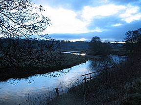
The Devon at dusk, near Tillicoultry
|
|
| Native name | Scottish Gaelic: Duibhe |
| Country | United Kingdom |
| Constituent country | Scotland |
| Physical characteristics | |
| River mouth | River Forth 56°07′14″N 3°51′11″W / 56.12067°N 3.85312°W |
The River Devon is a river in Scotland. It flows through an area called Clackmannanshire. The Devon is a tributary of the River Forth, which means it's a smaller river that flows into a larger one. Its old name was Dovan, and in Scottish Gaelic, it's called Duibhe.
Contents
Where Does the River Devon Flow?
The River Devon starts high up on Blairdenon Hill in the Ochil Hills. This is about 550 meters (1,800 feet) above sea level.
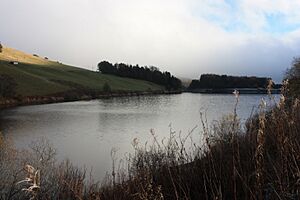
At its beginning, the river's path has been changed by dams. These dams created three reservoirs: Upper Glendevon, Lower Glendevon, and Castlehill.
The Devon then flows east and southeast through a valley called Glendevon. It turns southwest at a place called Crook of Devon. From there, it continues west, winding through its flat valley floor at the base of the Ochil Hills. Finally, it joins the River Forth near the village of Cambus.
Understanding the River's Surroundings
Experts from the UK Centre for Ecology & Hydrology study rivers like the Devon. They describe the area around the river, called its catchment area, like this:
- The parts where the river starts are steep.
- The lower valley is wide and very flat.
- The ground is mostly made of strong volcanic rocks. Half of this rock is covered by loose soil and gravel.
- In the valley, the land is used for growing crops. Higher up, it's mostly grassland, with some forests.
The entire area that collects water for the River Devon covers about 181 square kilometers.
Exploring Glen Devon
Glen Devon is a beautiful valley. It stretches from where the River Devon meets Glen Eagles (a valley shaped like a "U") southwards to a place called the Yetts of Muckhart. After that, the land opens up into a wide, flat area. The building of Castlehill Reservoir around 1975 greatly changed the natural look of this valley.
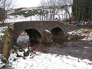
The main village in the glen is Glendevon, located north of the reservoir. For 70 years, it has been a popular spot for holiday cabins. Glen Devon Castle was mostly destroyed by fire around 1970. You can still see its arched entranceway at the north end of the reservoir. The village also has an old inn called The Tormaukin, which is now a restaurant. North of the village, you'll find the old church and its house. An old bridge from the 1700s crosses the Devon just south of the church.
Reservoirs for Fishing
There are several high-level reservoirs in the area. They are named Glenquey, Glensherup, and Upper and Lower Frandy. These names come from the smaller streams that feed into the Devon. All these reservoirs were built during the Second World War and are now used for trout fishing.
River Devon's Place in History
The River Devon has played a small part in Scottish history.
In 1560, during the Scottish Reformation, a man named William Kirkcaldy tried to stop French soldiers. He destroyed a bridge at Tullibody to prevent them from retreating. However, the French soldiers were clever. They took down the roof of Tullibody Kirk and used the wood to build a bridge across the Devon!
In 1766, the famous inventor James Watt studied the River Devon. He thought that if the riverbed was made deeper, boats might be able to travel as far as Dollar. He estimated this project would cost about £2,000.
The famous Scottish poet Robert Burns wrote two songs about the River Devon in 1787. They are called The Banks of the Devon and Fairest Maid on Devon Banks. These songs remember Charlotte Hamilton, a woman he met nearby.
Later, the Devon Valley Railway was built along the river's valley.
Dealing with Flooding on the Devon
The local council, Clackmannanshire Council, knows that flooding is a problem along the River Devon. They have been working to fix this issue, sometimes with groups like WWF-Scotland. They have done things like building willow walls, planting trees along the river, and blocking drains in wet areas.
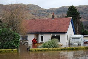
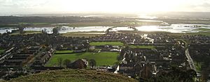
In January 2008, the area around the Devon received a lot of rain. The ground became completely soaked, and all the rainwater quickly flowed into the rivers. The river levels were extremely high. Upstream, all the reservoirs in the Ochil Hills were full. Castlehill reservoir was even overflowing for the entire month. The flood recorded at Castlehill was the second highest ever. Further downstream, the water level at Glenochil was the highest since records began in 1956.
Because of this, on January 25-26, 2008, homes and businesses in Tillicoultry were flooded. This flood was worse than any before. The Council hired experts to find out why it happened and what could be done to prevent it in the future.
In November 2008 and again in November 2009, there was more widespread flooding in the Hillfoots area. Several road bridges over the river became impossible to cross. Luckily, no houses were damaged on those two occasions.
You can now find hourly river level data for the Glenochil gauging station online from the SEPA.
 | Janet Taylor Pickett |
 | Synthia Saint James |
 | Howardena Pindell |
 | Faith Ringgold |


