River Keer facts for kids
Quick facts for kids River Keer |
|
|---|---|

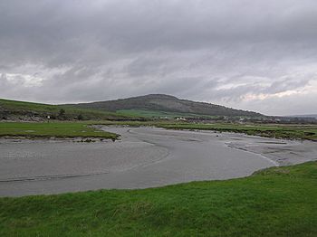
Bend in the Keer (with Warton Crag in the background) near Carnforth, Lancashire, England
|
|
| Country | United Kingdom |
| Part | England |
| County | Lancashire, Cumbria |
The River Keer is a small but important river located in the northwest of England. It flows through the county of Lancashire. This river helps shape the landscape and serves as a natural feature in the area.
Contents
Where the River Keer Flows
The River Keer has a clear path from where it begins to where it joins the sea. It travels through different types of land, from open moorland to coastal areas.
Starting Point and Journey
The River Keer starts its journey on Docker Moor. This area is near the village of Whittington. From there, the river flows mainly towards the west.
As it moves, the Keer passes by several small villages. These include Capernwray, Borwick, and Warton. It also flows past a place called Pine Lake.
Reaching the Sea
After passing these villages, the river reaches the town of Carnforth. Beyond Carnforth, the landscape changes. The river then flows through salt marshes. These are coastal wetlands that are flooded by salty water from the sea.
Finally, the River Keer empties into the Kent estuary. An estuary is where a river meets the sea. The Kent estuary then opens into Morecambe Bay, which is a large bay on the Irish Sea coast.
A Natural Border
For some parts of its journey, the River Keer acts as a natural dividing line. It marks the border between two different counties.
Dividing Counties
The river forms a boundary between Lancashire and Cumbria. These are two counties in northern England. This means that on one side of the river, you are in Lancashire, and on the other, you are in Cumbria.
Historic Boundaries
The River Keer also used to mark a border between older, historic areas. It separated the ancient county of Lancashire from Westmorland. Westmorland is no longer a county on its own, but its history is still remembered.
 | Tommie Smith |
 | Simone Manuel |
 | Shani Davis |
 | Simone Biles |
 | Alice Coachman |

