River Stour, Kent facts for kids
Quick facts for kids Great Stour |
|
|---|---|
 |
|
 |
|
| Country | England |
| County | Kent |
| Towns/Cities | Ashford, Kent, Wye, Kent, Chartham, Canterbury, Fordwich, Sandwich, Kent |
| Physical characteristics | |
| Main source | Lenham |
| River mouth | Pegwell Bay |
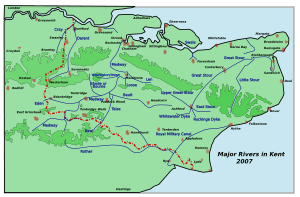
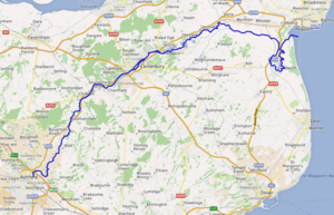
The River Stour is a river in Kent, England. It flows into the North Sea at Pegwell Bay. The river has different names along its path. Above Plucks Gutter, where the Little Stour joins it, it is usually called the Great Stour. The very top part of the river, before it meets the East Stour at Ashford, is sometimes known as the Upper Great Stour or West Stour. Near the sea, there is an artificial shortcut called the Stonar Cut. This cut helps boats avoid a long loop in the river.
The Stour has the second largest catchment area in Kent. A catchment area is all the land where water drains into a river. The lower part of the river is affected by the tides. Its original mouth was on the Wantsum Channel, which was an important sea route long ago. The river has three main rivers that flow into it, called tributaries, and many smaller ones. For most of its journey, it flows from the south-west to the north-east.
The historic city of Canterbury is built on the river. So are the towns of Sandwich and Ashford. You can walk along the river on the Stour Valley Walk path.
Contents
River Stour's Journey
Upper Great Stour Section
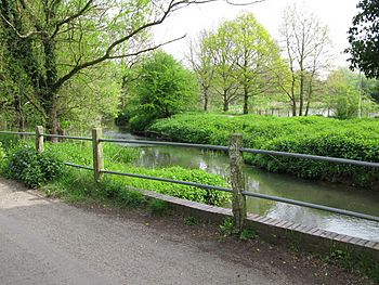
The Great Stour starts near the village of Lenham. This is close to the River Len, which flows into the Medway. The source is high up, near the North Downs. At first, the river flows south-east in a narrow valley. It then breaks through a ridge near Hothfield into a wider valley. Small streams join it from the north. Sometimes, flood defenses can turn this valley into a large lake.
The East Stour joins the Great Stour at Pledge's Mill in Ashford. The East Stour starts near Hythe.
Middle Great Stour Section
The town of Ashford is where the middle part of the river begins. Ashford is an old crossing point over the river. In Ashford, the river is part of the Ashford Green Corridor.
After Ashford, the Stour flows through the North Downs. Not many smaller streams join it here. The Brook stream enters from the right. From there, it is about 15 miles (24 km) to Canterbury. In this part, the river flows through villages like Wye, Chilham, and Chartham. Wye was a place where people could cross the river easily.
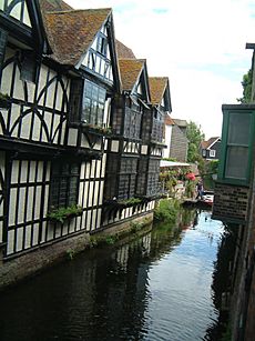
The historic city of Canterbury sits where four branches of the Roman road Watling Street met. These roads connected Canterbury to ports on the Kent coast. Inside the city, the river splits into two channels. One goes through the city center, and the other goes north of the city walls. The two channels meet again east of Canterbury. Then the river reaches Fordwich, which used to be a port for Canterbury. This is also where the river becomes tidal.
Beyond Fordwich, the river passes old gravel pits. It also flows through the reed beds of the Stodmarsh National Nature Reserve. After the nature reserve, there is open farmland on reclaimed marshes. These marshes are around the river crossing at Grove Ferry Picnic Area.
At Plucks Gutter, the Little Stour joins the main river. The Little Stour is about 18.9 miles (30.4 km) long. From this point, the river is usually called the River Stour.
Lower River Stour Section
The villages of West and East Stourmouth mark where the Stour used to flow into the Wantsum Channel. This channel was a sea strait used for hundreds of years. But over time, it filled with silt and became a large drainage ditch. Here, the Sarre Penn joins the river. It is about 8.4 miles (13.4 km) long.
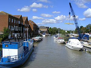
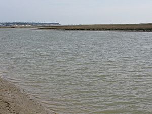
The river then turns south towards the port of Sandwich. After Sandwich, it loops back north before entering the Strait of Dover at Pegwell Bay. The Stonar Cut was built to allow ships to avoid the long loop around Sandwich.
From Fordwich to the sea, the river is surrounded by marshes. Many of these marshes are on what was once the Wantsum Channel. Others are behind the sand dunes of the Sandwich Flats. These marshes have many drainage ditches. Important marshes include Chislet, Wade, and Ash Level.
Stonar Cut History
In the mid-1700s, people needed to stop flooding along the lower Stour. Shingle moving along the coast had created a huge loop at the river's mouth. So, in 1774, a law was passed to create a shortcut. This shortcut, called the Stonar Cut, was finished in 1776. It used an existing sluice to cut across the narrowest part of the loop.
During World War I, a new port was secretly built at Richborough. This port helped move many troops and supplies. Landing areas were built along the Cut. A railway was also extended to serve the port. Today, most of these old structures are gone. The Cut has returned to a more natural state.
River Stour's Tributaries
The River Stour has several smaller rivers and streams that flow into it. Here are some of the main ones:
| Tributary | Length | Source | Confluence |
|---|---|---|---|
| East Stour | 10.3 miles (16.6 km) | Postling | Ashford |
| Aylesford Stream | 3.4 miles (5.5 km) | Sevington | Ashford |
| Ruckinge Dyke | 4.9 miles (7.9 km) | Hamstreet | Willesborough |
| Whitewater Dyke | 3.5 miles (5.6 km) | Shadoxhurst | Ashford |
| Kennington Stream | 1.1 miles (1.8 km) | Kennington | Ashford |
| Brook Stream | 3.8 miles (6.1 km) | Brook | Ashford |
| Kennington Stream (Pen Lee) | 1.4 miles (2.3 km) | Kennington | Ashford |
| Little Stour | 9 miles (14 km) | Littlebourne | Plucks Gutter |
| Nailbourne | 9 miles (14 km) | Lyminge | Littlebourne |
| River Wingham | 5 miles (8.0 km) | Ash (near Sandwich) | Wickhambreaux |
| River Wantsum | 6.7 miles (10.8 km) | Reculver | Stourmouth |
| Sarre Penn | 8.4 miles (13.5 km) | Dunkirk | Sarre |
| North Stream, Chislet | 5.4 miles (8.7 km) | Herne | Reculver |
| North and South Streams | 6.1 miles (9.8 km) | Hacklinge area | Sandwich |
River Stour's History
In Roman times and the Middle Ages, the River Stour was an important way to travel. It connected Canterbury with other countries. Fordwich became an important port for ships. This happened after the southern entrance to the English Channel became too shallow.
In 1831, Joseph Priestley wrote a book about rivers and canals. He described the "Canterbury Navigation, or River Stour." He wrote about its path and how people were improving it for boats. He also shared details about new port facilities.
River Stour's Uses
Water Mills
People have used the River Stour and its tributaries for hundreds of years to power machines. Water power helped with many tasks. These included grinding grain, making cloth, making paper, and even generating electricity. Many old mills are now homes. Two of them still work today for businesses.
Transportation Routes
Both roads and railways use the river's path. The old Roman road, Watling Street, linked Canterbury to Richborough. It also linked Canterbury southwards. This road used the natural gap in the North Downs created by the river. Today, railway lines from Canterbury to the Isle of Thanet and to Ashford follow the same routes. The main A28 road also follows the river.
The Stour Valley Walk is a long path, about 51.5 miles (82.9 km) long. It follows the river for most of its journey.
Fishing
The Great Stour's mouth at Plucks Gutter and Grove Ferry is famous for coarse fishing. Many people come here to catch fish, especially bream.
Flooding and Environment
Flooding Concerns
Some parts of Canterbury that are low-lying have often had floods in the past. The River Stour (Kent) Internal Drainage Board is responsible for reducing the risk of flooding. They work to manage the water in the river's catchment area.
Environmental Health
In 2006, scientists found male fish in the river near Ashford that showed signs of "feminisation." This happened after they were exposed to treated sewage water. It was found that certain chemicals from treated wastewater were entering the river.
In 2009, Southern Water started a big project. They spent £4.2 million to improve their water treatment works at Lenham. This helps make sure wastewater is cleaned to higher standards. New reed beds, with over 7,500 reeds, now help clean millions of liters of wastewater every day.
In 2017, a company called The Marine Group started work on the river. They used a special dredger to remove built-up sediment. This helps keep the river clear for boats near Sandwich and Richborough.
|
See also
 In Spanish: Río Stour (Kent) para niños
 | Calvin Brent |
 | Walter T. Bailey |
 | Martha Cassell Thompson |
 | Alberta Jeannette Cassell |


