
Rockville, Minnesota facts for kids
Quick facts for kids
Rockville
|
|
|---|---|
 |
|
| Motto(s):
"Granite-Heart Of The City"
|
|

Location of Rockville
within Stearns County, Minnesota |
|
| Country | United States |
| State | Minnesota |
| County | Stearns |
| Area | |
| • Total | 30.43 sq mi (78.82 km2) |
| • Land | 28.68 sq mi (74.29 km2) |
| • Water | 1.75 sq mi (4.53 km2) |
| Elevation | 1,125 ft (343 m) |
| Population
(2020)
|
|
| • Total | 2,382 |
| • Density | 83.05/sq mi (32.07/km2) |
| Time zone | UTC-6 (Central (CST)) |
| • Summer (DST) | UTC-5 (CDT) |
| ZIP code |
56369
|
| Area code(s) | 320 |
| FIPS code | 27-55078 |
| GNIS feature ID | 2396409 |
| Website | www.rockvillecity.org |
Rockville is a city located in Stearns County, Minnesota, United States. In 2010, about 2,448 people lived there. It is part of the larger St. Cloud area.
History of Rockville
Old stories say that a village of the Dakota people once existed north of the lake.
One of Rockville's first settlers was Michael Hanson, Sr. He was an older immigrant who came from a village called Obersgegen. This village was in a part of Prussia where people spoke Luxembourgish. Michael Hanson, Sr. was a homesteader, meaning he settled on land to farm it. He came with his sons and many grandchildren.
Michael Hanson, Sr. had fought in the Napoleonic Wars as part of the French Imperial Army. He even lost a leg during the fighting. He is buried in a cemetery in nearby Jacobs Prairie, Minnesota. He rests next to his good friend, Herr Pieck, who was also an early settler and a veteran of the Napoleonic Wars.
Rockville was officially planned in 1856. It got its name from the many granite rock formations found near the streams. A post office has been open in Rockville since 1857. Levi Gaylord was the first Postmaster, the person in charge of the post office. Newton Smith took over on June 6, 1861.
The Clark and McCormack Quarry and House is an important historical site in Rockville. It includes a quarry that started in 1907 and a house built in 1924. This site is listed on the National Register of Historic Places.
On June 1, 2002, the city of Pleasant Lake and Rockville Township joined together to become part of the city of Rockville.
Geography and Location
According to the United States Census Bureau, Rockville covers a total area of about 30.17 square miles (78.14 square kilometers). Most of this area, about 28.42 square miles (73.61 square kilometers), is land. The remaining 1.75 square miles (4.53 square kilometers) is water.
Rockville is located in a specific survey area known as Township 123 North of the Arkansas Base Line and Range 29 West of the Fifth Principal Meridian.
Population Information
| Historical population | |||
|---|---|---|---|
| Census | Pop. | %± | |
| 1910 | 127 | — | |
| 1920 | 172 | 35.4% | |
| 1930 | 294 | 70.9% | |
| 1940 | 345 | 17.3% | |
| 1950 | 288 | −16.5% | |
| 1960 | 357 | 24.0% | |
| 1970 | 302 | −15.4% | |
| 1980 | 597 | 97.7% | |
| 1990 | 579 | −3.0% | |
| 2000 | 749 | 29.4% | |
| 2010 | 2,448 | 226.8% | |
| 2020 | 2,382 | −2.7% | |
| U.S. Decennial Census | |||
2010 Population Count
In 2010, a census counted 2,448 people living in Rockville. There were 880 households and 703 families. The city had about 86.1 people per square mile (33.2 people per square kilometer). There were 1,041 housing units, with an average of 36.6 units per square mile (14.1 units per square kilometer).
Most of the people in Rockville were White (91.9%). Other groups included African American (0.3%), Native American (0.2%), Asian (0.2%), and Pacific Islander (0.5%). About 6.1% were from other races, and 0.8% were from two or more races. People of Hispanic or Latino background made up 9.3% of the population.
Out of the 880 households, 37.0% had children under 18 living with them. About 68.8% were married couples living together. About 14.4% of all households had only one person living there. About 4.8% had someone living alone who was 65 years old or older. The average household had 2.78 people, and the average family had 3.04 people.
The average age in the city was 40.5 years. About 25.8% of residents were under 18. About 11.4% were 65 years or older. The population was 51.9% male and 48.1% female.
City Services and Transport
How People Get Around
Minnesota State Highway 23 is a main road that goes through Rockville. Interstate 94 also passes close by.
A train line from Northern Lines Railway ends in Rockville. It serves a propane terminal just north of the city. Another train line that used to go to Willmar, Minnesota was closed in the 1980s.
Schools in Rockville
Most of Rockville is part of the Rocori Public School District. Some parts of the city are in the St. Cloud Area School District.
Students in the St. Cloud school district part of Rockville usually go to Discovery Elementary School. Most of these students then go to South Middle School and Technical Senior High School. A small area north of Highway 23 sends students to North Middle School and Apollo High School.
Images for kids
-
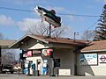
A fish sign on a shop in Rockville.
See also
 In Spanish: Rockville (Minnesota) para niños
