Rohrbachgraben facts for kids
Quick facts for kids
Rohrbachgraben
|
||
|---|---|---|

Rohrbachgraben village
|
||
|
||
| Country | Switzerland | |
| Canton | Bern | |
| District | Oberaargau | |
| Area | ||
| • Total | 6.46 km2 (2.49 sq mi) | |
| Elevation | 634 m (2,080 ft) | |
| Population
(Dec 2020 )
|
||
| • Total | 390 | |
| • Density | 60.4/km2 (156.4/sq mi) | |
| Postal code |
4938
|
|
| Surrounded by | Dürrenroth, Huttwil, Kleindietwil, Rohrbach, Ursenbach, Walterswil | |
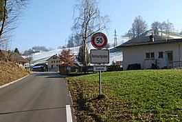
Rohrbachgraben is a small town in Switzerland. It is located in the Oberaargau area of the Bern region. It is known as a municipality, which is like a local government area.
Contents
History of Rohrbachgraben
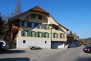
Rohrbachgraben started as many small farms and groups of houses. These were spread out along the Rohrbach stream. For a long time, it was part of the nearby village of Rohrbach.
During the Middle Ages, this whole area belonged to a powerful church group. This group was called the Abbey of St. Gall.
Even today, farming is very important here. In 2009, there were over 40 farms active in Rohrbachgraben.
The town has its own primary school. Older students go to secondary school in Kleindietwil.
Geography and Landscape
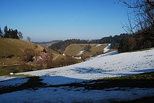
Rohrbachgraben covers an area of about 6.5 square kilometers (2.5 square miles). A large part of this land, about 69.1%, is used for farming. Forests cover another 27.8% of the area.
Only a small part, about 2.9%, has buildings or roads. The rest is made up of rivers or lakes. Most of the forest is dense, meaning it has many trees.
The farming land is used for crops and pastures for animals. Some areas also have orchards for fruit trees. All the water in the town is from flowing streams.
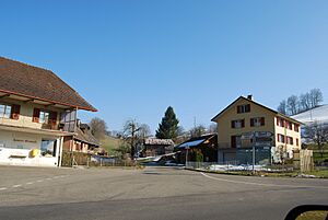
Rohrbachgraben does not have one main village center. Instead, it is a collection of small farms and groups of houses. These include places like Flückigen, Gansenberg, Glasbach, Kaltenegg, Liemberg, Matten, Wald, and Wil.
In 2010, Rohrbachgraben became part of a new administrative area. This new area is called Verwaltungskreis Oberaargau.
Town Symbol (Coat of Arms)
The symbol for Rohrbachgraben is called a coat of arms. It shows a black bear on one side and a wavy line on a green background on the other.
The wavy line on the symbol represents the stream (bach in German) and the channel (graben in German). This is how the town got its name.
People and Population
Rohrbachgraben has about 428 people living there as of 2023. A small number, about 2.3%, are people from other countries. Over the last 10 years, the population has decreased slightly.
Most people in Rohrbachgraben speak German. This is the main language for 99.1% of the population. A small number of people speak Albanian.
In 2008, the population was almost evenly split between males (50.5%) and females (49.5%). Most people living in Rohrbachgraben were also born there.
About 27.8% of the population are children and teenagers (0–19 years old). Adults (20–64 years old) make up 56.8%. Older adults (over 64 years old) are 15.4% of the population.
In 2000, there were 31 homes where only one person lived. There were also 32 homes with five or more people. Most homes (87.4%) were lived in all year round.
The chart below shows how the population has changed over many years:

Economy and Jobs
In 2011, Rohrbachgraben had a very low unemployment rate of 1.02%. This means almost everyone who wanted a job had one.
In 2008, 143 people worked in the town.
- Most jobs (102 people) were in the primary sector. This means jobs like farming. There were 36 businesses in this area.
- A few jobs (9 people) were in the secondary sector. This includes jobs like manufacturing. There were 3 businesses in this area.
- Some jobs (32 people) were in the tertiary sector. This includes jobs like sales, restaurants, and education. There were 8 businesses in this area.
Many people who live in Rohrbachgraben travel to other towns for work. In 2000, 119 people left the town for work, while only 23 came into the town to work.
About 6.6% of workers used public transportation to get to work. Most (44.1%) used a private car.
Religion
Based on information from 2000:
- About 2.5% of the people were Roman Catholic.
- Most people, about 85.8%, belonged to the Swiss Reformed Church.
- Around 18.35% belonged to other Christian churches.
- A small number (0.92%) were Islamic.
- About 0.92% did not belong to any church.
Education
In Rohrbachgraben, about 34.9% of adults have finished high school. About 6.9% have gone on to higher education, like a university.
The school system in Bern starts with one year of optional Kindergarten. Then, students go to six years of primary school. After that, there are three years of lower secondary school. Students are grouped by their abilities. After secondary school, students can continue their education or start an apprenticeship (learning a trade).
During the 2009-2010 school year, 55 students attended school in Rohrbachgraben. There was one kindergarten class with 14 students. The town also had two primary classes with 41 students.
In 2000, 7 students from other towns came to school in Rohrbachgraben. However, 31 students from Rohrbachgraben went to schools outside the town.
See also
 In Spanish: Rohrbachgraben para niños
 | Emma Amos |
 | Edward Mitchell Bannister |
 | Larry D. Alexander |
 | Ernie Barnes |


