Rollinsville, Colorado facts for kids
Quick facts for kids
Rollinsville, Colorado
|
|
|---|---|

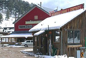
Businesses along State Highway 119 in Rollinsville, April 2005
|
|

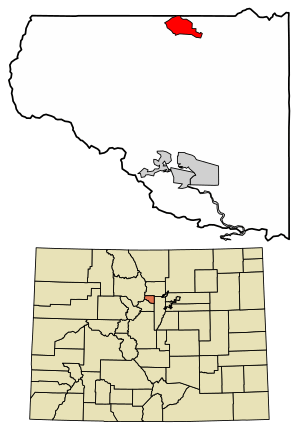
Location of the Rollinsville CDP in Gilpin County, Colorado
|
|
| Country | |
| State | |
| County | Gilpin County |
| Government | |
| • Type | unincorporated town |
| Area | |
| • Total | 3.658 km2 (1.412 sq mi) |
| • Land | 3.658 km2 (1.412 sq mi) |
| • Water | 0.000 km2 (0 sq mi) |
| Elevation | 2,642 m (8,668 ft) |
| Population
(2020)
|
|
| • Total | 194 |
| • Density | 53.03/km2 (137.4/sq mi) |
| Time zone | UTC-7 (MST) |
| • Summer (DST) | UTC-6 (MDT) |
| ZIP Code |
80474
|
| Area codes | 303 & 720 |
| GNIS feature ID | 2583288 |
Rollinsville is a small community in Gilpin County, Colorado, United States. It is known as a census-designated place (CDP). This means it is a special area defined by the government for counting people. Rollinsville is part of the larger Denver–Aurora–Lakewood, CO Metropolitan Statistical Area. It has its own post office with the ZIP Code 80474. In 2020, about 194 people lived in Rollinsville.
Contents
History of Rollinsville
The Rollinsville Post Office opened way back in 1871. The town got its name from John Q. A. Rollins. He was an important person in mining in Gilpin County during the 1860s and 1870s.
Geography and Location
Rollinsville is nestled in the mountains southwest of Boulder. It sits on a hill above South Boulder Creek. You can find it along State Highway 119. This highway runs between Nederland and Black Hawk.
The town has a few homes and businesses. It is at the end of the road that goes up to Rollins Pass. This pass is at the top of the Front Range mountains. South Boulder Creek flows just south of the town. The creek goes through a small canyon. Then it comes out near the border of Boulder and Gilpin counties. It then flows through Pinecliffe. The Rollinsville area covers about 3.658 square kilometers (1.412 square miles) of land.
Climate in Rollinsville
Rollinsville has a type of weather called a humid continental climate. This means it has warm summers and cold winters. It is also close to a subarctic climate, which is very cold. Weather stations nearby, like Pickle Gulch, help us know the temperatures. They also measure how much rain and snow falls.
People of Rollinsville
The United States Census Bureau counts the people living in Rollinsville. This count helps us understand how the community is growing.
- In 2010, the population was 181 people.
- In 2020, the population grew slightly to 194 people.
See also
 In Spanish: Rollinsville (Colorado) para niños


