Round Mountain (Northern Tablelands) facts for kids
Quick facts for kids Round Mountain |
|
|---|---|

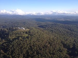
Radar station, Round Mountain
|
|
| Highest point | |
| Elevation | 1,586 m (5,203 ft) |
| Geography | |
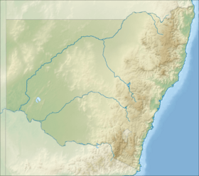
| Location | Northern Tablelands, New South Wales, Australia |
| Parent range | Snowy Range (in Northern NSW), Great Dividing Range |
| Topo map | Maiden Creek |
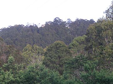
Round Mountain is a mountain in New South Wales, Australia. It is part of the Snowy Range, which is a smaller section of the huge Great Dividing Range. You can find it in the New England region, on the Northern Tablelands.
This mountain is quite tall, reaching 1,586 meters (about 5,203 feet) above sea level. It is the highest point in the Snowy Range. Round Mountain is located inside Cathedral Rock National Park. It is about 72 kilometers (45 miles) east of Armidale and 63 kilometers (39 miles) west of Dorrigo. A well-known spot called Point Lookout is about 10 kilometers (6.2 miles) to its southeast. The small town of Ebor is just a few kilometers west of the mountain. The closest main road is the Waterfall Way, which is about 6.5 kilometers (4 miles) from the peak.
What is Round Mountain Like?
The northern side of Round Mountain has streams that flow into the Guy Fawkes River. This river then goes over the famous Ebor Falls before joining the Clarence River.
On the southern side, water from Round Mountain flows into the Styx River. This river eventually reaches the Macleay River. Another river, the Oaky River, also starts here and flows into the Chandler River.
Radar Station on the Peak
At the very top of Round Mountain, there is a special radar station. This station helps control and guide airplanes. It uses radar technology to track aircraft in the sky. This makes air travel safer and more organized.
 | Kyle Baker |
 | Joseph Yoakum |
 | Laura Wheeler Waring |
 | Henry Ossawa Tanner |


