Clarence River (New South Wales) facts for kids
Quick facts for kids Clarence River |
|
|---|---|
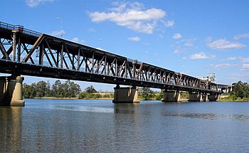
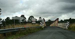
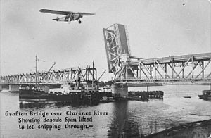
The Grafton Bridge across the Clarence River.
|
|
| Native name | Boorimbah or Ngunitiji |
| Other name(s) | Big River |
| Country | Australia |
| State | New South Wales |
| Region | NSW North Coast (IBRA), Northern Rivers |
| Local government areas | Kyogle, Clarence Valley |
| City | Grafton |
| Physical characteristics | |
| Main source | Border Ranges near Tooloom National Park and Bonalbo 252 m (827 ft) |
| 2nd source | Maryland River |
| River mouth | Coral Sea, South Pacific Ocean near Iluka and Yamba 29°25′32.6″S 153°21′19.4″E / 29.425722°S 153.355389°E |
| Length | 394 km (245 mi) |
| Basin features | |
| Basin size | 22,850 km2 (8,820 sq mi) |
| Tributaries |
|
| River islands | Woodford Island, Chatsworth Island, and Harwood Island |
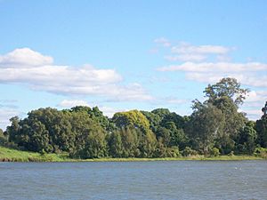
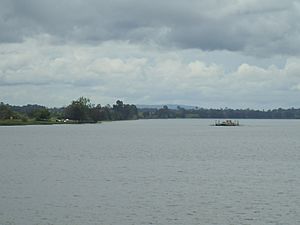
The Clarence River is a major river in the Northern Rivers area of New South Wales, Australia. It is known by different names by the local Aboriginal peoples: Boorimbah in the Bundjalung language and Ngunitiji in the Yaygir language.
This important river starts high up on the eastern side of the Great Dividing Range. It begins in the Border Ranges National Park, close to Bonalbo, where two smaller creeks, Koreelah Creek and Maryland River, meet. The river then flows for about 394 km (245 mi), heading generally south, southeast, and northeast. Along its journey, it drops about 256 metres (840 ft) in height.
Many smaller rivers and creeks join the Clarence River. These are called tributaries. Some of the main ones include the Mann, Nymboida, and Orara rivers. The Clarence River finally reaches the Coral Sea, which is part of the South Pacific Ocean, between the towns of Iluka and Yamba.
As it flows, the river passes through several towns like Tabulam, Copmanhurst, and Ulmarra. It also goes through the city of Grafton. The river is famous for its many large islands, such as Woodford Island, Chatsworth Island, and Harwood Island. The Clarence River is very important for fishing and prawning industries.
The Clarence River system is one of the largest on Australia's east coast. It's the biggest river in mainland Australia south of the Tropic of Capricorn, apart from the Murray River. Its basin, which is the area of land where all the water drains into the river, is Australia's largest on the Pacific side south of Bundaberg. Because the North Coast gets a lot of rain, the Clarence River can have big floods. For example, in 1890, the water level rose by 24 feet!
Contents
Weather and Floods in the Clarence Valley
The weather in most of the Clarence River basin is subtropical, meaning it's generally warm all year round. Near the coast, places like Yamba get about 1,600 millimetres (63 in) of rain each year. Inland, in Grafton, it's a bit drier with about 1,080 millimetres (43 in) of rain annually. The highest areas can get more rain, sometimes up to 2,000 millimetres (79 in).
Temperatures are usually warm. In January, the hottest month, temperatures can reach about 27 °C (81 °F). In July, the coolest month, they are around 19 °C (66 °F). In the higher areas, it's cooler. July temperatures can be as low as 2 °C (36 °F) at night and 13 °C (55 °F) during the day. Most rain falls in February and March. Sometimes, especially inland, dry periods can lead to bushfires.
How Flooding Affects the River
The Clarence River can experience significant flooding. For example, during Cyclone Oswald, the river flooded due to heavy rain from the storm. In Grafton, the river reached a record height of 8.1 metres (27 ft). Two years before that, the river peaked at 7.6 metres (25 ft), which made 3,000 people have to leave their homes. Luckily, the city has a levee (a protective wall) that helps prevent even worse flooding.
Local historians have kept records of newspaper reports about floods on the river, going all the way back to the late 1800s.
What the Land is Used For
Tourism is a big industry in the Clarence Valley. It brings in about A$457 million each year and provides jobs for around 2,500 people.
Most of the land around the Clarence River is covered in thick forests. There are also important areas of special rainforests. In places where the soil is very rich, people use the land for farming. The main types of farming are raising cattle and growing sugar cane in the lower areas.
One interesting place is the small island town of Harwood. Here, you can find a factory and an old-fashioned pub. Harwood is also home to the Harwood Sugar Mill, which was built in 1873. It's the oldest sugar mill in Australia that is still working! The mill was built by the river because, in the past, sugar cane was transported by boat from nearby farms. Harwood is located along Australia's National Highway, which connects major cities like Sydney and Brisbane.
The freshwater parts of the Clarence River are home to important native fish. This includes the Eastern freshwater cod, which is an endangered fish found only in the Clarence River system. You can also find Australian bass here.
Where the Name Comes From
The local Bundjalung people call the river Boorimbah. The Yaygir people who live near the coast call it the Ngunitiji. Aboriginal people from the Tenterfield area used the word neyand for the river's starting point, meaning "top."
British authorities didn't know about the river until the mid-1830s. An escaped convict named Richard Craig, who had lived with Aboriginal people in the area, told them about it. At first, it was called the Big River. However, this caused confusion because another river, the Gwydir River, was also known by that name.
In November 1839, the Governor of New South Wales, George Gipps, officially changed the name to the Clarence River. This was done to honor the previous King of the British Empire, William IV, who was also known as the Duke of Clarence.
The local government area, the Clarence Valley Council, gets its name from the river. It covers the lower part of the river valley.
How to Cross the Clarence River
There are not many fixed bridges or crossings over the Clarence River. Here are some of them, going from upstream (where the river starts) to downstream (where it meets the ocean):
- Bridge over Hootens Road in Bonalbo
- Bridge at Tabulam, which is part of the Bruxner Highway
- Ernie Baldwin Bridge, at Yates Crossing
- Bridge at Lilydale near Copmanhurst
- Rogan Bridge, carrying Rogan Bridge Road
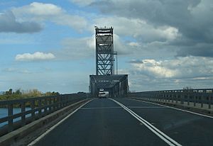
- Grafton Bridge at Grafton
- New Grafton Bridge also at Grafton
- Ulmarra-Southgate Ferry at Ulmarra (This is a ferry, not a bridge!)
- Harwood Bridge at Harwood
- Bluff Point Ferry at Lawrence (Another ferry!)
There are also crossings over the southern arm of the Clarence River:
- Wingfield Bridge at Cowper
- McFarlane Bridge at Maclean
And crossings over the northern arm of the Clarence River:
- Mororo Bridge at Mororo, New South Wales
- Warregah Island Bridge, at Chatsworth Island, New South Wales
- Serpentine Channel Bridge at Harwood
See also
 In Spanish: Río Clarence para niños
 | Isaac Myers |
 | D. Hamilton Jackson |
 | A. Philip Randolph |


