Royal City, Washington facts for kids
Quick facts for kids
Royal City
|
|
|---|---|
| Royal City, Washington | |

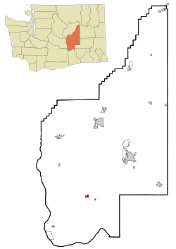
Location of Royal City, Washington
|
|
| Country | United States |
| State | Washington |
| County | Grant |
| Area | |
| • Total | 1.16 sq mi (3.01 km2) |
| • Land | 1.16 sq mi (3.01 km2) |
| • Water | 0.00 sq mi (0.00 km2) |
| Elevation | 1,063 ft (324 m) |
| Population
(2020)
|
|
| • Total | 1,776 |
| • Density | 1,921.82/sq mi (742.06/km2) |
| Time zone | UTC-8 (Pacific (PST)) |
| • Summer (DST) | UTC-7 (PDT) |
| ZIP code |
99357
|
| Area code(s) | 509 |
| FIPS code | 53-60230 |
| GNIS feature ID | 1512626 |
Royal City is a small city located in Grant County, Washington, in the United States. In 2020, about 1,776 people lived there.
Contents
History of Royal City
Royal City was started in 1956. It officially became a city on February 14, 1962. Before it was called Royal City, the area was known as Royal Flats and Royal Slope. This is how the city got its name.
In the 1960s, a special underground missile site called a Titan I ICBM silo was located near the town. On September 2, 2020, the Royal Slope area was named Washington state's 15th official wine growing region, also known as an AVA.
Farming and Fun Activities
Today, Royal City is a small farming community. It is well-known for growing many different crops. This is because the area has a long growing season. Farmers here grow apples, cherries, peaches, and various types of hay. They also produce melons, potatoes, onions, wine grapes, pears, mint, and corn.
The Royal Slope area is also a great place for outdoor activities. Many people enjoy watching birds, going hunting, and playing golf there.
Royal High School Sports
The Royal Knights, who are the sports teams from Royal High School, are very successful. Their football team has won many state championships in Division 1A. They won titles in 1996, 2000, 2004, 2005, 2007, 2015, 2016, 2017, 2019, 2021, and 2022.
The school's mascot is the Knight, and their colors are black and gold. These were chosen by the student leaders in 1965.
Geography of Royal City
Royal City is located at 46°54′7″N 119°37′38″W / 46.90194°N 119.62722°W. This helps us find its exact spot on a map.
The United States Census Bureau says that the city covers a total area of about 1.35 square miles (3.5 square kilometers). All of this area is land.
Population and People
| Historical population | |||
|---|---|---|---|
| Census | Pop. | %± | |
| 1970 | 477 | — | |
| 1980 | 676 | 41.7% | |
| 1990 | 1,104 | 63.3% | |
| 2000 | 1,823 | 65.1% | |
| 2010 | 2,140 | 17.4% | |
| 2020 | 1,776 | −17.0% | |
| U.S. Decennial Census 2020 Census |
|||
2010 Census Information
According to the 2010 census, there were 2,140 people living in Royal City. These people lived in 486 households, and 439 of these were families. The city had about 1,585 people per square mile (612 people per square kilometer).
Most of the people in Royal City were either White (45.7%) or from other races (48.7%). About 88.7% of the population identified as Hispanic or Latino.
Many households (72.2%) had children under 18 living with them. Most families (62.1%) were married couples living together. The average household had 4.26 people, and the average family had 4.20 people.
The average age of people in the city was 22.4 years old. A large portion, 40.1%, were under 18. About 14.7% were between 18 and 24. Most of the population was male (53.3%) compared to female (46.7%).
See also
In Spanish: Royal City para niños
 | Laphonza Butler |
 | Daisy Bates |
 | Elizabeth Piper Ensley |

