Royal Colonial Boundary of 1665 facts for kids
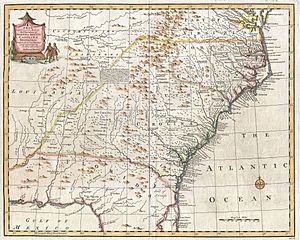
The Royal Colonial Boundary of 1665 was a very important border line. It separated the Colony of Virginia from the Province of Carolina. This line started at the Atlantic Ocean and was meant to go all the way across North America to the Pacific Ocean.
This boundary followed a specific line of latitude called parallel 36°30′ north. This same line later became a border for several U.S. states, reaching as far west as the Oklahoma Panhandle. It also became famous because of the Missouri Compromise in 1820.
Contents
Why Was This Line Important?
This boundary was the idea of King Charles II of England. He wanted a clear line to divide his lands in the new world. By 1819, the line had been measured and marked as far west as the Mississippi River. This is where it created a unique bend in the river known as the Kentucky Bend.
The American Society of Civil Engineers has called this boundary a historic civil engineering landmark. It was a huge project for its time. People later said that King Charles II's idea for this 3,000-mile-long line across an unknown continent was very grand!
How Was the Line Surveyed?
Measuring this long line was done in five steps. Surveyors used special techniques to map the land. This was one of the first times people had to think about the curvature of the Earth when marking such a long boundary.
Challenges in Surveying
One interesting mistake happened south of Damascus, Virginia. The surveyor, Peter Jefferson (who was the father of Thomas Jefferson), kept moving slightly north of the correct line. There are a few ideas why this happened:
- The surveyor might have been drunk.
- Iron in the mountains could have messed up the compass readings.
- People living in Tennessee might have influenced where the line was placed. (Not many British people lived in Tennessee when Peter Jefferson worked on this part of the line.)
Extending the Boundary
The boundary line was extended further west in 1779 and 1780. It reached the point where it would first cross the Cumberland River. From there, the state of Virginia hired Thomas Walker to survey the line all the way to the Mississippi River.
Walker faced many challenges. There were thick, old forests, tall mountains, and rough riverbeds. Because of this, his survey was not perfect.
In 1821, the state of Tennessee tried to survey the line again to find its true border with Kentucky. But Kentucky did not join in, so it wasn't fully settled. Finally, in 1859, both states worked together on a joint survey. Austin P. Cox and Benjamin Pebbles led this project. They surveyed about 320 miles from the New Madrid Bend of the Mississippi River to the Cumberland Gap. They placed a 3-foot-high stone marker every 5 miles along the way.
The Line's Later Importance
In the west, this boundary line later became important for the Missouri Compromise of 1820. This compromise was a way to decide where slavery could or could not be allowed in new states joining the United States. The 36°30′ north line was used as a general boundary for this purpose.
At the Cumberland Gap National Historical Park, there is a marker showing where the borders of Kentucky, Tennessee, and Virginia meet. This spot also marked how far west a British colonist was allowed to live under the Royal Proclamation of 1763.
 | Mary Eliza Mahoney |
 | Susie King Taylor |
 | Ida Gray |
 | Eliza Ann Grier |


