Rush Springs, Oklahoma facts for kids
Quick facts for kids
Rush Springs, Oklahoma
|
|
|---|---|
| Nickname(s):
Radiator Springs
|
|
| Motto(s):
"Watermelon Capital of the World"
|
|

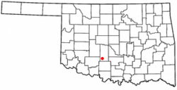
Location of Rush Springs, Oklahoma
|
|
| Country | United States |
| State | Oklahoma |
| County | Grady |
| Area | |
| • Total | 1.16 sq mi (3.01 km2) |
| • Land | 1.16 sq mi (3.01 km2) |
| • Water | 0.00 sq mi (0.00 km2) |
| Elevation | 1,296 ft (395 m) |
| Population
(2020)
|
|
| • Total | 997 |
| • Density | 858.00/sq mi (331.32/km2) |
| Time zone | UTC-6 (Central (CST)) |
| • Summer (DST) | UTC-5 (CDT) |
| ZIP code |
73082
|
| Area code(s) | 580 |
| FIPS code | 40-64300 |
| GNIS feature ID | 2412584 |
Rush Springs is a small town in Grady County, Oklahoma, United States. In 2020, about 997 people lived there. The town is famous for its watermelons. It calls itself the "Watermelon Capital of the World."
Every year, Rush Springs hosts a big event called the Rush Springs Watermelon Festival. Around 30,000 people come to enjoy the fun. They eat about 50,000 pounds of watermelon during the festival!
Contents
History of Rush Springs
Early Beginnings
Around 1850, the Wichita people built a village near some springs on Rush Creek. The town of Rush Springs later grew about 4 miles (6.4 km) northwest of this spot. Cowboys used to water their cattle here. They were driving their herds north from Texas to Kansas on the famous Chisholm Trail.
Battle of Wichita Village
On October 1, 1858, an event called the Battle of the Wichita Village happened nearby. US Army soldiers attacked a Comanche camp on Rush Creek. The army did not know that the Comanche and Wichita tribes were having a peace meeting. After the attack, the army burned the Wichita's crops. This destroyed their food supply. The Wichita people then went to Fort Arbuckle for help.
Railroads and Growth
In 1871, supplies for Fort Sill came through Rush Springs. The Missouri-Kansas-Texas Railway brought goods to Caddo, Oklahoma. From there, wagons carried them to Rush Springs. This wagon route stopped around 1885.
The first post office opened in July 1883. It was called Parr. In July 1892, the Chicago, Rock Island and Pacific Railway built its line through Rush Springs. The post office moved into the new town and was renamed Rush Springs. The town was officially formed on November 21, 1898.
By 1900, Rush Springs had 518 people. When Oklahoma became a state in 1907, the population was 588. Rush Springs became part of Grady County, Oklahoma.
Great Depression Era
During the Great Depression, a special project helped people find jobs. It was called the Civilian Conservation Corps. Young men worked on the east side of Rush Springs. They built terraces and ponds. They also planted trees to help the land. This project started in June 1933 and ended in July 1942.
Geography and Location
Rush Springs is in the southern part of Grady County. U.S. Route 81 goes through the town. This road leads north 19 miles (31 km) to Chickasha. Chickasha is the main city of the county. The road also goes south 20 miles (32 km) to Duncan.
The town covers an area of about 1.16 square miles (3.01 km2). All of this area is land.
Population Information
| Historical population | |||
|---|---|---|---|
| Census | Pop. | %± | |
| 1900 | 518 | — | |
| 1910 | 823 | 58.9% | |
| 1920 | 768 | −6.7% | |
| 1930 | 1,340 | 74.5% | |
| 1940 | 1,422 | 6.1% | |
| 1950 | 1,402 | −1.4% | |
| 1960 | 1,303 | −7.1% | |
| 1970 | 1,381 | 6.0% | |
| 1980 | 1,451 | 5.1% | |
| 1990 | 1,229 | −15.3% | |
| 2000 | 1,278 | 4.0% | |
| 2010 | 1,231 | −3.7% | |
| 2020 | 997 | −19.0% | |
| U.S. Decennial Census | |||
In 2000, there were 1,278 people living in Rush Springs. There were 525 households, which are groups of people living together. The population density was about 1,201.7 people per square mile.
The average household had 2.43 people. The average family had 3.01 people. About 27.6% of the population was under 18 years old. About 17.9% of the people were 65 years or older. The average age in the town was 36 years.
See also
 In Spanish: Rush Springs (Oklahoma) para niños
 | Charles R. Drew |
 | Benjamin Banneker |
 | Jane C. Wright |
 | Roger Arliner Young |

