
Russellville, Alabama facts for kids
Quick facts for kids
Russellville
|
|
|---|---|

Jackson Avenue
|
|

Location of Russellville in Franklin County, Alabama.
|
|
| Country | United States |
| State | Alabama |
| County | Franklin |
| Incorporated | November 27, 1819 |
| Named for | Major William Russell |
| Government | |
| • Type | Municipality |
| Area | |
| • Total | 13.52 sq mi (35.00 km2) |
| • Land | 13.41 sq mi (34.73 km2) |
| • Water | 0.11 sq mi (0.27 km2) |
| Elevation | 764 ft (233 m) |
| Population
(2020)
|
|
| • Total | 10,855 |
| • Density | 809.47/sq mi (312.55/km2) |
| Time zone | UTC-6 (Central (CST)) |
| • Summer (DST) | UTC-5 (CDT) |
| ZIP codes |
35653-35654
|
| Area code(s) | 256 |
| FIPS code | 01-67056 |
| GNIS feature ID | 0126047 |
Russellville is a city located in Franklin County, in the state of Alabama, USA. It is the main city and the county seat of Franklin County. In 2020, the city's population was 10,855 people. This was an increase from 9,830 people counted in 2010.
Contents
History of Russellville
Early Roads and Settlement
After the War of 1812, the U.S. government decided to improve a major road. This road connected Nashville to New Orleans. It was named Jackson's Military Road after Andrew Jackson. This important road passed right through the area where Russellville is today. Parts of this old road are still used as Jackson Avenue and U.S. Route 43.
Russellville got its name from Major William Russell. He was an early settler in the area. Major Russell also helped build Jackson's Military Road. The town began to grow where this road crossed another path called the Gaines Trace.
Becoming a City
Russellville officially became a city on November 27, 1819. This means it was given the right to govern itself.
Russellville was the first county seat for Franklin County from 1818 to 1849. A county seat is the main town where the county government is located. Later, the county seat moved to Frankfort (1849-1879). After a fire at the courthouse in Belgreen in 1890, Russellville became the county seat again in 1891.
Geography and Climate
Where is Russellville Located?
Russellville is found in the northeastern part of Franklin County. U.S. Route 43 runs through the eastern side of the city. This road goes north 18 miles to Muscle Shoals and southwest 31 miles to Hamilton. Both Muscle Shoals and Hamilton are other towns in Alabama.
Alabama State Route 24 also passes through the southern part of Russellville. It goes east 47 miles to Decatur. To the west, it goes 26 miles to Red Bay, which is near the Mississippi border.
Land and Water Area
The U.S. Census Bureau states that Russellville covers a total area of about 13.52 square miles (35.0 square kilometers). Most of this area, about 13.41 square miles (34.7 square kilometers), is land. A small part, about 0.11 square miles (0.3 square kilometers), is water.
Weather in Russellville
Russellville has a climate typical of Alabama. It has warm summers and mild winters. The area gets a good amount of rain throughout the year.
| Climate data for Russellville, Alabama, 1991–2020 normals, extremes 1953–present | |||||||||||||
|---|---|---|---|---|---|---|---|---|---|---|---|---|---|
| Month | Jan | Feb | Mar | Apr | May | Jun | Jul | Aug | Sep | Oct | Nov | Dec | Year |
| Record high °F (°C) | 78 (26) |
84 (29) |
87 (31) |
92 (33) |
95 (35) |
106 (41) |
103 (39) |
106 (41) |
102 (39) |
98 (37) |
86 (30) |
85 (29) |
106 (41) |
| Mean maximum °F (°C) | 68.5 (20.3) |
73.6 (23.1) |
80.6 (27.0) |
85.6 (29.8) |
89.8 (32.1) |
94.4 (34.7) |
96.3 (35.7) |
96.9 (36.1) |
93.6 (34.2) |
86.5 (30.3) |
78.2 (25.7) |
70.0 (21.1) |
97.9 (36.6) |
| Mean daily maximum °F (°C) | 51.1 (10.6) |
55.9 (13.3) |
64.7 (18.2) |
73.2 (22.9) |
80.9 (27.2) |
88.0 (31.1) |
90.9 (32.7) |
90.5 (32.5) |
85.4 (29.7) |
74.8 (23.8) |
63.0 (17.2) |
54.0 (12.2) |
72.7 (22.6) |
| Daily mean °F (°C) | 41.4 (5.2) |
45.0 (7.2) |
52.5 (11.4) |
60.9 (16.1) |
69.2 (20.7) |
76.8 (24.9) |
80.3 (26.8) |
79.6 (26.4) |
73.6 (23.1) |
62.4 (16.9) |
51.4 (10.8) |
44.1 (6.7) |
61.4 (16.3) |
| Mean daily minimum °F (°C) | 31.7 (−0.2) |
34.2 (1.2) |
40.3 (4.6) |
48.6 (9.2) |
57.5 (14.2) |
65.7 (18.7) |
69.8 (21.0) |
68.8 (20.4) |
61.8 (16.6) |
50.1 (10.1) |
39.8 (4.3) |
34.3 (1.3) |
50.2 (10.1) |
| Mean minimum °F (°C) | 12.6 (−10.8) |
17.3 (−8.2) |
23.1 (−4.9) |
31.6 (−0.2) |
41.5 (5.3) |
53.8 (12.1) |
61.2 (16.2) |
59.2 (15.1) |
47.3 (8.5) |
33.3 (0.7) |
24.0 (−4.4) |
18.7 (−7.4) |
10.4 (−12.0) |
| Record low °F (°C) | −24 (−31) |
−12 (−24) |
5 (−15) |
22 (−6) |
31 (−1) |
36 (2) |
45 (7) |
46 (8) |
30 (−1) |
19 (−7) |
10 (−12) |
−7 (−22) |
−24 (−31) |
| Average precipitation inches (mm) | 5.00 (127) |
5.08 (129) |
5.43 (138) |
5.12 (130) |
5.38 (137) |
3.82 (97) |
4.48 (114) |
4.66 (118) |
3.99 (101) |
3.76 (96) |
4.54 (115) |
5.44 (138) |
56.7 (1,440) |
| Average snowfall inches (cm) | 0.3 (0.76) |
0.2 (0.51) |
0.1 (0.25) |
0.0 (0.0) |
0.0 (0.0) |
0.0 (0.0) |
0.0 (0.0) |
0.0 (0.0) |
0.0 (0.0) |
0.0 (0.0) |
0.0 (0.0) |
0.0 (0.0) |
0.6 (1.52) |
| Average precipitation days (≥ 0.01 in) | 9.2 | 8.8 | 9.0 | 8.0 | 8.3 | 8.1 | 8.7 | 7.3 | 6.0 | 6.3 | 7.7 | 8.7 | 96.1 |
| Average snowy days (≥ 0.1 in) | 0.2 | 0.2 | 0.0 | 0.0 | 0.0 | 0.0 | 0.0 | 0.0 | 0.0 | 0.0 | 0.0 | 0.2 | 0.6 |
| Source 1: NOAA | |||||||||||||
| Source 2: National Weather Service | |||||||||||||
Population and People
How Many People Live in Russellville?
The population of Russellville has grown over the years. Here's a look at how the number of people living there has changed:
| Historical population | |||
|---|---|---|---|
| Census | Pop. | %± | |
| 1870 | 180 | — | |
| 1880 | 186 | 3.3% | |
| 1890 | 920 | 394.6% | |
| 1900 | 1,602 | 74.1% | |
| 1910 | 2,046 | 27.7% | |
| 1920 | 2,269 | 10.9% | |
| 1930 | 3,146 | 38.7% | |
| 1940 | 3,510 | 11.6% | |
| 1950 | 6,012 | 71.3% | |
| 1960 | 6,628 | 10.2% | |
| 1970 | 7,814 | 17.9% | |
| 1980 | 8,195 | 4.9% | |
| 1990 | 7,812 | −4.7% | |
| 2000 | 8,971 | 14.8% | |
| 2010 | 9,830 | 9.6% | |
| 2020 | 10,855 | 10.4% | |
| U.S. Decennial Census | |||
Snapshot of the Population in 2010
In 2010, there were 9,830 people living in Russellville. There were 3,556 households, which are groups of people living together.
- About 73.68% of the people were White.
- About 11.25% were Black or African American.
- About 12.64% of the population identified as Hispanic or Latino.
Many households (30.6%) had children under 18 living with them. The average household had about 2.44 people. The average age of people in Russellville was 37 years old.
Snapshot of the Population in 2020
By 2020, the population grew to 10,855 people. There were 3,238 households and 2,244 families.
| Race | Num. | Perc. |
|---|---|---|
| White (non-Hispanic) | 5,515 | 50.81% |
| Black or African American (non-Hispanic) | 870 | 8.01% |
| Native American | 42 | 0.39% |
| Asian | 29 | 0.27% |
| Other/Mixed | 285 | 2.63% |
| Hispanic or Latino | 4,114 | 37.9% |
Fun Things to Do and See
Russellville has several interesting places and events for people to enjoy.
Annual Watermelon Festival
Each August, Russellville hosts its annual "Watermelon Festival." This fun event takes place downtown. It features live music and entertainment. You can also see cool cars and tractors at shows. Many local artists and crafters sell their unique items.
Roxy Theater
The Roxy Theater was built in 1949. It used to be mainly a movie theater. In the early 1980s, it was not used as much. Now, thanks to the Franklin County Arts and Humanities Council and local support, it has been brought back to life. It is now a place for live shows and entertainment.
King Drive-In (Closed)
The King Drive-In was a special outdoor movie theater. It was located just north of Russellville. It was one of the few drive-in theaters still open in Alabama. It showed new movies on Friday, Saturday, and Sunday nights during spring and summer. You could listen to the movie sound through old-style car speakers or on your car radio. The King Drive-In closed in 2024.
RHS Stadium
The Russellville High School Stadium is where local residents cheer on their high school football team. The Russellville football team is known for being one of the most successful teams in Alabama. They have won many playoff games over the years.
Local Information
Media and News
Russellville has local media outlets to keep residents informed.
- WMTY-TV broadcasts local news and weather for the Russellville area. Most of its other programs are religious.
- Radio stations include WKAX AM 1500, WGOL AM 920, and WPMR-LP 99.7 FM.
- Local newspapers are The Franklin Free Press and the Franklin County Times.
Getting Around Russellville
Russellville does not have a public bus system with set routes. However, there is a service called NACOLG Transit. This service lets you call ahead to arrange a ride. It is operated by the Northwest Alabama Council of Local Governments.
Famous People from Russellville
Many notable people have connections to Russellville:
- Lee Clayton - A musician and composer of rock and country music.
- Luther Duncan - A pioneer in youth development programs like 4-H. He also led the Alabama Extension Service and was president of Auburn University. He was born near Russellville.
- Althea Brown Edmiston - A Presbyterian missionary who worked in the Belgian Congo.
- Junius Foy Guin Jr. - A federal judge.
- Gustav Hasford - A writer and screenwriter. His novel The Short-Timers was used for the movie Full Metal Jacket.
- Joey Manley - A publisher and author of webcomics.
- Sonequa Martin-Green - A television actress.
- Bryson Mitchell - A racing driver.
- Madeline Mitchell - Crowned Miss Alabama USA in 2011.
- Chucky Mullins - A college football player.
- T. Ray Richeson - A former professional football player and coach.
- Thomas William Sadler - A U.S. congressman from 1885 to 1887. He was born near Russellville.
- Arron Sears - A professional football player.
Images for kids
-
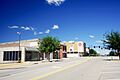
Jackson Avenue
-
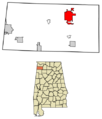
Location of Russellville in Franklin County, Alabama.
See also
 In Spanish: Russellville (Alabama) para niños
