
Saint-Charles River (Quebec City) facts for kids
Quick facts for kids Saint Charles River |
|
|---|---|

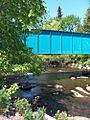
Saint-Charles River seen from Drouin bridge
|
|
| Other name(s) | Akiawenrahk |
| Country | Canada |
| Province | Quebec |
| Region | Capitale-Nationale |
| City | Quebec City |
| Physical characteristics | |
| Main source | Saint-Charles Lake Quebec City 152 m (499 ft) 46°56′28″N 71°23′14″W / 46.94111°N 71.38722°W |
| River mouth | Estuary of Saint Lawrence Quebec City 4 m (13 ft) 46°49′37″N 71°11′52″W / 46.826988°N 71.197672°W |
| Length | 33 km (21 mi) |
| Basin features | |
| Basin size | 550 km2 (210 sq mi) |
| Tributaries |
|
The Saint-Charles River is a major river in Quebec City, Canada. Its Huron-Wendat name is Akiawenrahk. This means it has been important to Indigenous peoples for a long time.
The river's surface usually freezes from early December to late March. However, it's safest to walk on the ice from late December to early March. The water level changes with the seasons and rain. The biggest floods usually happen in March or April.
Contents
Geography of the Saint-Charles River
The Saint-Charles River starts at Lake Saint-Charles. It flows for about 33 km (21 mi) before joining the Saint Lawrence River. The area of land that drains into the river, called its drainage basin, is 550 km2 (210 sq mi).
About 350,000 people live in this area, mostly in Quebec City. This makes it the most crowded river basin in Quebec. Many people enjoy the riverbanks, especially along the linear park.
River's Drainage Basin
Many smaller streams in Quebec City flow into the Saint-Charles River.

The main areas that drain into the river include:
Other smaller streams also feed the Saint-Charles River. These include the Hibou River and the Lairet River.
Bridges and Crossings

The Saint-Charles River has many crossings. There are 21 road bridges, 13 footbridges for walking, and 2 railway bridges. Also, four dams control the river's flow.
Some of the important bridges are:
- Scott Bridge
- Marie-de-l'Incarnation Bridge
- Trois-Soeurs Footbridge (in Victoria Park)
- Lavigueur Bridge
- Pont Drouin
- Dorchester Bridge
How the River Flows
From the dam at Lake Saint-Charles, the river flows for about 33.8 kilometres (21.0 mi). It drops about 148 metres (486 ft) in height along its path. The river winds through urban areas and collects water from other streams. It passes through neighborhoods like Château-d'Eau and Village-des-Hurons. Finally, it reaches its mouth where it joins the Saint Lawrence River.
Attractions Along the River
The Saint-Charles River offers many fun places to visit.
Saint-Charles River Linear Park
The Parc linéaire des rivières Saint-Charles et du Berger is a 32 kilometres (20 mi) walking trail. It runs along the entire length of the river. Starting in downtown Quebec, it goes north where the scenery becomes wilder. Many walkways let you cross the river.
Along the path, you can see:
- The Parc of the Kabir Kouba Cliff and Waterfall
- A canyon and a bog with a wooden walkway
- Wooded areas and a lake
- Many types of plants and birds
- Historic houses and the Hotel-Museum First Nations
- A Wyandot village and interesting artworks
Cartier-Brébeuf Park

Cartier-Brébeuf National Historic Site is on the north bank of the river in Limoilou. This park remembers Jacques Cartier's visit in 1535-1536. It also marks where the first Jesuit mission was set up by Jean de Brébeuf in 1625.
The park's landscape shows why Jacques Cartier chose this spot for his winter camp. Today, you can find a museum and an inner-city park with monuments. There's also a reconstructed Longhouses of the indigenous peoples of North America like those found in Stadaconé. The Saint-Charles cycleway also passes through this park.
Kabir-Kouba Waterfall

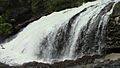
The river flows through the Wyandot territory of Wendake. Here, you'll find rapids and waterfalls called Kabir Kouba. This name means "Silver Serpent" in the Wyandot language.
The Parc de la Falaise et de la chute Kabir Kouba is next to the falls. It has a visitor center and trails. You can see the 28-metre-high (92 ft) Kabir Kouba waterfall in a 42-metre-deep (138 ft) canyon. The park also has rich plant life and fossils that are 455 million years old. A song by Claire Pelletier, Kabir Kouba, tells about the Wyandot legends of the river.
Other Parks Along the River
Many other parks are located along the Saint-Charles River.
- Parc Chauveau is the largest park in Quebec City. It's bigger than the Plains of Abraham, with 120 ha (300 acres) of space. It also hosts the Quebec urban fishing Festival. Fish are released into the river for this event.
- Les Saules Park is where you can see the beautiful gardens of the O'Neill House.
- In Loretteville, people can walk, bike, and enjoy the fresh air in Jean-Roger-Durand Park.
History of the Saint-Charles River
The mouth of the Saint-Charles River at the Saint Lawrence River is very important historically. This is where the Stadaconé village of the Saint-Lawrence Iroquoian people was located. It's also where Jacques Cartier spent his first winter in Canada in 1535–36.
Cartier first named the river Petite Rivière or Rivière Sainte-Croix. This was because he arrived on the day of the feast of the Cross. The French also built their first fort here with the same name. The river got its current name, Saint-Charles, between 1615 and 1625. Récollets missionaries named it after their protector, Charles de Boves. They also honored Saint Charles Borromeo.
In the 1960s, industries were built near the river's mouth. The river faced challenges with pollution. However, since the mid-1990s, a huge effort has been made to clean up and restore the river. This "renaturalisation" project cost over 100 million Canadian dollars.

Improvements have been made to manage water flow and reduce pollution. For example, large retention reservoirs were built between 2002 and 2006. These efforts have greatly improved the river's health.
Since 1979, a group called "Fishing in town" releases young brook trout into the river. This helps young fishers enjoy fishing. In 2008, 25,000 trout were added. Over 700,000 have been added since the group started.
River Names and Meanings
The river was known as the Petite Rivière in the early 1600s. It became the Saint-Charles River between 1615 and 1625. This name honored Charles de Boves and Saint Charles Borromée.
Indigenous peoples had their own names for the river. The Montagnais called it Cabirecoubat, meaning it turns and makes many points. The Hurons (Wendats) called it Oriaouenrak, which means "trout river." Jacques Cartier named it "ripvière saincte Croix" in 1535. Maps by Champlain (1632) and Bourdon (around 1641) show it as Rivière Saint-Charles.
The name "Saint-Charles River" was officially recognized on December 5, 1968, by the Commission de toponymie du Québec.
Tributes to the River
- The Saint-Charles River has been featured in art and culture.
- A song by the singer Claire Pelletier, called Kabir Kouba, tells about the many Huron legends connected to the river.
Images for kids
-
Cycleway bridge over the Saint-Charles River (Loretteville, Quebec)
-
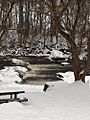
Jean-Roger-Durand Park and Saint-Charles River (Loretteville, Quebec)
-
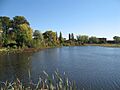
Saint-Charles River
-
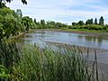
The Saint-Charles River (low water)
-
The Kabir-Kouba waterfall


.jpg)

See also
 In Spanish: Río San Carlos para niños
