
St Heliers facts for kids
Quick facts for kids
St Heliers
|
|
|---|---|
|
Suburb
|
|

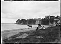
View of St Heliers Beach towards Achilles Point
|
|
| Country | New Zealand |
| Local authority | Auckland |
| Electoral ward | Ōrākei ward |
| Local board | Ōrākei Local Board |
| Area | |
| • Land | 375 ha (927 acre) |
| Population
(June 2023)
|
|
| • Total | Expression error: Unrecognized punctuation character "[". |
|
|
||
St Heliers is a beautiful seaside suburb in Auckland, New Zealand. It is a popular spot for visitors because of its lovely beaches, cafes, and amazing views of Rangitoto Island. Rangitoto is a unique volcanic island located in the Hauraki Gulf.
St Heliers is found at the eastern end of Tamaki Drive. It used to be the place where the Tamaki estuary separated Auckland from Manukau City. However, in 2010, the whole Auckland area joined together under one council, the Auckland Council. The local government for St Heliers is now the Ōrākei Local Board. This board also looks after nearby suburbs like Ōrākei, Kohimarama, and Mission Bay.
Contents
About St Heliers' Population
St Heliers covers about 3.75 square kilometers. In 2018, around 11,529 people lived here. This was a small increase from earlier years.
The people living in St Heliers come from many different backgrounds. Most residents are of European descent. There are also people from Māori, Pacific, and Asian backgrounds. About 35.8% of the people living here were born outside New Zealand.
When it comes to beliefs, about 44.4% of people said they had no religion. Around 44.8% were Christian. There were also smaller groups of people following Hindu, Muslim, and Buddhist faiths.
Many adults in St Heliers have a university degree. Most people work full-time or part-time.
St Heliers' History

Early Māori History
The area around Glover Park and Achilles Point has a long history. The Tainui iwi (tribe) called it Te Pane o Horoiwi. This name means "The Head of Horoiwi." Horoiwi was one of the first people to settle here around the 13th century.
There was once a fortified village, called a pā, at Te Pane o Horoiwi. It was located on a high point of the old volcano, Whakamuhu / Glover Park. Later, the Ngāti Whātua iwi took over the area. They then gave the land to the Ngāti Pāoa iwi in the late 1700s. The area was left empty in the 1820s because of fighting during the Musket Wars. However, people returned by the late 1830s.
European Settlers Arrive
In 1841, the British Crown bought the land around St Heliers from Ngāti Pāoa. European settlement started on the slopes of St Heliers bay. The first important house, Glen Orchard homestead, was built in the 1850s. This house is very old and has a grand design. It shows how wealthy some of the early settlers in Auckland were.
Glen Orchard was home to Lieutenant-General William Taylor. His son, Charles John Taylor, married into the family of Alfred Domett, who was a New Zealand Premier.
In 1879, Glen Orchard became Auckland's first stud farm, which is a place where horses are bred. The manager, Major Walmsley, suggested the name St Heliers Bay. He thought it looked like the popular holiday spot Bay of Saint Helier in Jersey, one of Britain’s Channel Islands.
How St Heliers Grew
In 1881, a company bought St Heliers Bay to build homes there. They wanted to make it easier to get to St Heliers from Auckland's town center. At that time, it was quicker to travel by boat (30 minutes) than by land (13 km).
Even with advertisements, not many people bought land. The company built a long pier (460 meters) in 1882 but then ran out of money. A planned tram connection to Auckland never happened.
By 1890, St Heliers became a popular place for day trips. People would come from Auckland and Thames for excursions, especially moonlight trips with dancing on boats. After Tamaki Drive opened in 1932, St Heliers became a suburb where people lived and traveled to work. It also became a popular spot for Sunday drives.
Famous Places and Features
Achilles Point
Achilles Point is a rocky spot between St Heliers and the Tamaki River estuary. It offers amazing views of the Waitematā Harbour and the Gulf Islands. In 1940, it was named after the New Zealand battleship HMS Achilles.
The Achilles was the first New Zealand ship to fight in World War II. It fired on the German ship Admiral Graf Spee in 1939. This battle, called the Battle of the River Plate, was the first big naval fight of World War II. The Achilles helped defeat the Admiral Graf Spee.
Parks to Explore
Dingle Dell Reserve
Dingle Dell became a public park in 1930. The Auckland Council now looks after it. Native trees were planted there.
Today, Dingle Dell is a quiet place in the middle of St Heliers. People can enjoy a picnic or go for a walk through the bush. The park is home to native plants like kohekohe and tanekaha.
Glover Park

St Heliers has a hidden volcano called a maar. Its crater was a swamp when European settlers arrived. On one side, there was once a Māori pā (fortified village).
The Auckland City Council bought the land in the 1930s. In 1953, part of the area was drained. Trees were planted to remember soldiers who died in World War I and II. More drainage work in 1959 made the park safe. Now, Glover Park is used for sports fields.
Statues, Memorials and Sculptures
- St Heliers Memorial Fountain
- St Heliers War Memorial
Fun Events in St Heliers
Weet-Bix Kids TRYathlon Park – New Zealand's first triathlon for children happened in St Heliers in 1992. About 500 kids took part. Children swim 50 meters, cycle 4 kilometers, and run 1 kilometer. This event has grown a lot. In 2013, 20,000 children competed in TRYathlons across the country.
Round The Bays Fun Run – This yearly running event is one of the biggest in the world. It started in the 1970s. The run is 8.4 kilometers long along Tamaki Drive. This flat road follows the Waitematā Harbour. It passes Hobson Bay, Okahu Bay, Mission Bay, and Kohimarama Beach. The run finishes in St Heliers Bay Reserve. Today, between 70,000 and 80,000 runners join in each year.
Education in St Heliers
St Heliers has two main schools:
- St Heliers School is a primary school for children from years 1 to 8.
- St Ignatius Catholic School is a primary school for children from years 1 to 6.
Both schools welcome both boys and girls.
Gallery
-
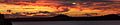
Waitematā Harbour at sunset, taken from the point between Kohimarama and St Heliers Beaches
-
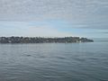
Waterview of St Heliers
-
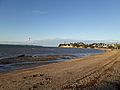
St Heliers Beach in Auckland
-
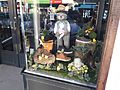
Shop window display of a shoe shop in St Heliers in Auckland
-
View of the eastern end of St Heliers Bay. Photographed by William Archer Price between 1910 and 1930.
-
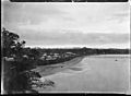
View of St Heliers Bay, Auckland, looking west. The wharf is in the middle distance. Photographed by William Archer Price between 1910 and 1930.


.jpg)
.jpg)
