Saint Jacques River (Roussillon) facts for kids
Quick facts for kids Saint Jacques River |
|
|---|---|
| Countries | Canada |
| Provinces and territories of Canada | Quebec |
| Administrative region | Montérégie |
| Physical characteristics | |
| Main source | Saint-Jacques-le-Mineur, Quebec 56 m (184 ft) |
| River mouth | Laprairie 11 m (36 ft) |
| Length | 33.1 km (20.6 mi) |
| Basin features | |
| Tributaries |
|
The Saint-Jacques River is a cool waterway in southwestern Quebec, Canada. It helps drain the flat lands near the Saint Lawrence River. This river flows mostly from south to north. It starts near a place called Saint-Jacques-le-Mineur and ends where it joins the big Saint Lawrence River. This meeting point is right between the cities of Brossard and La Prairie.
Contents
Exploring the Saint-Jacques River's Path
The Saint-Jacques River winds its way through farms and forests in the Montérégie region. This area is close to the Saint Lawrence River. The river flows through both quiet farming towns and busy suburban cities. These places are on the south shore of the Island of Montreal.
Where the River Gets Its Water
The main areas that feed the Saint-Jacques River are:
- To the north: Prairie Creek.
- To the east: Acadia River and Lécuyer watercourse.
- To the south: Saint-André Creek and Acadia River.
- To the west: The Saint Lawrence Seaway and the Saint Lawrence River.
The Saint-Jacques River starts from many small farm streams. These streams drain the land south of Saint-Jacques-le-Mineur, Quebec. They also drain the area west of where the water flows towards the Acadia River.
The River's Journey from the Start
The Saint-Jacques River first flows north for about 8.6 kilometres (5.3 mi). It passes west of the village of Saint-Jacques-le-Mineur, Quebec. Then, it reaches the Méchal Creek, which flows in from the southwest. In this first part, the river goes through areas called Saint-Philippe-Nord and Saint-Marc.
Next, the river turns northwest. It flows through the village of Saint-Philippe-de-Laprairie in a curvy way. From this village, the river continues northwest for about 3.4 kilometres (2.1 mi). It winds until it meets the Saint-André Creek, which comes from the southwest.
After that, the river runs north for about 8.6 kilometres (5.3 mi). It stays on the east side of Autoroute 30. It winds through farms in the rang Saint-Joseph-Nord in the Town of La Prairie, Quebec. Finally, it reaches Autoroute 10.
Downstream from Autoroute 10
After crossing Autoroute 10, the Saint-Jacques River flows northwest for 1.6 kilometres (0.99 mi). This part is still in a farming area. It then crosses Autoroute 30.
The river then flows northwest for about 4.3 kilometres (2.7 mi). It passes Illinois Park in Brossard, Quebec and winds towards route 134, also known as Taschereau Boulevard. This last part of the river goes east of Parc Émilie-Gamelin in La Prairie, Quebec. It also collects water from the Saint-Claude stream. This stream's main smaller rivers are "ruisseau des Bois" and "Battle Creek". In this final stretch, the Saint-Jacques River flows west. It crosses a golf course and often forms the border between the cities of Brossard, Quebec and La Prairie, Quebec.
Why the River Bends and Turns
Rivers like the Saint-Jacques often flow through soft, sedimentary soil in flat areas. This causes them to form many bends and curves. Sometimes, these bends can even create oxbow lakes. This bending and curving is called meandering. It happens because the river's water slowly wears away the soil. One interesting oxbow lake on this river is in Brossard. It forms a small island.
Saint-Jacques River Regional Park Project
There's a plan to create a special park called the Saint-Jacques Regional Park. This idea is supported by the Ville-Marie Priority Intervention Area Committee. The area between Taschereau Boulevard and Autoroute 30 includes public lands. These lands still need to be officially given to the cities.
The long-term goal for this park is to include the Boisé de Brossard and the "Boisé de la Commune" in La Prairie. The Boisé de Brossard is mostly private land, and the "Boisé de la Commune" is all private land.
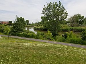
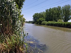
You can explore this river by canoe or kayak from the seaway up to the east of Autoroute 30. This river marks the boundary between Brossard and La Prairie, Quebec. It is surrounded by old farmland. The riverbanks usually don't have many trees. You might spot turtles and water birds like ducks and herons here.
People are hoping this area could become a regional park. This park could even be bigger than the Mont-Saint-Bruno National Park. You can get to the river through Radisson Park. Visitors can even rent boats there.
In December 2014, the City of Brossard bought a strip of land along the river. It was 50 meters (55 yards) wide and covered 9830 square meters (about 2½ acres). This land is between Radisson Park and Taschereau Boulevard. The city bought it to help protect this important waterfront area.
A Look Back: History of the River
Early 17th Century Discoveries
The Saint-Jacques River was first written about by Samuel de Champlain. He was a famous explorer. He described the river in his notes from a trip in 1611. He was exploring the Saint Lawrence River and the area around La Place Royale on the Island of Montreal.
Champlain wrote that on the 7th day, he found a small river. He noted that Indigenous people sometimes used it for travel. He said it was a very pleasant place, with more than three leagues of open fields and good land for farming. He also mentioned it was close to the big waterfall and La Place Royale.


