St. Michael, Alaska facts for kids
Quick facts for kids
St. Michael
|
|
|---|---|
| Country | United States |
| State | Alaska |
| Census Area | Nome |
| Incorporated | July 15, 1969 |
| Area | |
| • Total | 28.06 sq mi (72.69 km2) |
| • Land | 21.75 sq mi (56.33 km2) |
| • Water | 6.32 sq mi (16.36 km2) |
| Elevation | 26 ft (8 m) |
| Population
(2020)
|
|
| • Total | 456 |
| • Density | 20.97/sq mi (8.10/km2) |
| Time zone | UTC-9 (Alaska (AKST)) |
| • Summer (DST) | UTC-8 (AKDT) |
| ZIP code |
99659
|
| Area code | 907 |
| FIPS code | 02-66360 |
| GNIS feature ID | 1408977 |
St. Michael is a small city located in Alaska, a state in the United States. It is also known by its native names: Central Yupik: Taciq (in the Yup'ik language) and Inupiaq: Tasiq (in the Inupiaq language). In the past, it was often called Saint Michael.
St. Michael is part of the Nome Census Area, Alaska. According to the 2020 census, about 456 people live there.
Contents
Where is St. Michael Located?
St. Michael is found on the eastern side of St. Michael Island. This island is at the southeastern end of the Norton Sound in Alaska.
The city covers a total area of about 72.7 square kilometers (28.1 square miles). Most of this area is land, about 56.3 square kilometers (21.8 square miles). The rest, about 16.4 square kilometers (6.3 square miles), is water.
Who Lives in St. Michael?
| Historical population | |||
|---|---|---|---|
| Census | Pop. | %± | |
| 1880 | 109 | — | |
| 1890 | 101 | −7.3% | |
| 1900 | 857 | 748.5% | |
| 1910 | 415 | −51.6% | |
| 1920 | 371 | −10.6% | |
| 1930 | 147 | −60.4% | |
| 1940 | 142 | −3.4% | |
| 1950 | 157 | 10.6% | |
| 1960 | 205 | 30.6% | |
| 1970 | 207 | 1.0% | |
| 1980 | 239 | 15.5% | |
| 1990 | 295 | 23.4% | |
| 2000 | 368 | 24.7% | |
| 2010 | 401 | 9.0% | |
| 2020 | 456 | 13.7% | |
| U.S. Decennial Census | |||
St. Michael first appeared in the U.S. Census in 1880. At that time, it was listed as "Saint Michael and Tachik," which were unincorporated Inuit villages. The city officially became an incorporated city in 1969.
Most of the people living in St. Michael today are Yup'ik people. Many residents also have ancestors who were Russian traders.
In 2000, there were 368 people living in St. Michael. About 92.66% of the people were Native American. Many households (54.4%) had children under 18 living with them. The average age of people in the city was 22 years old.
Education in St. Michael
Students in St. Michael attend schools run by the Bering Strait School District. The local school is called Anthony A. Andrews School. It serves students from Pre-Kindergarten all the way through 12th grade.
History of St. Michael

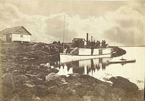
St. Michael has a long history. It was founded in 1833 by traders from the Russian-American Company. They built a trading post called Redoubt St. Michael. This post was used for trading with the local Yup'ik people. The trading post and the island were named after the archangel Michael.
Later, in 1897, a U.S. military base called Fort St. Michael was set up. During the Klondike Gold Rush in 1897, St. Michael became a very important place. It was a main entry point to the inside of Alaska, especially for people traveling to the Yukon River Delta. This area was about 40 miles (64 km) southwest of St. Michael. During the gold rush, it's believed that as many as 10,000 people lived in St. Michael.
St. Michael was also a popular place for Alaska Natives to trade their goods for supplies from the Western world. More Yup'ik people from nearby villages moved to St. Michael after a measles outbreak in 1900 and a flu epidemic in 1918.
Economy and Jobs
The economy in St. Michael is mainly based on gathering food from nature. This includes hunting, fishing, and gardening. People also earn money through part-time jobs.
Most jobs are with the city government, the local IRA council (which represents Native communities), village corporations, schools, and local stores. Some residents also have special permits for commercial fishing, especially for herring.
See also
 In Spanish: St. Michael (Alaska) para niños


