Saint Onge, South Dakota facts for kids
Quick facts for kids
Saint Onge, South Dakota
|
|
|---|---|
| Country | United States |
| State | South Dakota |
| County | Lawrence |
| Area | |
| • Total | 1.34 sq mi (3.48 km2) |
| • Land | 1.34 sq mi (3.48 km2) |
| • Water | 0.00 sq mi (0.00 km2) |
| Elevation | 3,432 ft (1,046 m) |
| Population
(2020)
|
|
| • Total | 170 |
| • Density | 126.39/sq mi (48.82/km2) |
| Time zone | UTC-6 (Central (CST)) |
| • Summer (DST) | UTC-5 (CDT) |
| ZIP code |
57779
|
| FIPS code | 46-57260 |
| GNIS feature ID | 2628850 |
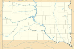
Saint Onge (pronounced "saynt AHNJ'") is a small community in Lawrence County, South Dakota, United States. It is known as an unincorporated community and a census-designated place (CDP). This means it's a group of homes and businesses that isn't officially a city or town, but the government counts its population. In 2020, about 170 people lived there.
Contents
History of Saint Onge
Saint Onge was first planned out in 1881. The community got its name from Henry St. Onge, who was one of the first settlers in the area. A post office, where people could send and receive mail, has been open in Saint Onge since 1881. The community uses the ZIP code 57779 for its mail.
Geography and Location
Saint Onge is located in the northeastern part of Lawrence County. It sits along South Dakota Highway 34. This highway can take you about 12 miles northwest to a town called Belle Fourche. If you go southeast for about 7 miles, you'll reach Interstate 90 near Whitewood. Spearfish, which is the biggest community in the county, is about 12 miles southwest of Saint Onge.
Land and Water Around Saint Onge
The U.S. Census Bureau says that the Saint Onge area covers about 3.5 square kilometers (or 1.34 square miles). All of this area is land. There are also some creeks nearby. False Bottom Creek runs along the western edge of the community. Dry Creek, which flows into False Bottom Creek, forms the northeastern edge. False Bottom Creek then flows northwest into the Redwater River. The Redwater River eventually joins the Belle Fourche River, which flows east to the large Missouri River.
Population of Saint Onge
| Historical population | |||
|---|---|---|---|
| Census | Pop. | %± | |
| 2020 | 170 | — | |
| U.S. Decennial Census | |||
The word "demographics" means the facts about a population, like how many people live somewhere. According to the 2020 census, the population of Saint Onge was 170 people. This number helps us understand the size of the community.
See also
 In Spanish: St. Onge (Dakota del Sur) para niños
 | Charles R. Drew |
 | Benjamin Banneker |
 | Jane C. Wright |
 | Roger Arliner Young |


