
Sal, Cape Verde facts for kids
 |
|
 |
|

Sal
Location in Cape Verde

Sal
Location in Africa
|
|
| Geography | |
|---|---|
| Location | Africa |
| Coordinates | 16°43′N 22°56′W / 16.717°N 22.933°W |
| Area | 219.84 km2 (84.88 sq mi) |
| Length | 29.7 km (18.45 mi) |
| Width | 11.8 km (7.33 mi) |
| Highest elevation | 406 m (1,332 ft) |
| Highest point | Monte Grande |
| Administration | |
| Municipality | Sal |
| Largest settlement | Espargos |
| Demographics | |
| Population | 39,700 (2019) |
| Pop. density | 180 /km2 (470 /sq mi) |
Sal (which means "salt" in Portuguese) is a sunny island in Cape Verde. It's a popular place for tourists because of its white sandy beaches and over 350 days of sunshine each year! Sal is one of three sandy islands in the eastern part of the archipelago (a group of islands). It's located in the middle of the Atlantic Ocean, about 350 miles off the west coast of Africa. Cape Verde is famous for kiteboarding all year round. It's also known for the many Caretta turtles that hatch there from July to September. And don't forget the amazing music of Cesaria Evora!
Contents
Island History
Discovery and Early Days
Europeans first found Sal Island on December 3, 1460. They called it Llana, which means "flat." Later, its name was changed to "Sal" (salt) because two big salt ponds were found there. These ponds are in Pedra de Lume and Santa Maria.
For the first 300 years after its discovery, not many people lived on Sal. In 1720, there was just a small fishing village near where Palmeira is today.
The Salt Industry
Things changed when the salt industry started to grow in the late 1700s. This began in Pedra de Lume. The town of Santa Maria was founded in the south of the island in 1830 by Manuel António Martins. The salt business did very well, and in its early years, about 30,000 tons of salt were sent out! Most of this salt went to Brazil. After Brazil took control of its own salt industry in 1887, Portuguese and French investors continued salt production until 1984.
Airport and Recent Events
In 1939, Italy began building an airport on Sal. This airport was meant for flights between Europe and South America. However, construction stopped during World War II. Portugal bought the airport from Italy and finished building it in 1949. Workers from São Nicolau Island settled in a village called Preguiça, which is now part of Espargos, northeast of the airport. In 2015, Hurricane Fred hit Sal Island. It caused some damage to homes, tourist places, and boats.
Island Geography
Size and Shape
Sal Island is about 29.7 kilometers long and 11.8 kilometers wide. Its total area is about 219.84 square kilometers. It's one of the three sandy islands in the eastern part of the archipelago, known for its beautiful white beaches. The island is mostly flat. Its highest point is Monte Grande, which is 406 meters high. A small, uninhabited island called Ilhéu Rabo de Junco is located near Sal's west coast.
Natural Features
You can find areas with salty marshes inside the Pedra de Lume crater. There are also saline marshes north of Santa Maria.
Island Climate
Sal Island gets sunshine for about 350 days a year! Winds mostly blow from the northeast. Sometimes there are clouds, but they are usually spread out and rarely bring rain. The "rainy season" is from July to mid-October. Even then, it doesn't rain much.
| Climate data for Sal, Cape Verde (Amílcar Cabral International Airport) 1991–2020, extremes 1950–1990 | |||||||||||||
|---|---|---|---|---|---|---|---|---|---|---|---|---|---|
| Month | Jan | Feb | Mar | Apr | May | Jun | Jul | Aug | Sep | Oct | Nov | Dec | Year |
| Record high °C (°F) | 32 (90) |
30 (86) |
33 (91) |
33 (91) |
33 (91) |
34 (93) |
33 (91) |
33 (91) |
38 (100) |
34 (93) |
33 (91) |
30 (86) |
38 (100) |
| Mean daily maximum °C (°F) | 25.0 (77.0) |
24.9 (76.8) |
25.2 (77.4) |
25.5 (77.9) |
26.1 (79.0) |
27.0 (80.6) |
28.1 (82.6) |
29.6 (85.3) |
30.1 (86.2) |
29.6 (85.3) |
28.1 (82.6) |
26.1 (79.0) |
27.1 (80.8) |
| Daily mean °C (°F) | 22.0 (71.6) |
21.8 (71.2) |
22.0 (71.6) |
22.5 (72.5) |
23.4 (74.1) |
24.3 (75.7) |
25.4 (77.7) |
26.9 (80.4) |
27.4 (81.3) |
26.8 (80.2) |
25.2 (77.4) |
23.3 (73.9) |
24.2 (75.6) |
| Mean daily minimum °C (°F) | 19.2 (66.6) |
18.8 (65.8) |
18.9 (66.0) |
19.6 (67.3) |
20.6 (69.1) |
21.6 (70.9) |
22.8 (73.0) |
24.2 (75.6) |
24.8 (76.6) |
24.1 (75.4) |
22.5 (72.5) |
20.5 (68.9) |
21.5 (70.6) |
| Record low °C (°F) | 12 (54) |
10 (50) |
12 (54) |
15 (59) |
15 (59) |
15 (59) |
17 (63) |
20 (68) |
20 (68) |
19 (66) |
17 (63) |
16 (61) |
10 (50) |
| Average precipitation mm (inches) | 2.8 (0.11) |
0.5 (0.02) |
0.5 (0.02) |
1.0 (0.04) |
0.5 (0.02) |
0.0 (0.0) |
2.4 (0.09) |
12.8 (0.50) |
34.5 (1.36) |
15.6 (0.61) |
1.3 (0.05) |
3.4 (0.13) |
75.3 (2.95) |
| Average precipitation days (≥ 0.1 mm) | 0.5 | 0.2 | 0.1 | 0.2 | 0.1 | 0 | 0.1 | 1.2 | 2.7 | 1.1 | 0.4 | 0.5 | 7.1 |
| Average relative humidity (%) | 69.0 | 70.9 | 70.9 | 70.6 | 73.3 | 75.4 | 75.5 | 75.9 | 77.1 | 74.7 | 72.9 | 71.1 | 73.1 |
| Mean monthly sunshine hours | 182.9 | 175.2 | 201.5 | 216.0 | 204.6 | 174.0 | 148.8 | 161.2 | 180.0 | 198.4 | 189.0 | 155.0 | 2,186.6 |
| Mean daily sunshine hours | 5.9 | 6.2 | 6.5 | 7.2 | 6.6 | 5.8 | 4.8 | 5.2 | 6.0 | 6.4 | 6.3 | 5.0 | 6.0 |
| Source 1: NOAA, Instituto Nacional de Meteorologia e Geofísica (humidity 1981-2010) | |||||||||||||
| Source 2: Deutscher Wetterdienst (extremes, sun) | |||||||||||||
| Jan | Feb | Mar | Apr | May | Jun | Jul | Aug | Sep | Oct | Nov | Dec | Year |
|---|---|---|---|---|---|---|---|---|---|---|---|---|
| 23 °C (73 °F) | 22 °C (72 °F) | 22 °C (72 °F) | 22 °C (72 °F) | 23 °C (73 °F) | 23 °C (73 °F) | 24 °C (75 °F) | 25 °C (77 °F) | 26 °C (79 °F) | 26 °C (79 °F) | 25 °C (77 °F) | 24 °C (75 °F) | 24 °C (75 °F) |
Island Administration
Sal Municipality
Sal Island is governed by one local area called a Concelho do Sal, or the Municipality of Sal. This municipality includes one freguesia (a type of civil parish) called Nossa Senhora das Dores, which covers the whole island.
The Municipality of Sal was created in 1935. Before that, it was part of the Municipality of Boa Vista. The main office for the municipality used to be in Santa Maria. But in the 1970s, Espargos became the main municipal town.
Main Settlements
The freguesia of Nossa Senhora das Dores is divided into these main towns and villages:
- Espargos (a city)
- Murdeira
- Palmeira (a town)
- Pedra de Lume
- Santa Maria (a city)
- Terra Boa
Island Population
In 1832, only about 400 people lived on Sal Island. Until 1960, it had the fewest people of the nine islands in Cape Verde where people lived, with less than 3,000 residents.
Since then, the number of people living on Sal has grown very quickly. By 2019, there were around 40,000 people. This makes Sal the third most populated island in Cape Verde, after Santiago and São Vicente. It now has more people than Santo Antão and Fogo islands.
| Year | Population |
|---|---|
| 1940 |
1,121
|
| 1950 |
1,838
|
| 1960 |
2,608
|
| 1970 |
5,505
|
| 1980 |
5,826
|
| 1990 |
7,715
|
| 2000 |
14,792
|
| 2010 |
25,779
|
| 2015 |
33,747
|
| 2019 |
39,700
|
Island Economy
Main Industries
The main town on Sal Island, Espargos, is home to one of Cape Verde's international airports. Today, tourism is the biggest source of money for the island. It has taken over from salt production and fishing. Most of the tourism is focused around Santa Maria. In 2017, almost half (48.2%) of all the hotel beds in Cape Verde were on Sal Island.
People on Sal Island generally have a good quality of life, among the best in the Cape Verde islands. In 2015, the average amount of money earned per person on the island was about 495,827 escudos (which is about 4,497 euro).
Infrastructure and Transport
Sal Island has the Amílcar Cabral International Airport, which is the busiest airport in Cape Verde. The main port for the island is in Palmeira.
The main roads on the island are:
- Santa Maria - Espargos Road (EN1-SL01)
- Palmeira - Espargos Road (EN1-SL02)
Island Sports

Football (soccer) is the most popular sport on Sal Island. It has its own football association, the Sal Regional Football Association. The main football competitions are the Premier and the Second Divisions. Some of the island's main football clubs are Académica do Sal, Académico do Aeroporto, Juventude, and SC Santa Maria. All regional matches are played at the island's main stadium, Estádio Marcelo Leitão, which is southeast of Espargos.
Basketball is the second most popular sport, along with volleyball. These games are played at Polidesportivo do Sal. Académico do Sal is the island's best basketball team. Futsal (a type of indoor soccer) is also played.
Water sports like surfing, windsurfing, and kitesurfing are very popular, especially on the beaches in the south of the island and the waters around them. These sports have become very popular over the last 25 years, and Sal is now a top spot in the country for windsurfing and kitesurfing.
Twin Towns and Sister Cities
Sal Island has special partnerships with other cities around the world. These are called "twin towns" or "sister cities":
 Cascais, Portugal
 Desenzano del Garda, Italy
- Grottammare, Italy
 South Normanton, England
Notable Residents
Many talented people have lived on Sal Island, including:
- Maria Alice, a singer
- Carlos Andrade, a basketball player
- Rodirlei José Ascensão Duarte (Rody), a footballer
- Elvis Évora (Elvis), a footballer
- Ana Firmino, a singer
- Hermínia da Cruz Fortes, a singer
- Ildo Lobo, a musician
- Mirri Lobo, a musician
- Ildo Augusto Dos Santos Lopes Fortes, a bishop
- 4BGSal Islands, an artist
- Nelson Marcos, a soccer player
- Basílio Ramos, a politician
- Héldon Ramos (Héldon), a footballer
- Ruben Sança, an athlete
- Dona Tututa, a composer and pianist
Gallery
-
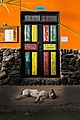
A sleeping dog
-
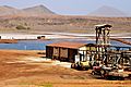
Salt evaporation pond in Volcanic crater (Pedra de Lume)
-
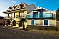
Buildings in Santa Maria
-
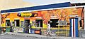
A souvenir shop in Santa Maria
-
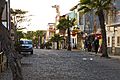
The Mainstreet in Santa Maria, Cabo Verde
-
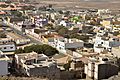
Cityview over Espargos
-
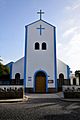
Catholic Church in Santa Maria
-
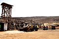
Machinery in Volcanic crater, Pedra de Lume
-
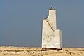
Ponta do Sinó lighthouse
-
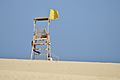
Lifeguard Tower
-
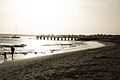
Santa Maria Beach in the evening
-
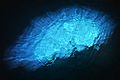
Cave "Blue Eye"
-
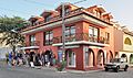
Stores in Santa Maria
-
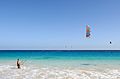
Kiteboarding in Sal, Cape Verde
-
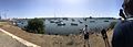
Panorama taken at Palmeira harbour

.JPEG)


.JPEG)


See also
 In Spanish: Isla de Sal para niños
