Salisbury North, South Australia facts for kids
Quick facts for kids Salisbury NorthAdelaide, South Australia |
|||||||||||||||
|---|---|---|---|---|---|---|---|---|---|---|---|---|---|---|---|

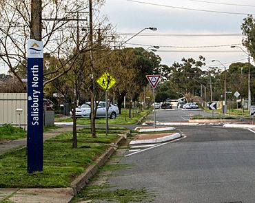
Whites Road, Salisbury North
|
|||||||||||||||
| Population | 10,900 (2016 census) | ||||||||||||||
| Established | 1949 | ||||||||||||||
| Postcode(s) | 5108 | ||||||||||||||
| LGA(s) | City of Salisbury | ||||||||||||||
| State electorate(s) | Ramsay | ||||||||||||||
| Federal Division(s) | Spence | ||||||||||||||
|
|||||||||||||||
Salisbury North is a suburb located in the northern part of Adelaide, South Australia. It is part of the City of Salisbury area. This suburb was created in the early 1950s. It was built on land that was previously undeveloped.
The main reason Salisbury North was built was to provide homes. These homes were for people who worked at a special facility nearby. This facility was called the Long Range Weapons Establishment.
Salisbury North has clear boundaries. To the north, it is bordered by the Adelaide–Port Augusta railway line. The Gawler railway line forms its eastern border. To the south, you'll find the Little Para River and Waterloo Corner Road. Finally, Bolivar Road marks its western edge.
Contents
History of Salisbury North
How Salisbury North Started
Salisbury North was established in 1949. The South Australian Housing Trust was in charge of building it. They built many homes on what was once open land. This was a big project to help people find places to live.
Homes for Workers
The new homes were mostly for workers. These workers were employed at the Long Range Weapons Establishment. This was an important facility for defence and research. Building homes close by made it easier for workers to live and work.
Growth and Development
Over the years, Salisbury North has grown. It has become a well-established community. The suburb provides homes and services for its residents. It continues to be an important part of the northern Adelaide region.
Location and Surroundings
Where is Salisbury North?
Salisbury North is located about 20 kilometers north of Adelaide's city center. It is part of a larger group of suburbs in the northern area. This makes it easy to access other parts of Adelaide.
Nearby Suburbs and Features
Salisbury North is surrounded by several other suburbs. To the north is Edinburgh. Elizabeth South is to the east. To the south, you'll find Salisbury itself. Burton is to the west. These nearby areas offer various facilities and connections.
Rivers and Roads
The Little Para River flows along the southern border. This river adds a natural touch to the area. Major roads like Waterloo Corner Road and Bolivar Road help people travel around. The railway lines also provide important transport links.
Community Life
Living in Salisbury North
Salisbury North is home to over 10,000 people. It is a family-friendly suburb. Residents have access to local schools and shops. There are also parks and open spaces for recreation.
Local Government
The suburb is managed by the City of Salisbury. This local government body provides services. These include waste collection, road maintenance, and community programs. They work to improve the quality of life for residents.
Representation in Government
Salisbury North is part of a state government area. This area is called the Electoral District of Ramsay. For federal government, it is in the Division of Spence. These elected representatives speak for the community.
Images for kids
-
A semi-detached "maisonette" in the Adelaide suburb of Seaton, similar to those built at Salisbury North by the South Australian Housing Trust.
 | Dorothy Vaughan |
 | Charles Henry Turner |
 | Hildrus Poindexter |
 | Henry Cecil McBay |


